
| Memorials | : | 0 |
| Location | : | Rothenburg ob der Tauber, Landkreis Ansbach, Germany |
| Coordinate | : | 49.3766670, 10.1763890 |
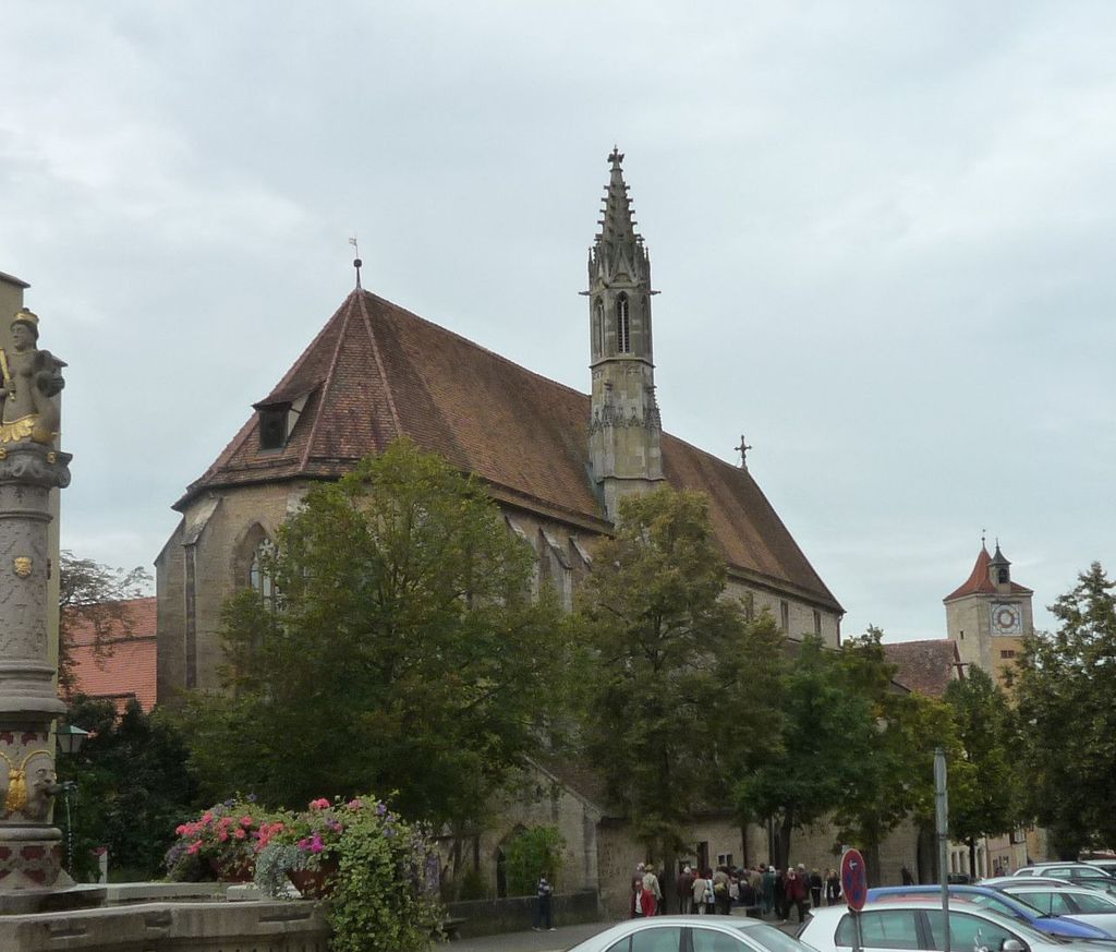
| Description | : | The Franciscan Abbey of Rothenburg ob der Tauber is a former monastery for the Conventual Franciscans in the town of Rothenburg ob der Tauber in Bavaria in the diocese of Bamberg. Nowadays the former abbey church is an Evangelical Lutheran parish church. The abbey, consecrated to the Virgin Mary was founded in 1281 by Hermann von Hornburg, Schultheiß and others. It folded in 1548 in the wake of the Reformation. In the buildings of the freely-abandoned abbey a school of latin was formed; later it became the dower residence of priests' widows. In 1805 the building became, inter alia, a salt... Read More |
frequently asked questions (FAQ):
-
Where is Franziskanerkloster Rothenburg o.d. Tauber?
Franziskanerkloster Rothenburg o.d. Tauber is located at Rothenburg ob der Tauber, Landkreis Ansbach ,Bavaria (Bayern) , 91541Germany.
-
Franziskanerkloster Rothenburg o.d. Tauber cemetery's updated grave count on graveviews.com?
0 memorials
-
Where are the coordinates of the Franziskanerkloster Rothenburg o.d. Tauber?
Latitude: 49.3766670
Longitude: 10.1763890
Nearby Cemetories:
1. Neuer Friedhof Rothenburg
Rothenburg ob der Tauber, Landkreis Ansbach, Germany
Coordinate: 49.3741670, 10.1865520
2. Alter Friedhof Rothenburg
Rothenburg ob der Tauber, Landkreis Ansbach, Germany
Coordinate: 49.3754270, 10.1874910
3. Neuer jüdischer Friedhof Rothenburg
Rothenburg ob der Tauber, Landkreis Ansbach, Germany
Coordinate: 49.3843200, 10.1867210
4. Friedhof Sankt Leonhard
Rothenburg ob der Tauber, Landkreis Ansbach, Germany
Coordinate: 49.3619997, 10.1952344
5. Gebsattel
Gebsattel, Landkreis Ansbach, Germany
Coordinate: 49.3503735, 10.1932641
6. Friedhof Neusitz
Neusitz, Landkreis Ansbach, Germany
Coordinate: 49.3714107, 10.2224423
7. Friedhof Bockenfeld
Bockenfeld, Landkreis Ansbach, Germany
Coordinate: 49.3286696, 10.1967328
8. Friedhof Heiligenbronn
Heiligenbronn, Landkreis Schwäbisch Hall, Germany
Coordinate: 49.3794013, 10.0981218
9. Friedhof Diebach
Diebach, Landkreis Ansbach, Germany
Coordinate: 49.3093394, 10.1865778
10. Friedhof Insingen
Insingen, Landkreis Ansbach, Germany
Coordinate: 49.3033533, 10.1619194
11. Friedhof Gammesfeld
Gammesfeld, Landkreis Schwäbisch Hall, Germany
Coordinate: 49.3112540, 10.0948363
12. Friedhof Hausen am Bach
Rot am See, Landkreis Schwäbisch Hall, Germany
Coordinate: 49.2959356, 10.1179181
13. Friedhof Diebach-Oberoestheim
Oberoestheim, Landkreis Ansbach, Germany
Coordinate: 49.2861721, 10.2036907
14. Friedhof Ohrenbach
Ohrenbach, Landkreis Ansbach, Germany
Coordinate: 49.4691644, 10.2109335
15. Friedhof Gastenfelden
Gastenfelden (Buch am Wald), Landkreis Ansbach, Germany
Coordinate: 49.3160642, 10.2959667
16. Friedhof Archshofen
Archshofen, Main-Tauber-Kreis, Germany
Coordinate: 49.4529800, 10.0750300
17. Gailnau Cemetery
Untergailnau, Landkreis Ansbach, Germany
Coordinate: 49.2678533, 10.1887184
18. Friedhof Brettheim
Brettheim, Landkreis Schwäbisch Hall, Germany
Coordinate: 49.2782623, 10.0903073
19. Friedhof Wettringen
Wettringen, Landkreis Ansbach, Germany
Coordinate: 49.2579900, 10.1574300
20. Friedhof Krailshausen
Krailshausen, Landkreis Schwäbisch Hall, Germany
Coordinate: 49.3665818, 9.9915662
21. Friedhof Wörnitz
Wörnitz, Landkreis Ansbach, Germany
Coordinate: 49.2567417, 10.2422890
22. Friedhof Wildentierbach
Wildentierbach, Main-Tauber-Kreis, Germany
Coordinate: 49.3952860, 9.9825730
23. Friedhof Hilgartshausen
Rot am See, Landkreis Schwäbisch Hall, Germany
Coordinate: 49.2672091, 10.0675529
24. Alter Friedhof Schrozberg
Schrozberg, Landkreis Schwäbisch Hall, Germany
Coordinate: 49.3425961, 9.9791354