
| Memorials | : | 0 |
| Location | : | Rothenburg ob der Tauber, Landkreis Ansbach, Germany |
| Coordinate | : | 49.3741670, 10.1865520 |
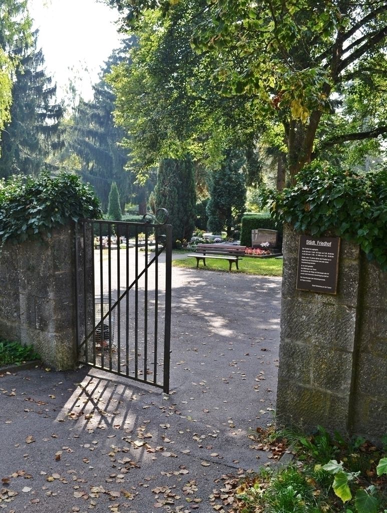
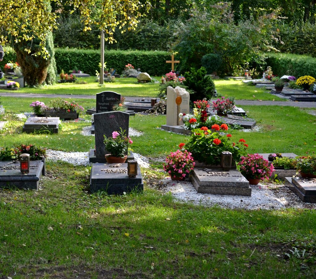
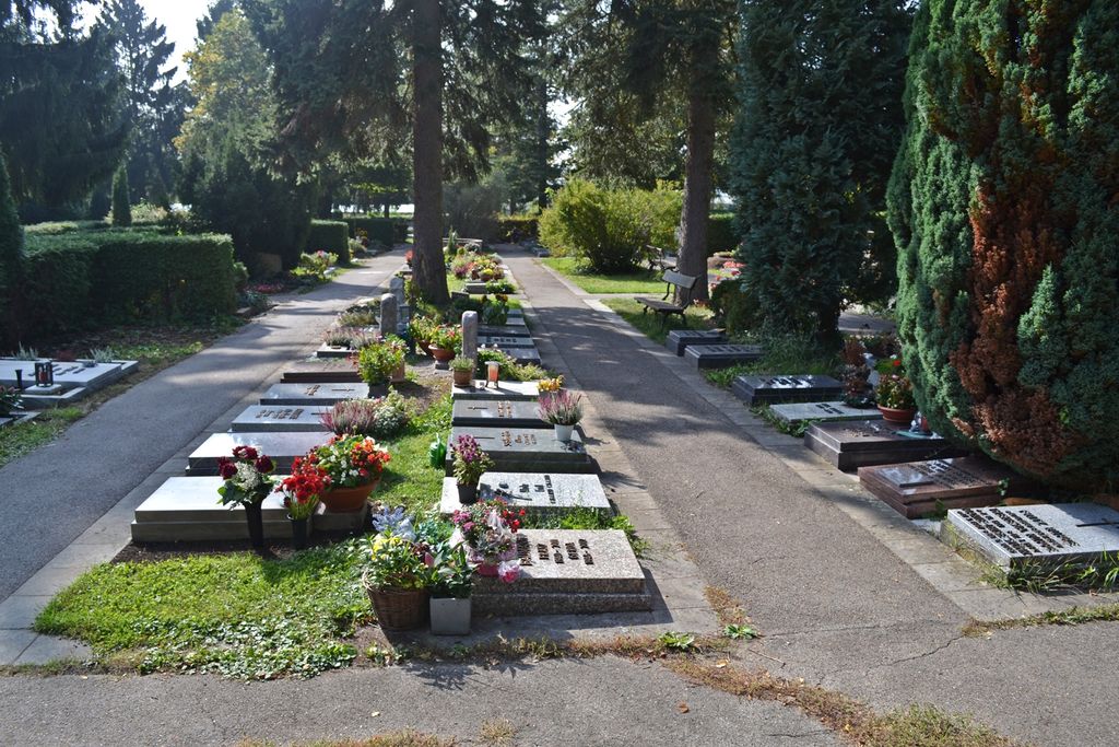
| Description | : | The new cemetery in Rothenburg is located on the western side of Erlbacher Strasse, across from the old one. The cemetery is owned and maintained by the city of Rothenburg. Also known as the "Städtischer Friedhof Rothenburg" In the middle of the cemetery, under a group of large trees, there is the Children's Corner, an area for burials of infants and children. Many of their grave markers display no last names. Please note that the graves in Germany are not perpetual. After a certain period of repose the graves are being leveled and re-used. There is no toxic embalming being done in... Read More |
frequently asked questions (FAQ):
-
Where is Neuer Friedhof Rothenburg?
Neuer Friedhof Rothenburg is located at Erlbacher Strasse Rothenburg ob der Tauber, Landkreis Ansbach ,Bavaria (Bayern) , 91541Germany.
-
Neuer Friedhof Rothenburg cemetery's updated grave count on graveviews.com?
0 memorials
-
Where are the coordinates of the Neuer Friedhof Rothenburg?
Latitude: 49.3741670
Longitude: 10.1865520
Nearby Cemetories:
1. Alter Friedhof Rothenburg
Rothenburg ob der Tauber, Landkreis Ansbach, Germany
Coordinate: 49.3754270, 10.1874910
2. Franziskanerkloster Rothenburg o.d. Tauber
Rothenburg ob der Tauber, Landkreis Ansbach, Germany
Coordinate: 49.3766670, 10.1763890
3. Neuer jüdischer Friedhof Rothenburg
Rothenburg ob der Tauber, Landkreis Ansbach, Germany
Coordinate: 49.3843200, 10.1867210
4. Friedhof Sankt Leonhard
Rothenburg ob der Tauber, Landkreis Ansbach, Germany
Coordinate: 49.3619997, 10.1952344
5. Friedhof Neusitz
Neusitz, Landkreis Ansbach, Germany
Coordinate: 49.3714107, 10.2224423
6. Gebsattel
Gebsattel, Landkreis Ansbach, Germany
Coordinate: 49.3503735, 10.1932641
7. Friedhof Bockenfeld
Bockenfeld, Landkreis Ansbach, Germany
Coordinate: 49.3286696, 10.1967328
8. Friedhof Heiligenbronn
Heiligenbronn, Landkreis Schwäbisch Hall, Germany
Coordinate: 49.3794013, 10.0981218
9. Friedhof Diebach
Diebach, Landkreis Ansbach, Germany
Coordinate: 49.3093394, 10.1865778
10. Friedhof Insingen
Insingen, Landkreis Ansbach, Germany
Coordinate: 49.3033533, 10.1619194
11. Friedhof Gammesfeld
Gammesfeld, Landkreis Schwäbisch Hall, Germany
Coordinate: 49.3112540, 10.0948363
12. Friedhof Diebach-Oberoestheim
Oberoestheim, Landkreis Ansbach, Germany
Coordinate: 49.2861721, 10.2036907
13. Friedhof Hausen am Bach
Rot am See, Landkreis Schwäbisch Hall, Germany
Coordinate: 49.2959356, 10.1179181
14. Friedhof Gastenfelden
Gastenfelden (Buch am Wald), Landkreis Ansbach, Germany
Coordinate: 49.3160642, 10.2959667
15. Friedhof Ohrenbach
Ohrenbach, Landkreis Ansbach, Germany
Coordinate: 49.4691644, 10.2109335
16. Gailnau Cemetery
Untergailnau, Landkreis Ansbach, Germany
Coordinate: 49.2678533, 10.1887184
17. Friedhof Archshofen
Archshofen, Main-Tauber-Kreis, Germany
Coordinate: 49.4529800, 10.0750300
18. Friedhof Brettheim
Brettheim, Landkreis Schwäbisch Hall, Germany
Coordinate: 49.2782623, 10.0903073
19. Friedhof Wettringen
Wettringen, Landkreis Ansbach, Germany
Coordinate: 49.2579900, 10.1574300
20. Friedhof Wörnitz
Wörnitz, Landkreis Ansbach, Germany
Coordinate: 49.2567417, 10.2422890
21. Friedhof Krailshausen
Krailshausen, Landkreis Schwäbisch Hall, Germany
Coordinate: 49.3665818, 9.9915662
22. Friedhof Marktbergel
Marktbergel, Landkreis Neustadt-Bad Windsheim, Germany
Coordinate: 49.4406240, 10.3596980
23. Friedhof Hilgartshausen
Rot am See, Landkreis Schwäbisch Hall, Germany
Coordinate: 49.2672091, 10.0675529
24. Friedhof Wildentierbach
Wildentierbach, Main-Tauber-Kreis, Germany
Coordinate: 49.3952860, 9.9825730