
| Memorials | : | 0 |
| Location | : | Rutsweiler am Glan, Landkreis Kusel, Germany |
| Coordinate | : | 49.5316860, 7.4578340 |
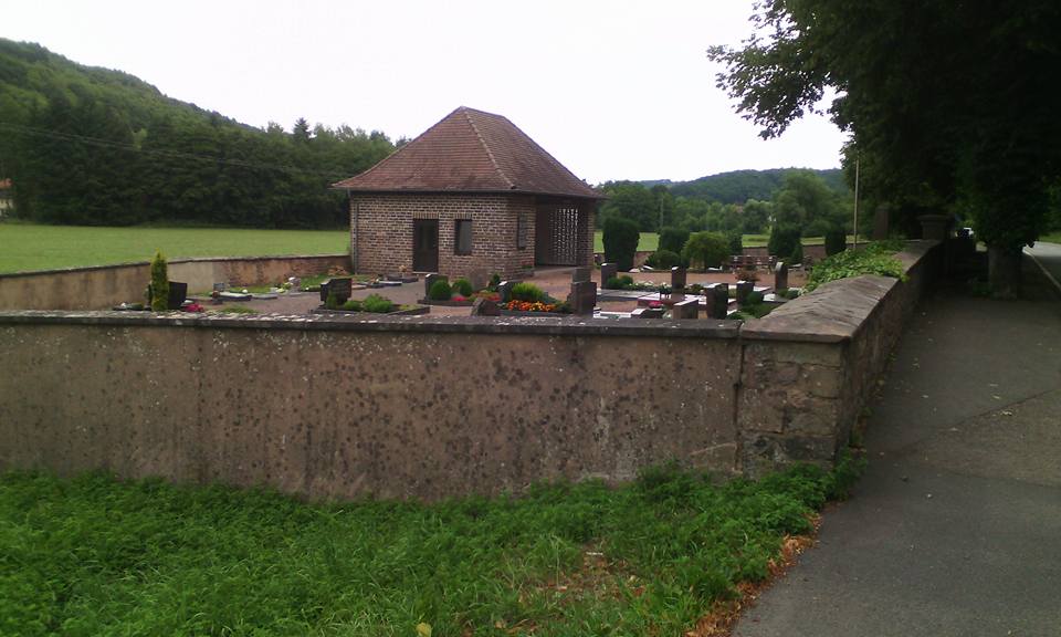
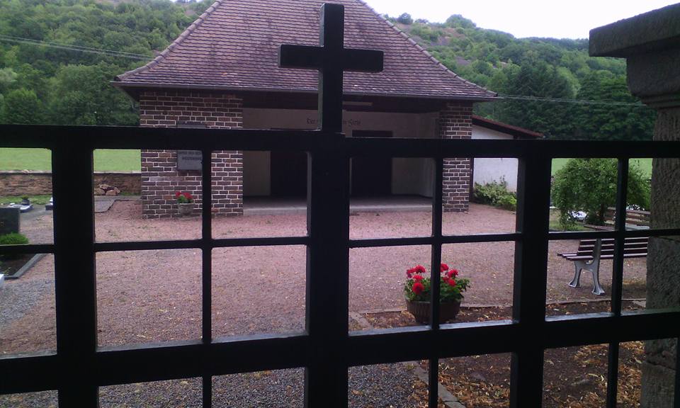
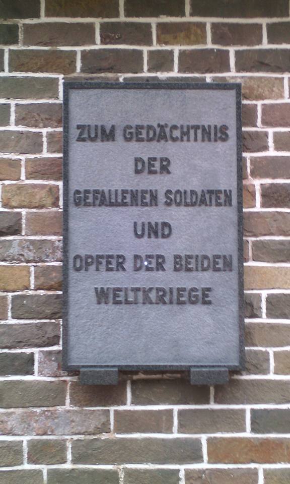
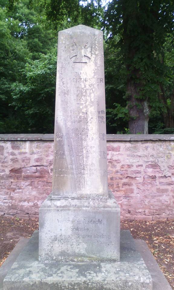
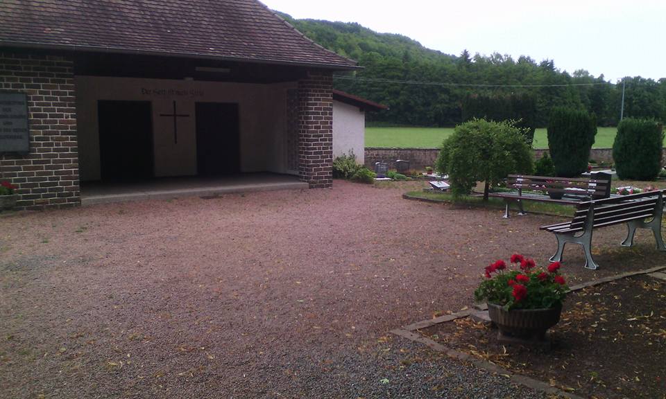
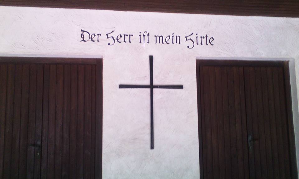
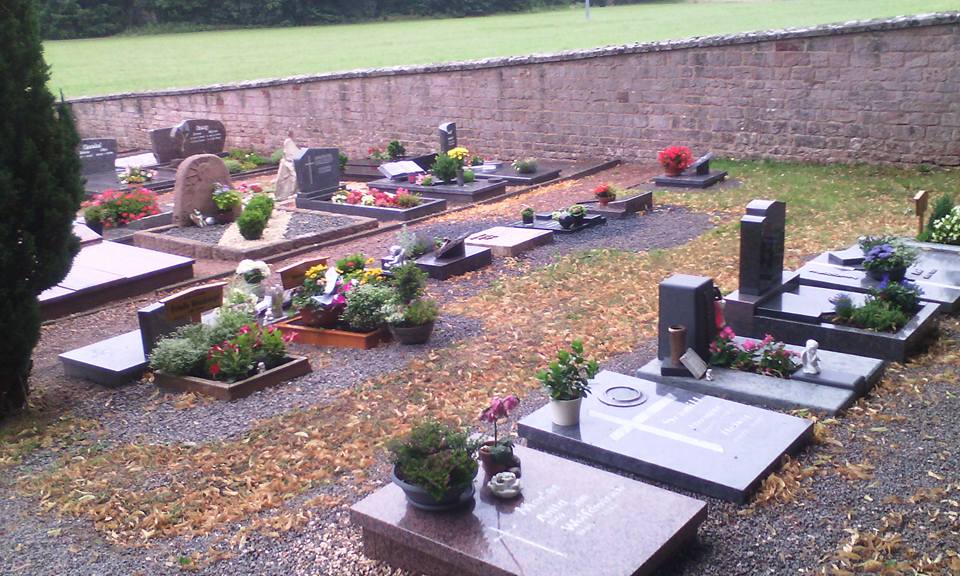
| Description | : | This cemetery has been in existence for centuries and is used solely for the temporary occupancy of the village's deceased citizens, as each community has it's own designated burial grounds. Following World War II, a memorial was erected just inside and to the right of the gated entry, as well as a plaque affixed upon a single building that stands in the back center area of the cemetery, intended to commemorate the villages losses in both World Wars. Rutsweiler am Glan had four fallen during World War I and, in the Second World War, twenty-two had fallen in battle, killed in... Read More |
frequently asked questions (FAQ):
-
Where is Friedhof Rutsweiler am Glan?
Friedhof Rutsweiler am Glan is located at Hauptstraße 97 Rutsweiler am Glan, Landkreis Kusel ,Rheinland-Pfalz , 66887Germany.
-
Friedhof Rutsweiler am Glan cemetery's updated grave count on graveviews.com?
0 memorials
-
Where are the coordinates of the Friedhof Rutsweiler am Glan?
Latitude: 49.5316860
Longitude: 7.4578340
Nearby Cemetories:
1. Propsteikirche
Haschbach am Remigiusberg, Landkreis Kusel, Germany
Coordinate: 49.5212180, 7.4382500
2. Friedhof Altenglan
Altenglan, Landkreis Kusel, Germany
Coordinate: 49.5542360, 7.4599070
3. Friedhof Kusel
Kirrweiler, Landkreis Kusel, Germany
Coordinate: 49.5416190, 7.4167560
4. Friedhof Rehweiler
Rehweiler, Landkreis Kusel, Germany
Coordinate: 49.4803625, 7.4387971
5. Friedhof Quirnbach
Quirnbach, Landkreis Kusel, Germany
Coordinate: 49.4784922, 7.4182498
6. Ulmet Flurskapelle
Ulmet, Landkreis Kusel, Germany
Coordinate: 49.5912230, 7.4527580
7. Friedhof Henschtal
Landkreis Kusel, Germany
Coordinate: 49.4646293, 7.4056378
8. Trahweiler
Trahweiler, Landkreis Kusel, Germany
Coordinate: 49.4643049, 7.4015576
9. Friedhof Pfeffelbach
Pfeffelbach, Landkreis Kusel, Germany
Coordinate: 49.5417772, 7.3308117
10. Jüdischer Friedhof Steinbach am Glan
Steinbach, Landkreis Kusel, Germany
Coordinate: 49.4577760, 7.3982190
11. Friedhof 2
Frutzweiler, Landkreis Kusel, Germany
Coordinate: 49.4546832, 7.3807754
12. Friedhof 1
Frutzweiler, Landkreis Kusel, Germany
Coordinate: 49.4517685, 7.3762781
13. Friedhof Ramstein
Ramstein-Miesenbach, Landkreis Kaiserslautern, Germany
Coordinate: 49.4473300, 7.5494100
14. Friedhof Ohmbach
Ohmbach, Landkreis Kusel, Germany
Coordinate: 49.4509570, 7.3474230
15. Ilgesheim Evangelical Cemetery
Ilgesheim, Landkreis Kusel, Germany
Coordinate: 49.6510000, 7.4454300
16. Friedhof Fohren-Linden
Fohren-Linden, Landkreis Birkenfeld, Germany
Coordinate: 49.5890821, 7.2836588
17. Hausweiler Friedhof
Hausweiler, Landkreis Kusel, Germany
Coordinate: 49.6460360, 7.5604180
18. Friedhof Hauptstuhl
Hauptstuhl, Landkreis Kaiserslautern, Germany
Coordinate: 49.4003883, 7.4991166
19. Friedhof Kübelberg
Schönenberg-Kübelberg, Landkreis Kusel, Germany
Coordinate: 49.4079629, 7.3698712
20. Friedhofsverwaltung
Bad Kreuznach, Landkreis Bad Kreuznach, Germany
Coordinate: 49.4000000, 7.5200000
21. St. Andreas-Kirche
Landstuhl, Landkreis Kaiserslautern, Germany
Coordinate: 49.4095100, 7.5701620
22. Landstuhl Cemetery
Landstuhl, Landkreis Kaiserslautern, Germany
Coordinate: 49.4132313, 7.5803565
23. Friedhof Kindsbach
Kindsbach, Landkreis Kaiserslautern, Germany
Coordinate: 49.4167321, 7.6071109
24. Friedhof Martinshöhe
Martinshöhe, Landkreis Kaiserslautern, Germany
Coordinate: 49.3700529, 7.4817782