
| Memorials | : | 0 |
| Location | : | Mattapoisett, Plymouth County, USA |
| Coordinate | : | 41.6658110, -70.7838390 |
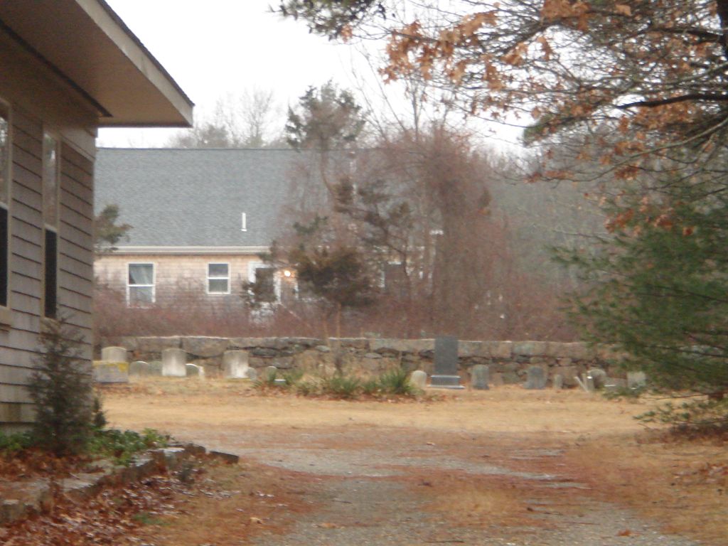
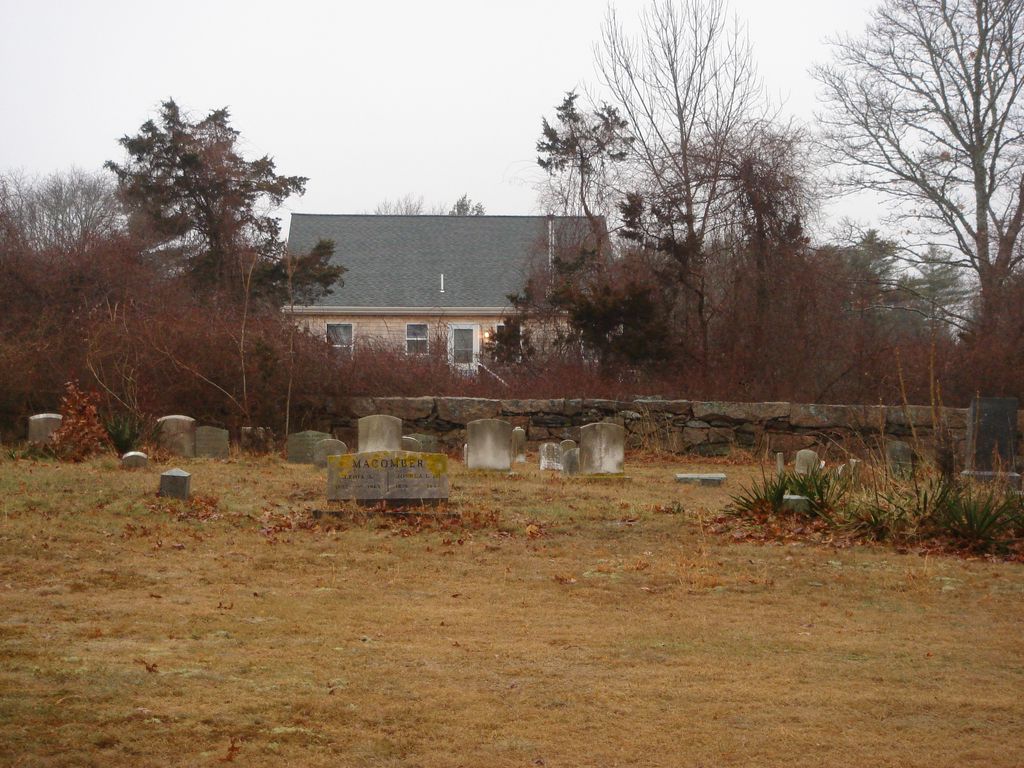
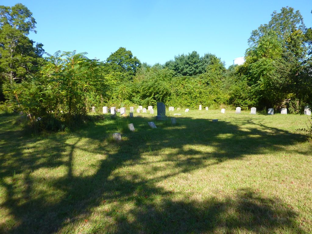
| Description | : | The Massachusetts Historical Commission refers to this cemetery in MACRIS as MAT803. This burial place is referenced to in the book "Vital Records of Rochester, Massachusetts to 1850", Published by the New England Historic Genealogical Society, as G.R.20. Mattapoisett separated from Rochester in 1857. This burial place is referenced to in the book "Old Cemeteries of Southeastern Massachusetts" by Charles M Thatcher as "Quaker Church Cemetery Mattapoisett on Marion Road". |
frequently asked questions (FAQ):
-
Where is Friends Cemetery?
Friends Cemetery is located at 103 Marion Road (Route 6) Mattapoisett, Plymouth County ,Massachusetts ,USA.
-
Friends Cemetery cemetery's updated grave count on graveviews.com?
0 memorials
-
Where are the coordinates of the Friends Cemetery?
Latitude: 41.6658110
Longitude: -70.7838390
Nearby Cemetories:
1. Pine Island Cemetery
Mattapoisett, Plymouth County, USA
Coordinate: 41.6624947, -70.7928925
2. Barlow Cemetery
Mattapoisett, Plymouth County, USA
Coordinate: 41.6641045, -70.8232269
3. Cushing Cemetery
Mattapoisett, Plymouth County, USA
Coordinate: 41.6624985, -70.8255997
4. Evergreen Cemetery
Marion, Plymouth County, USA
Coordinate: 41.6985435, -70.7698517
5. Saint Anthonys Cemetery
Mattapoisett, Plymouth County, USA
Coordinate: 41.6781060, -70.8271560
6. Hammond Cemetery
Mattapoisett, Plymouth County, USA
Coordinate: 41.6638300, -70.8351500
7. Saint Gabriels Episcopal Memorial Garden
Marion, Plymouth County, USA
Coordinate: 41.7020200, -70.7626500
8. Old Landing Cemetery
Marion, Plymouth County, USA
Coordinate: 41.7103004, -70.7707977
9. Point Road Memorial Forest
Marion, Plymouth County, USA
Coordinate: 41.7071400, -70.7385050
10. Blankenship Cemetery
Marion, Plymouth County, USA
Coordinate: 41.7076200, -70.7392100
11. Little Neck Cemetery
Marion, Plymouth County, USA
Coordinate: 41.7175200, -70.7624900
12. Ellis Cemetery
Mattapoisett, Plymouth County, USA
Coordinate: 41.6957817, -70.8545609
13. Ellis Family Burial Ground
Rochester, Plymouth County, USA
Coordinate: 41.7105620, -70.8397580
14. Friends Burial Ground
Marion, Plymouth County, USA
Coordinate: 41.7279129, -70.7757416
15. North Marion Cemetery
Marion, Plymouth County, USA
Coordinate: 41.7280884, -70.7763062
16. Center Cemetery
Rochester, Plymouth County, USA
Coordinate: 41.7301530, -70.8185830
17. Naskatucket Cemetery
Fairhaven, Bristol County, USA
Coordinate: 41.6426100, -70.8727200
18. Perry Family Cemetery
Rochester, Plymouth County, USA
Coordinate: 41.7501840, -70.7914780
19. Howse Family Burial Ground
Rochester, Plymouth County, USA
Coordinate: 41.7262300, -70.8632760
20. Sacred Hearts of Jesus and Mary Community Cemetery
Fairhaven, Bristol County, USA
Coordinate: 41.6420000, -70.8978000
21. Burnham Cemetery
Acushnet, Bristol County, USA
Coordinate: 41.7090300, -70.8885400
22. Woodside Cemetery
Fairhaven, Bristol County, USA
Coordinate: 41.6589012, -70.9085999
23. Friends Cemetery
Acushnet, Bristol County, USA
Coordinate: 41.6841100, -70.9067100
24. Tabor Cemetery
Acushnet, Bristol County, USA
Coordinate: 41.6838900, -70.9070000