
| Memorials | : | 95 |
| Location | : | Marion, Plymouth County, USA |
| Coordinate | : | 41.7071400, -70.7385050 |
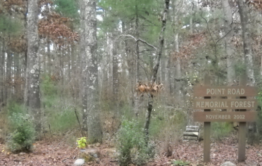
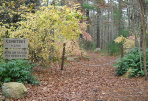
| Description | : | The Point Road Memorial Forest is located next to the Blankenship Cemetery. This cemetery is for cremains only. For information, contact the Town of Marion Department of Public Works. |
frequently asked questions (FAQ):
-
Where is Point Road Memorial Forest?
Point Road Memorial Forest is located at across from 662 Point Road Marion, Plymouth County ,Massachusetts ,USA.
-
Point Road Memorial Forest cemetery's updated grave count on graveviews.com?
89 memorials
-
Where are the coordinates of the Point Road Memorial Forest?
Latitude: 41.7071400
Longitude: -70.7385050
Nearby Cemetories:
1. Blankenship Cemetery
Marion, Plymouth County, USA
Coordinate: 41.7076200, -70.7392100
2. Saint Gabriels Episcopal Memorial Garden
Marion, Plymouth County, USA
Coordinate: 41.7020200, -70.7626500
3. Little Neck Cemetery
Marion, Plymouth County, USA
Coordinate: 41.7175200, -70.7624900
4. Old Landing Cemetery
Marion, Plymouth County, USA
Coordinate: 41.7103004, -70.7707977
5. Evergreen Cemetery
Marion, Plymouth County, USA
Coordinate: 41.6985435, -70.7698517
6. Friends Burial Ground
Marion, Plymouth County, USA
Coordinate: 41.7279129, -70.7757416
7. North Marion Cemetery
Marion, Plymouth County, USA
Coordinate: 41.7280884, -70.7763062
8. Agawam Cemetery
Wareham, Plymouth County, USA
Coordinate: 41.7463989, -70.6908035
9. Friends Cemetery
Mattapoisett, Plymouth County, USA
Coordinate: 41.6658110, -70.7838390
10. Perry Family Cemetery
Rochester, Plymouth County, USA
Coordinate: 41.7501840, -70.7914780
11. Pine Island Cemetery
Mattapoisett, Plymouth County, USA
Coordinate: 41.6624947, -70.7928925
12. Saint Patricks Cemetery
Wareham, Plymouth County, USA
Coordinate: 41.7703018, -70.7264023
13. Center Cemetery
Rochester, Plymouth County, USA
Coordinate: 41.7301530, -70.8185830
14. Centre Cemetery
Wareham, Plymouth County, USA
Coordinate: 41.7708015, -70.7277985
15. Tobey-Fearing-Bliss Cemetery (Defunct)
Wareham, Plymouth County, USA
Coordinate: 41.7722600, -70.7464100
16. Saint Anthonys Cemetery
Mattapoisett, Plymouth County, USA
Coordinate: 41.6781060, -70.8271560
17. Ellis Family Burial Ground
Rochester, Plymouth County, USA
Coordinate: 41.7105620, -70.8397580
18. Barlow Cemetery
Mattapoisett, Plymouth County, USA
Coordinate: 41.6641045, -70.8232269
19. Hillside Cemetery
Rochester, Plymouth County, USA
Coordinate: 41.7750015, -70.7889023
20. Cushing Cemetery
Mattapoisett, Plymouth County, USA
Coordinate: 41.6624985, -70.8255997
21. Union Cemetery
Rochester, Plymouth County, USA
Coordinate: 41.7573640, -70.8202030
22. Woodside Cemetery
Rochester, Plymouth County, USA
Coordinate: 41.7848816, -70.7774887
23. Hammond Cemetery
Mattapoisett, Plymouth County, USA
Coordinate: 41.6638300, -70.8351500
24. Long Neck Cemetery
Wareham, Plymouth County, USA
Coordinate: 41.7461014, -70.6369019