
| Memorials | : | 0 |
| Location | : | Randolph County, USA |
| Coordinate | : | 39.3919730, -92.5837650 |
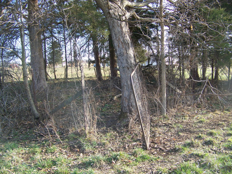
| Description | : | Located in T53 R15 S15 in clump of trees on the east side of CR 2160 across the road from a yellow house (in 2008). Livestock and fallen trees have pretty much destroyed this cemetery. There are several graves marked only with fieldstones. |
frequently asked questions (FAQ):
-
Where is Fullington Cemetery?
Fullington Cemetery is located at Randolph County ,Missouri ,USA.
-
Fullington Cemetery cemetery's updated grave count on graveviews.com?
0 memorials
-
Where are the coordinates of the Fullington Cemetery?
Latitude: 39.3919730
Longitude: -92.5837650

Nearby Cemetories:
1. Oliver Cemetery
Randolph County, USA
Coordinate: 39.3871600, -92.5831100
2. Mount Salem Cemetery
Huntsville, Randolph County, USA
Coordinate: 39.3890200, -92.5688200
3. Jackson Family Cemetery
Huntsville, Randolph County, USA
Coordinate: 39.3759810, -92.5692600
4. John Atterbury Farm Cemetery
Mount Airy, Randolph County, USA
Coordinate: 39.3833620, -92.6098600
5. Charles Barron Cemetery
Randolph County, USA
Coordinate: 39.3805710, -92.5589660
6. Burton-Burk Cemetery
Clifton Hill, Randolph County, USA
Coordinate: 39.4152590, -92.5930630
7. Original Nichols Cemetery
Randolph County, USA
Coordinate: 39.3712360, -92.5668110
8. Mathis Cemetery
Huntsville, Randolph County, USA
Coordinate: 39.3806380, -92.6250540
9. Hurt Cemetery
Mount Airy, Randolph County, USA
Coordinate: 39.3720890, -92.6300010
10. Sweet Springs Baptist Church Cemetery
Huntsville, Randolph County, USA
Coordinate: 39.3816500, -92.5259500
11. Freeman Cemetery
Randolph County, USA
Coordinate: 39.3476470, -92.5616940
12. Old Mount Airy-Stark Cemetery
Randolph County, USA
Coordinate: 39.3760700, -92.6418100
13. Bagby Cemetery
Huntsville, Randolph County, USA
Coordinate: 39.3474998, -92.5610962
14. Patrick Robertson Cemetery
Randolph County, USA
Coordinate: 39.3418470, -92.5756330
15. Henry Austin Cemetery
Huntsville, Randolph County, USA
Coordinate: 39.4365180, -92.5434960
16. Boulware-Morehead Cemetery
Randolph County, USA
Coordinate: 39.4398600, -92.5504750
17. Hagar Cemetery
Huntsville, Randolph County, USA
Coordinate: 39.4049988, -92.5130997
18. Collins Family Cemetery
Randolph County, USA
Coordinate: 39.3574860, -92.5243130
19. Huntsville City Cemetery
Huntsville, Randolph County, USA
Coordinate: 39.4440500, -92.5460000
20. Goodman Cemetery
Mount Airy, Randolph County, USA
Coordinate: 39.3629680, -92.6539190
21. Nicholas Dysart Cemetery
Randolph County, USA
Coordinate: 39.3302260, -92.5969630
22. Devore Family Cemetery
Randolph County, USA
Coordinate: 39.4269540, -92.5165500
23. Babcock Farm Cemetery
Clifton Hill, Randolph County, USA
Coordinate: 39.4036000, -92.6660000
24. Barron Cemetery
Higbee, Randolph County, USA
Coordinate: 39.3640470, -92.5080860