
| Memorials | : | 0 |
| Location | : | Randolph County, USA |
| Coordinate | : | 39.3760700, -92.6418100 |
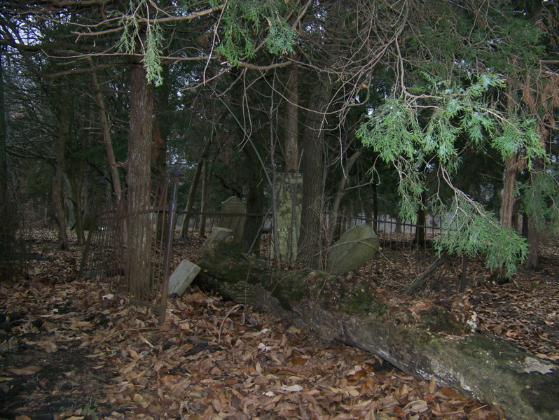
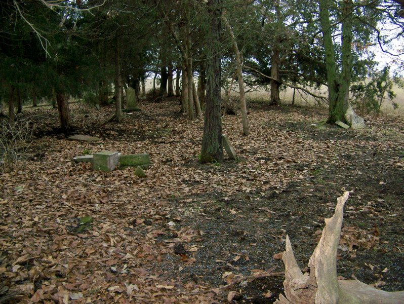
| Description | : | Located in T53 R15 S19 on a wooded hill near the junction of Hwy 3 & Rt U near Mt Airy. Silver Creek Baptist Church, first known as the Old Goose Pond Church, was located nearby. Several of the early settlers of this area are buried here. Most stones have been damaged by livestock and fallen trees. |
frequently asked questions (FAQ):
-
Where is Old Mount Airy-Stark Cemetery?
Old Mount Airy-Stark Cemetery is located at Randolph County ,Missouri ,USA.
-
Old Mount Airy-Stark Cemetery cemetery's updated grave count on graveviews.com?
0 memorials
-
Where are the coordinates of the Old Mount Airy-Stark Cemetery?
Latitude: 39.3760700
Longitude: -92.6418100
Nearby Cemetories:
1. Hurt Cemetery
Mount Airy, Randolph County, USA
Coordinate: 39.3720890, -92.6300010
2. Mathis Cemetery
Huntsville, Randolph County, USA
Coordinate: 39.3806380, -92.6250540
3. Goodman Cemetery
Mount Airy, Randolph County, USA
Coordinate: 39.3629680, -92.6539190
4. John Atterbury Farm Cemetery
Mount Airy, Randolph County, USA
Coordinate: 39.3833620, -92.6098600
5. Mayo Graveyard
Mount Airy, Randolph County, USA
Coordinate: 39.3698380, -92.6755570
6. McDavitt Family Cemetery
Randolph County, USA
Coordinate: 39.3743360, -92.6806940
7. Babcock Farm Cemetery
Clifton Hill, Randolph County, USA
Coordinate: 39.4036000, -92.6660000
8. Head Family Cemetery
Randolph County, USA
Coordinate: 39.3468500, -92.6771800
9. Ferguson Farm Cemetery
Mount Airy, Randolph County, USA
Coordinate: 39.3380370, -92.6694590
10. Oliver Cemetery
Randolph County, USA
Coordinate: 39.3871600, -92.5831100
11. Fullington Cemetery
Randolph County, USA
Coordinate: 39.3919730, -92.5837650
12. Dennis Cemetery
Salisbury Township, Chariton County, USA
Coordinate: 39.3726006, -92.7102966
13. Burton-Burk Cemetery
Clifton Hill, Randolph County, USA
Coordinate: 39.4152590, -92.5930630
14. Gunn Cemetery
Randolph County, USA
Coordinate: 39.4159540, -92.6908860
15. Jackson Family Cemetery
Huntsville, Randolph County, USA
Coordinate: 39.3759810, -92.5692600
16. Nicholas Dysart Cemetery
Randolph County, USA
Coordinate: 39.3302260, -92.5969630
17. Mount Salem Cemetery
Huntsville, Randolph County, USA
Coordinate: 39.3890200, -92.5688200
18. Original Nichols Cemetery
Randolph County, USA
Coordinate: 39.3712360, -92.5668110
19. Delphi Robertson Cemetery
Randolph County, USA
Coordinate: 39.3397950, -92.7044400
20. Patrick Robertson Cemetery
Randolph County, USA
Coordinate: 39.3418470, -92.5756330
21. Mansfield Cemetery
Randolph County, USA
Coordinate: 39.3321050, -92.6983690
22. Gooch Cemetery
Salisbury Township, Chariton County, USA
Coordinate: 39.3695410, -92.7223460
23. Pitts Family Cemetery
Randolph County, USA
Coordinate: 39.3126670, -92.6302160
24. Charles Barron Cemetery
Randolph County, USA
Coordinate: 39.3805710, -92.5589660