
| Memorials | : | 19 |
| Location | : | Georgetown, Harrison County, USA |
| Coordinate | : | 40.2155991, -80.9227982 |
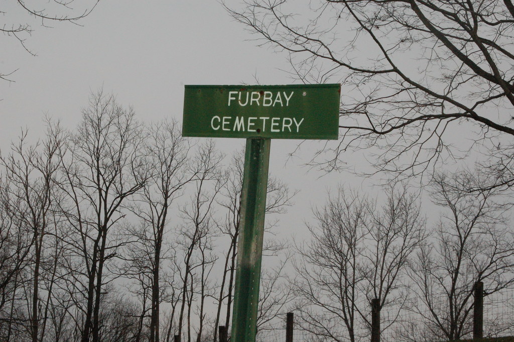
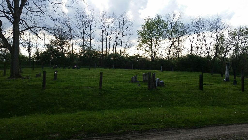
| Description | : | The cemetery is located about 0.3 miles north of Cadiz-Harrisville Road (US 250) about 0.4 miles northwest of its intersection with Georgetown Road (County Road 41). The cemetery was established in 1828 and is 0.15 acres in size. The cemetery can be accessed via a lane going north from Cadiz-Harrisville Road (US 250) about 0.6 miles northwest of its intersection with Georgetown Road (County Road 41). The cemetery is located in Short Creek Township, Harrison County, Ohio, and is # 5045 (Furbay Cemetery / Branson Cemetery) in “Ohio Cemeteries 1803-2003”, compiled by the Ohio Genealogical Society. The cemetery... Read More |
frequently asked questions (FAQ):
-
Where is Furbay Cemetery?
Furbay Cemetery is located at Cadiz-Harrisville Road (US 250) Georgetown, Harrison County ,Ohio , 43907USA.
-
Furbay Cemetery cemetery's updated grave count on graveviews.com?
19 memorials
-
Where are the coordinates of the Furbay Cemetery?
Latitude: 40.2155991
Longitude: -80.9227982
Nearby Cemetories:
1. Georgetown Graveyard
Harrisville, Harrison County, USA
Coordinate: 40.2138830, -80.9275670
2. Short Creek Cemetery
Georgetown, Harrison County, USA
Coordinate: 40.2139015, -80.9278030
3. West Grove Cemetery
Cadiz, Harrison County, USA
Coordinate: 40.2285995, -80.9366989
4. Adena Presbyterian Church Cemetery
Smithfield, Jefferson County, USA
Coordinate: 40.2161805, -80.8742561
5. Olive Branch Cemetery
Harrisville, Harrison County, USA
Coordinate: 40.1810989, -80.8953018
6. Friends Meeting House Cemetery
Adena, Jefferson County, USA
Coordinate: 40.1903970, -80.8805160
7. Alley Cemetery
Harrisville, Harrison County, USA
Coordinate: 40.1828003, -80.8861008
8. Wilson Cemetery
Mount Pleasant Township, Jefferson County, USA
Coordinate: 40.1824989, -80.8807983
9. Stiers Cemetery
Harrisville, Harrison County, USA
Coordinate: 40.1692009, -80.9400024
10. Dickerson Church Cemetery
Cadiz, Harrison County, USA
Coordinate: 40.2308006, -80.9839020
11. Rehoboth Cemetery
Smithfield Township, Jefferson County, USA
Coordinate: 40.2336006, -80.8593979
12. Holmes Pioneer Cemetery
Adena, Jefferson County, USA
Coordinate: 40.2182999, -80.8527985
13. Saint Casimirs Roman Catholic Church Cemetery
Smithfield, Jefferson County, USA
Coordinate: 40.2131004, -80.8510971
14. Longview Cemetery
New Athens, Harrison County, USA
Coordinate: 40.1911011, -80.9931030
15. New Athens Methodist Episcopal Cemetery
New Athens, Harrison County, USA
Coordinate: 40.1851270, -80.9969550
16. Wheeling Valley Cemetery
Fairpoint, Belmont County, USA
Coordinate: 40.1455570, -80.9022550
17. Unity Cemetery
Fairpoint, Belmont County, USA
Coordinate: 40.1522920, -80.9723180
18. Cadiz Union Cemetery
Cadiz, Harrison County, USA
Coordinate: 40.2705994, -80.9882965
19. Old Cadiz Cemetery
Cadiz, Harrison County, USA
Coordinate: 40.2694016, -80.9981003
20. Beech Spring Cemetery
Hopedale, Harrison County, USA
Coordinate: 40.2933006, -80.8936005
21. Crabapple Cemetery
Wheeling Township, Belmont County, USA
Coordinate: 40.1556015, -80.9953003
22. Hicksite Cemetery
Emerson, Jefferson County, USA
Coordinate: 40.1761017, -80.8289032
23. Pleasant Grove Cemetery
Pleasant Grove, Belmont County, USA
Coordinate: 40.1507988, -80.8463974
24. Short Creek Cemetery
Bergholz, Jefferson County, USA
Coordinate: 40.1817017, -80.8116989