
| Memorials | : | 5 |
| Location | : | Harrisville, Harrison County, USA |
| Coordinate | : | 40.1828003, -80.8861008 |
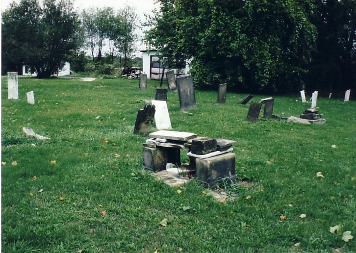
| Description | : | The cemetery is located on the north side of Back Street about 200 feet north of its intersection with East main Street (US 250). The cemetery is located in Short Creek Township, Harrison County, Ohio, and is # 5046 (Harrisville Methodist Episcopal Cemetery / Alley Cemetery) in “Ohio Cemeteries 1803-2003”, compiled by the Ohio Genealogical Society. The U.S. Geological Survey (USGS) Geographic Names Information System (GNIS) feature ID for the cemetery is 1037378 (Alley Cemetery / Harrisville Methodist Episcopal Cemetery). |
frequently asked questions (FAQ):
-
Where is Alley Cemetery?
Alley Cemetery is located at Back Street Harrisville, Harrison County ,Ohio , 43901USA.
-
Alley Cemetery cemetery's updated grave count on graveviews.com?
5 memorials
-
Where are the coordinates of the Alley Cemetery?
Latitude: 40.1828003
Longitude: -80.8861008
Nearby Cemetories:
1. Wilson Cemetery
Mount Pleasant Township, Jefferson County, USA
Coordinate: 40.1824989, -80.8807983
2. Olive Branch Cemetery
Harrisville, Harrison County, USA
Coordinate: 40.1810989, -80.8953018
3. Friends Meeting House Cemetery
Adena, Jefferson County, USA
Coordinate: 40.1903970, -80.8805160
4. Adena Presbyterian Church Cemetery
Smithfield, Jefferson County, USA
Coordinate: 40.2161805, -80.8742561
5. Wheeling Valley Cemetery
Fairpoint, Belmont County, USA
Coordinate: 40.1455570, -80.9022550
6. Saint Casimirs Roman Catholic Church Cemetery
Smithfield, Jefferson County, USA
Coordinate: 40.2131004, -80.8510971
7. Furbay Cemetery
Georgetown, Harrison County, USA
Coordinate: 40.2155991, -80.9227982
8. Stiers Cemetery
Harrisville, Harrison County, USA
Coordinate: 40.1692009, -80.9400024
9. Holmes Pioneer Cemetery
Adena, Jefferson County, USA
Coordinate: 40.2182999, -80.8527985
10. Pleasant Grove Cemetery
Pleasant Grove, Belmont County, USA
Coordinate: 40.1507988, -80.8463974
11. Hicksite Cemetery
Emerson, Jefferson County, USA
Coordinate: 40.1761017, -80.8289032
12. Georgetown Graveyard
Harrisville, Harrison County, USA
Coordinate: 40.2138830, -80.9275670
13. Short Creek Cemetery
Georgetown, Harrison County, USA
Coordinate: 40.2139015, -80.9278030
14. Holly Memorial Gardens
Pleasant Grove, Belmont County, USA
Coordinate: 40.1479460, -80.8419940
15. Rehoboth Cemetery
Smithfield Township, Jefferson County, USA
Coordinate: 40.2336006, -80.8593979
16. Short Creek Cemetery
Mount Pleasant, Jefferson County, USA
Coordinate: 40.1802000, -80.8124400
17. Short Creek Cemetery
Bergholz, Jefferson County, USA
Coordinate: 40.1817017, -80.8116989
18. Coleman Cemetery
Wheeling Township, Belmont County, USA
Coordinate: 40.1244011, -80.8992004
19. West Grove Cemetery
Cadiz, Harrison County, USA
Coordinate: 40.2285995, -80.9366989
20. Highland Cemetery
Mount Pleasant, Jefferson County, USA
Coordinate: 40.1785580, -80.7966240
21. Seceder Cemetery
Mount Pleasant, Jefferson County, USA
Coordinate: 40.1749992, -80.7936020
22. Unity Cemetery
Fairpoint, Belmont County, USA
Coordinate: 40.1522920, -80.9723180
23. Joshua Maule Family Burying Ground
Colerain, Belmont County, USA
Coordinate: 40.1350000, -80.8058330
24. Barton Cemetery
Barton, Belmont County, USA
Coordinate: 40.1136017, -80.8296967