
| Memorials | : | 4 |
| Location | : | Adena, Jefferson County, USA |
| Coordinate | : | 40.2182999, -80.8527985 |
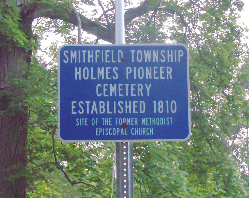
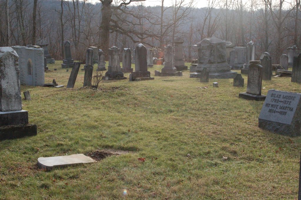
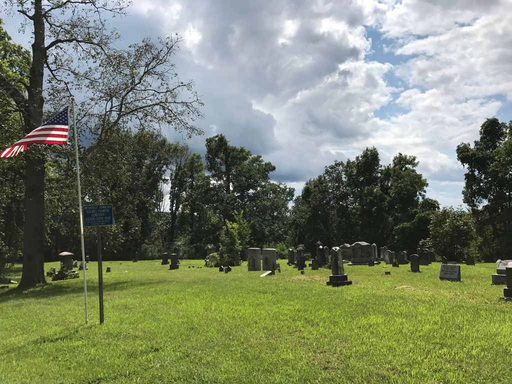
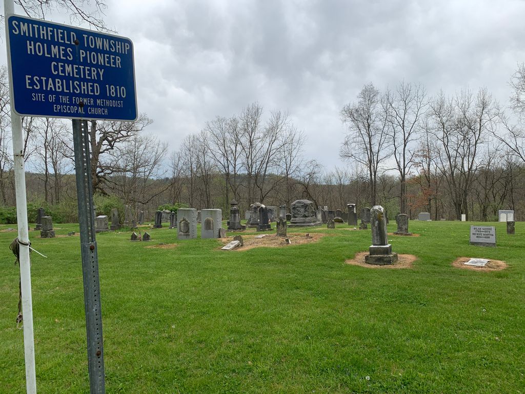
| Description | : | The cemetery is reached by going south about 1 mile on a lane exiting Township Highway 130 where it makes a sharp turn to the north about 0.6 miles east of its junction with Smithfield Adena Road (County Road 10). The cemetery was established in 1810 and is 0.5 acres in size. The cemetery is located in Smithfield Township, Jefferson County, Ohio, and is # 6081 (Holmes Methodist Cemetery / Holmes Cemetery) in “Ohio Cemeteries 1803-2003”, compiled by the Ohio Genealogical Society. The U.S. Geological Survey (USGS) Geographic Names Information System (GNIS) feature ID for the cemetery is... Read More |
frequently asked questions (FAQ):
-
Where is Holmes Pioneer Cemetery?
Holmes Pioneer Cemetery is located at Township Highway 130 Adena, Jefferson County ,Ohio , 43901USA.
-
Holmes Pioneer Cemetery cemetery's updated grave count on graveviews.com?
4 memorials
-
Where are the coordinates of the Holmes Pioneer Cemetery?
Latitude: 40.2182999
Longitude: -80.8527985
Nearby Cemetories:
1. Saint Casimirs Roman Catholic Church Cemetery
Smithfield, Jefferson County, USA
Coordinate: 40.2131004, -80.8510971
2. Rehoboth Cemetery
Smithfield Township, Jefferson County, USA
Coordinate: 40.2336006, -80.8593979
3. Adena Presbyterian Church Cemetery
Smithfield, Jefferson County, USA
Coordinate: 40.2161805, -80.8742561
4. Friends Meeting House Cemetery
Adena, Jefferson County, USA
Coordinate: 40.1903970, -80.8805160
5. Wilson Cemetery
Mount Pleasant Township, Jefferson County, USA
Coordinate: 40.1824989, -80.8807983
6. Alley Cemetery
Harrisville, Harrison County, USA
Coordinate: 40.1828003, -80.8861008
7. Hicksite Cemetery
Emerson, Jefferson County, USA
Coordinate: 40.1761017, -80.8289032
8. Short Creek Cemetery
Bergholz, Jefferson County, USA
Coordinate: 40.1817017, -80.8116989
9. Wheeler Cemetery
Smithfield, Jefferson County, USA
Coordinate: 40.2453003, -80.7996979
10. Short Creek Cemetery
Mount Pleasant, Jefferson County, USA
Coordinate: 40.1802000, -80.8124400
11. Olive Branch Cemetery
Harrisville, Harrison County, USA
Coordinate: 40.1810989, -80.8953018
12. Furbay Cemetery
Georgetown, Harrison County, USA
Coordinate: 40.2155991, -80.9227982
13. Georgetown Graveyard
Harrisville, Harrison County, USA
Coordinate: 40.2138830, -80.9275670
14. Short Creek Cemetery
Georgetown, Harrison County, USA
Coordinate: 40.2139015, -80.9278030
15. Highland Cemetery
Mount Pleasant, Jefferson County, USA
Coordinate: 40.1785580, -80.7966240
16. Seceder Cemetery
Mount Pleasant, Jefferson County, USA
Coordinate: 40.1749992, -80.7936020
17. West Grove Cemetery
Cadiz, Harrison County, USA
Coordinate: 40.2285995, -80.9366989
18. Pleasant Grove Cemetery
Pleasant Grove, Belmont County, USA
Coordinate: 40.1507988, -80.8463974
19. Holly Memorial Gardens
Pleasant Grove, Belmont County, USA
Coordinate: 40.1479460, -80.8419940
20. Smithfield Quaker Cemetery
Smithfield, Jefferson County, USA
Coordinate: 40.2670010, -80.7844370
21. Northern Cemetery
Smithfield, Jefferson County, USA
Coordinate: 40.2736805, -80.7817502
22. Oak Grove Cemetery
Mount Pleasant, Jefferson County, USA
Coordinate: 40.1769060, -80.7655010
23. Saint Adalbert Cemetery
Warren Township, Jefferson County, USA
Coordinate: 40.2033005, -80.7518997
24. Beech Spring Cemetery
Hopedale, Harrison County, USA
Coordinate: 40.2933006, -80.8936005