
| Memorials | : | 0 |
| Location | : | Gilmer County, USA |
| Coordinate | : | 34.8335880, -84.4629230 |
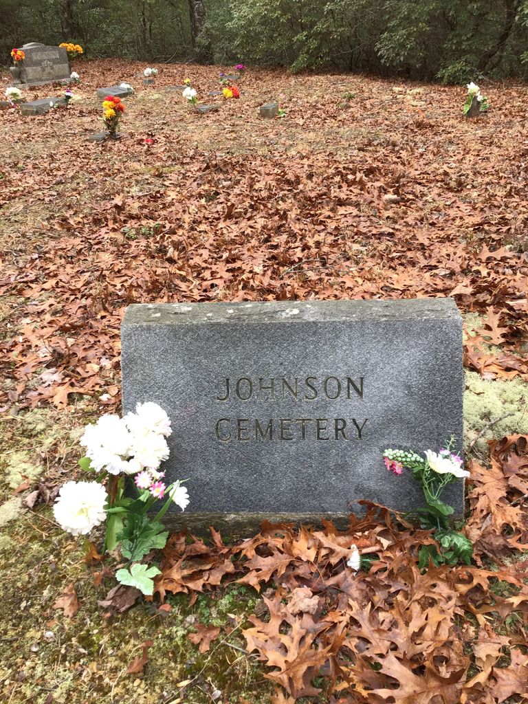
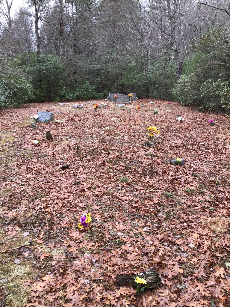
| Description | : | The Johnson Family Cemetery was surveyed by Howard Withrow in 2002; he has granted permission to use his survey to create the memorials on this site. -------------------------- A 4-wheel drive vehicle is recommended for a trip to this cemetery; it requires driving on an unpaved road and fording a stream multiple times. From the roundabout in center of Ellijay, turn right (north) onto Dalton Street (signs also say "Hwy 52 West"). Go approximately one-half mile, where Hwy 52 makes a sharp turn to the left (west). Don't make that sharp turn ... continue north almost straight ahead onto Boardtown Road. ... Read More |
frequently asked questions (FAQ):
-
Where is Johnson Family Cemetery?
Johnson Family Cemetery is located at Cashes Valley Road Gilmer County ,Georgia ,USA.
-
Johnson Family Cemetery cemetery's updated grave count on graveviews.com?
0 memorials
-
Where are the coordinates of the Johnson Family Cemetery?
Latitude: 34.8335880
Longitude: -84.4629230
Nearby Cemetories:
1. Cashes Valley Church of Christ Cemetery
Gilmer County, USA
Coordinate: 34.8361015, -84.4700012
2. Chapman Cemetery
Gilmer County, USA
Coordinate: 34.8161011, -84.4152985
3. Mount Pleasant Baptist Church Cemetery #1
Gilmer County, USA
Coordinate: 34.8013230, -84.4245730
4. Boardtown Church of Christ Cemetery
Gilmer County, USA
Coordinate: 34.8213997, -84.4064026
5. Holloway Family Cemetery
Gilmer County, USA
Coordinate: 34.8208600, -84.4063100
6. Dyer Mountain Cemetery
Fannin County, USA
Coordinate: 34.8692017, -84.5147018
7. Jones Cemetery
Ellijay, Gilmer County, USA
Coordinate: 34.7743988, -84.4443970
8. Hipps Chapel Methodist Church Cemetery
Blue Ridge, Fannin County, USA
Coordinate: 34.8952640, -84.4752290
9. Flat Branch Baptist Church Cemetery
Flat Branch, Gilmer County, USA
Coordinate: 34.7724460, -84.4893530
10. Golden Cemetery
Fannin County, USA
Coordinate: 34.8442001, -84.3842010
11. Mount Moriah Church Cemetery
Fannin County, USA
Coordinate: 34.8920000, -84.4260000
12. Colwell Baptist Church Cemetery
Higdon, Fannin County, USA
Coordinate: 34.9008370, -84.4603490
13. New Vision Church
Blue Ridge, Fannin County, USA
Coordinate: 34.8932950, -84.4228980
14. Sharp Cemetery
Gilmer County, USA
Coordinate: 34.7869300, -84.4019900
15. Zion Hill Baptist Church Cemetery
Ellijay, Gilmer County, USA
Coordinate: 34.7864700, -84.5256030
16. Macedonia Church of Christ Cemetery
Blue Ridge, Fannin County, USA
Coordinate: 34.8651500, -84.3861150
17. Salem Baptist Church Cemetery
Ellijay, Gilmer County, USA
Coordinate: 34.7642479, -84.4466705
18. Sisson Cemetery
Cherry Log, Gilmer County, USA
Coordinate: 34.8271590, -84.3768400
19. Helping Hand Fellowship Cemetery
Epworth, Fannin County, USA
Coordinate: 34.9026250, -84.4395580
20. Rogers Family Cemetery
Cherry Log, Gilmer County, USA
Coordinate: 34.7811800, -84.3976480
21. Whitaker Cemetery
Cherry Log, Gilmer County, USA
Coordinate: 34.7672220, -84.4134720
22. Cherry Hill Cemetery
Cherry Log, Gilmer County, USA
Coordinate: 34.7901000, -84.3842000
23. Underwood Cemetery
Gilmer County, USA
Coordinate: 34.7891890, -84.3848250
24. Cherry Log Baptist Church Old Cemetery
Cherry Log, Gilmer County, USA
Coordinate: 34.8147415, -84.3675650