
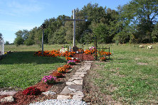
| Memorials | : | 0 |
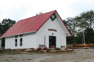
| Location | : | Lathrop, Clinton County, USA |
| Coordinate | : | 39.5073700, -94.3891100 |
frequently asked questions (FAQ):
-
Where is Mackintyre's Church and Cemetery?
Mackintyre's Church and Cemetery is located at Lathrop, Clinton County ,Missouri ,USA.
-
Mackintyre's Church and Cemetery cemetery's updated grave count on graveviews.com?
0 memorials
-
Where are the coordinates of the Mackintyre's Church and Cemetery?
Latitude: 39.5073700
Longitude: -94.3891100


Nearby Cemetories:
1. Mount Zion Cemetery
Plattsburg, Clinton County, USA
Coordinate: 39.4672012, -94.4242020
2. Cook Cemetery
Clinton County, USA
Coordinate: 39.4805984, -94.4452972
3. Eberts Cemetery
Clinton County, USA
Coordinate: 39.4692001, -94.4356003
4. Fairview Cemetery
Guyton, Clinton County, USA
Coordinate: 39.4756012, -94.4443970
5. Hanks Cemetery
Clinton County, USA
Coordinate: 39.5289001, -94.4625015
6. Mount Washington Cemetery
Plattsburg, Clinton County, USA
Coordinate: 39.5572014, -94.4411011
7. Lathrop Cemetery
Lathrop, Clinton County, USA
Coordinate: 39.5463104, -94.3201294
8. Calvary Cemetery
Plattsburg, Clinton County, USA
Coordinate: 39.5583000, -94.4436035
9. McWilliams Cemetery
Clinton County, USA
Coordinate: 39.5755997, -94.3855972
10. Arnold-Holt Cemetery
Clay County, USA
Coordinate: 39.4410000, -94.3682000
11. Greenlawn Cemetery
Plattsburg, Clinton County, USA
Coordinate: 39.5586014, -94.4483032
12. Old Plattsburg Cemetery
Plattsburg, Clinton County, USA
Coordinate: 39.5635900, -94.4470600
13. Antioch Cemetery
Holt, Clay County, USA
Coordinate: 39.4552994, -94.3214035
14. Wilerton - McClelland Cemetery
Clay County, USA
Coordinate: 39.4481823, -94.3315423
15. Oakland Cemetery
Haynesville, Clinton County, USA
Coordinate: 39.4631004, -94.3114014
16. Transue Cemetery
Plattsburg, Clinton County, USA
Coordinate: 39.5821991, -94.4030991
17. Arnold-Spellman Graveyard
Holt, Clay County, USA
Coordinate: 39.4364000, -94.3320000
18. Converse Cemetery
Lathrop, Clinton County, USA
Coordinate: 39.4994011, -94.2794037
19. Brethren Church Cemetery
Plattsburg, Clinton County, USA
Coordinate: 39.5865898, -94.4329605
20. Muddy Fork Cemetery
Kearney, Clay County, USA
Coordinate: 39.4193993, -94.3703003
21. New Hope Cemetery
Holt, Clay County, USA
Coordinate: 39.4332809, -94.3245773
22. Gill Family Cemetery
Holt, Clay County, USA
Coordinate: 39.4496384, -94.2937927
23. Mecca Cemetery
Mecca, Clinton County, USA
Coordinate: 39.4895200, -94.5105200
24. Log Church Cemetery
Perrin, Clinton County, USA
Coordinate: 39.6010017, -94.4135971