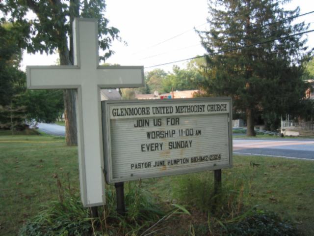
| Memorials | : | 0 |
| Location | : | Glenmoore, Chester County, USA |
| Coordinate | : | 40.0881996, -75.7718964 |
frequently asked questions (FAQ):
-
Where is Glen Moore United Methodist Cemetery?
Glen Moore United Methodist Cemetery is located at 1920 Creek Road Glenmoore, Chester County ,Pennsylvania , 19343USA.
-
Glen Moore United Methodist Cemetery cemetery's updated grave count on graveviews.com?
0 memorials
-
Where are the coordinates of the Glen Moore United Methodist Cemetery?
Latitude: 40.0881996
Longitude: -75.7718964
Nearby Cemetories:
1. Fairview Presbyterian Church Cemetery
Glenmoore, Chester County, USA
Coordinate: 40.0947189, -75.7580261
2. Forks of the Brandywine New Side Presbyterian Burial Ground
Glenmoore, Chester County, USA
Coordinate: 40.0601501, -75.8068695
3. Forks of the Brandywine Presbyterian Cemetery
Glenmoore, Chester County, USA
Coordinate: 40.0604000, -75.8106000
4. Forks of the Brandywine Seceder Cemetery
Glenmoore, Chester County, USA
Coordinate: 40.0592003, -75.8161011
5. All Souls Cemetery
Coatesville, Chester County, USA
Coordinate: 40.0540340, -75.8121820
6. East Nantmeal Baptist Cemetery
Nantmeal Village, Chester County, USA
Coordinate: 40.1409912, -75.7511597
7. Hopewell United Methodist Church Cemetery
Downingtown, Chester County, USA
Coordinate: 40.0382996, -75.7351990
8. Windsor Baptist Church Cemetery
Eagle, Chester County, USA
Coordinate: 40.0798988, -75.6927032
9. Saint Andrew's Episcopal Cemetery
Ludwigs Corner, Chester County, USA
Coordinate: 40.1161003, -75.6966019
10. East Brandywine Baptist Church Cemetery
Guthriesville, Chester County, USA
Coordinate: 40.0256004, -75.7491989
11. Nantmeal Friends Burial Grounds
Nantmeal Village, Chester County, USA
Coordinate: 40.1394440, -75.7066530
12. Benson's Chapel Methodist Episcopal Cemetery
Eagle, Chester County, USA
Coordinate: 40.0687400, -75.6816500
13. Ebenezer Bible Chapel Cemetery
Warwick Township, Chester County, USA
Coordinate: 40.1593018, -75.7515030
14. Morningside Cemetery
Warwick Township, Chester County, USA
Coordinate: 40.1613998, -75.7771988
15. Nantmeal United Methodist Church Cemetery
Nantmeal Village, Chester County, USA
Coordinate: 40.1418991, -75.7055969
16. Living God Lutheran Church Columbarium
Honey Brook Township, Chester County, USA
Coordinate: 40.0790000, -75.8690000
17. Saint Mary's Episcopal Church Cemetery
Warwick, Chester County, USA
Coordinate: 40.1655846, -75.7811813
18. Saint Matthew's Lutheran Cemetery
Chester Springs, Chester County, USA
Coordinate: 40.1073990, -75.6728973
19. Hibernia United Methodist Cemetery
Cedar Knoll, Chester County, USA
Coordinate: 40.0250015, -75.8339005
20. Old Caln Friends Meeting Burial Ground
Coatesville, Chester County, USA
Coordinate: 40.0074997, -75.7647018
21. Caln Orthodox Friends Burial Ground
Coatesville, Chester County, USA
Coordinate: 40.0071710, -75.7634290
22. Elverson Methodist Cemetery
Elverson, Chester County, USA
Coordinate: 40.1567950, -75.8304480
23. Springfield United Brethren Church Cemetery
Elverson, Chester County, USA
Coordinate: 40.1553001, -75.8336029
24. Saint Matthew's United Church of Christ Cemetery
Chester Springs, Chester County, USA
Coordinate: 40.1049995, -75.6669006


