
| Memorials | : | 0 |
| Location | : | Glenmoore, Chester County, USA |
| Coordinate | : | 40.0601501, -75.8068695 |
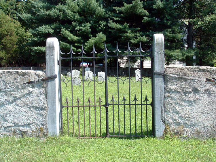
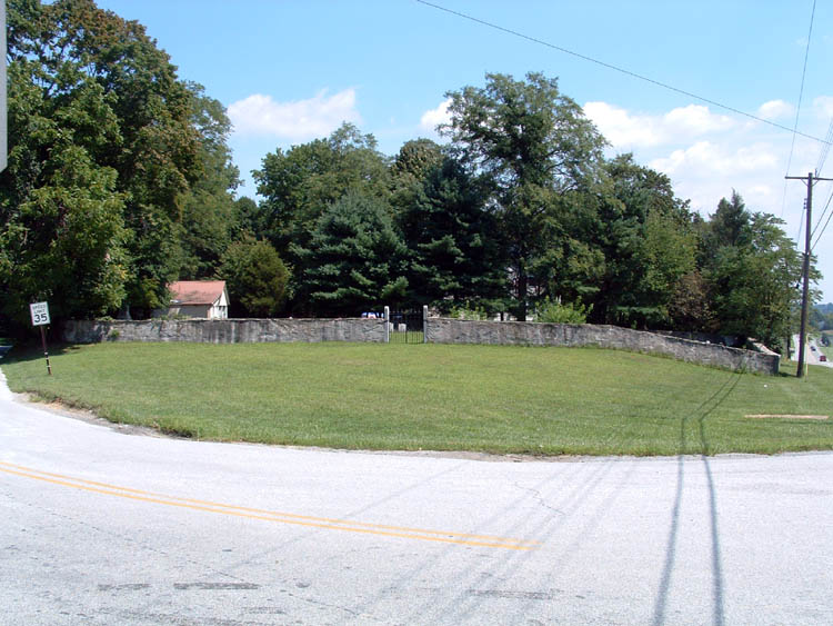
| Description | : | When a schism developed in the Presbyterian Church in America in the early-mid 18th century, some members of the Forks of the Brandywine Presbyterian Church withdrew from the congregation and placed themselves under the direction of the Synod of New Brunswick in the early 1740s; they became known as the "New Side" Presbytery. When they built their Meeting House across the Horseshoe Pike, below the old Forks of the Brandywine Church in ca. 1744, they set apart a portion of the land which they had obtained for use as a burial ground. Among those first interred in this graveyard was... Read More |
frequently asked questions (FAQ):
-
Where is Forks of the Brandywine New Side Presbyterian Burial Ground?
Forks of the Brandywine New Side Presbyterian Burial Ground is located at 890 Highspire Rd Glenmoore, Chester County ,Pennsylvania , 19343USA.
-
Forks of the Brandywine New Side Presbyterian Burial Ground cemetery's updated grave count on graveviews.com?
0 memorials
-
Where are the coordinates of the Forks of the Brandywine New Side Presbyterian Burial Ground?
Latitude: 40.0601501
Longitude: -75.8068695
Nearby Cemetories:
1. Forks of the Brandywine Presbyterian Cemetery
Glenmoore, Chester County, USA
Coordinate: 40.0604000, -75.8106000
2. Forks of the Brandywine Seceder Cemetery
Glenmoore, Chester County, USA
Coordinate: 40.0592003, -75.8161011
3. All Souls Cemetery
Coatesville, Chester County, USA
Coordinate: 40.0540340, -75.8121820
4. Glen Moore United Methodist Cemetery
Glenmoore, Chester County, USA
Coordinate: 40.0881996, -75.7718964
5. Hibernia United Methodist Cemetery
Cedar Knoll, Chester County, USA
Coordinate: 40.0250015, -75.8339005
6. Fairview Presbyterian Church Cemetery
Glenmoore, Chester County, USA
Coordinate: 40.0947189, -75.7580261
7. Living God Lutheran Church Columbarium
Honey Brook Township, Chester County, USA
Coordinate: 40.0790000, -75.8690000
8. West Caln Baptist Cemetery
Wagontown, Chester County, USA
Coordinate: 40.0172005, -75.8491974
9. East Brandywine Baptist Church Cemetery
Guthriesville, Chester County, USA
Coordinate: 40.0256004, -75.7491989
10. Hopewell United Methodist Church Cemetery
Downingtown, Chester County, USA
Coordinate: 40.0382996, -75.7351990
11. Old Caln Friends Meeting Burial Ground
Coatesville, Chester County, USA
Coordinate: 40.0074997, -75.7647018
12. Caln Orthodox Friends Burial Ground
Coatesville, Chester County, USA
Coordinate: 40.0071710, -75.7634290
13. Beth Israel Cemetery
Coatesville, Chester County, USA
Coordinate: 40.0053497, -75.8470131
14. Saint Stanislaus Kostka Polish Catholic Cemetery
Coatesville, Chester County, USA
Coordinate: 40.0046349, -75.8459930
15. West Caln Friends Burial Ground
Wagontown, Chester County, USA
Coordinate: 40.0109000, -75.8694000
16. Saint Cecelia's Roman Catholic Cemetery
Coatesville, Chester County, USA
Coordinate: 39.9906006, -75.8114014
17. Lutheran Church of the Good Shepherd Columbarium
Coatesville, Chester County, USA
Coordinate: 39.9842680, -75.7891530
18. Coatesville Presbyterian Cemetery
Coatesville, Chester County, USA
Coordinate: 39.9831543, -75.8184738
19. Stoltzfus Old Order Amish Cemetery
Honey Brook Township, Chester County, USA
Coordinate: 40.1013700, -75.8957000
20. Fairview Cemetery
Coatesville, Chester County, USA
Coordinate: 39.9789009, -75.8071976
21. Dawson Family Cemetery
West Caln Township, Chester County, USA
Coordinate: 40.0009930, -75.8796790
22. Honey Brook Presbyterian Cemetery
Honey Brook Borough, Chester County, USA
Coordinate: 40.0927010, -75.9089966
23. Honey Brook United Methodist Church Cemetery
Honey Brook Township, Chester County, USA
Coordinate: 40.0956001, -75.9076004
24. New Evergreen Cemetery
Coatesville, Chester County, USA
Coordinate: 39.9810220, -75.8495130