
| Memorials | : | 0 |
| Location | : | Glenmoore, Chester County, USA |
| Coordinate | : | 40.0592003, -75.8161011 |
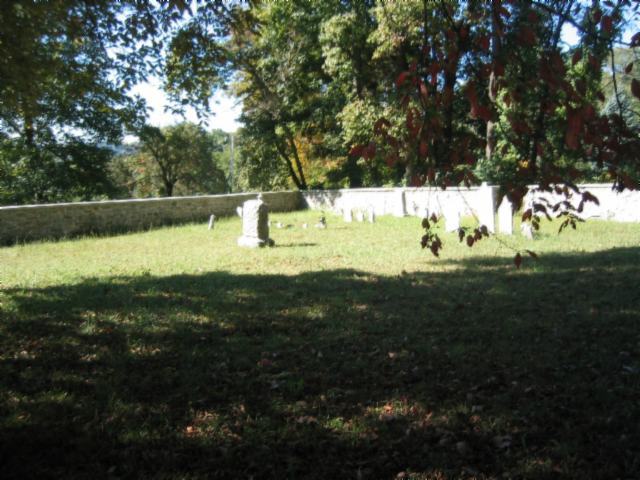
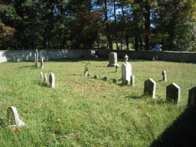
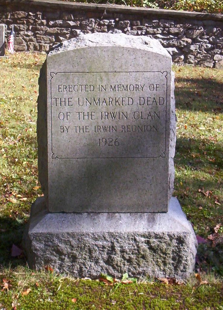
| Description | : | The first missionaries sent by the Associate Presbytery (also referred to as the Seceder Church) to America arrived in 1753 and erected buildings for public worship. One of these was located on the southern slope of the Barren Hill, where Hibernia Road intersects Pennsylvania Route 82, and a few hundred yards west of the Forks of the Brandywine Presbyterian Church. This Secession Church building, erected in 1756 or 1757, was poorly constructed, and had become so much out of repair by 1780 that a board tent was placed in front of it and used in its stead. Religious exercises were... Read More |
frequently asked questions (FAQ):
-
Where is Forks of the Brandywine Seceder Cemetery?
Forks of the Brandywine Seceder Cemetery is located at 648 Hibernia Rd Glenmoore, Chester County ,Pennsylvania , 19343USA.
-
Forks of the Brandywine Seceder Cemetery cemetery's updated grave count on graveviews.com?
0 memorials
-
Where are the coordinates of the Forks of the Brandywine Seceder Cemetery?
Latitude: 40.0592003
Longitude: -75.8161011

Nearby Cemetories:
1. Forks of the Brandywine Presbyterian Cemetery
Glenmoore, Chester County, USA
Coordinate: 40.0604000, -75.8106000
2. All Souls Cemetery
Coatesville, Chester County, USA
Coordinate: 40.0540340, -75.8121820
3. Forks of the Brandywine New Side Presbyterian Burial Ground
Glenmoore, Chester County, USA
Coordinate: 40.0601501, -75.8068695
4. Hibernia United Methodist Cemetery
Cedar Knoll, Chester County, USA
Coordinate: 40.0250015, -75.8339005
5. Glen Moore United Methodist Cemetery
Glenmoore, Chester County, USA
Coordinate: 40.0881996, -75.7718964
6. Living God Lutheran Church Columbarium
Honey Brook Township, Chester County, USA
Coordinate: 40.0790000, -75.8690000
7. West Caln Baptist Cemetery
Wagontown, Chester County, USA
Coordinate: 40.0172005, -75.8491974
8. Fairview Presbyterian Church Cemetery
Glenmoore, Chester County, USA
Coordinate: 40.0947189, -75.7580261
9. Beth Israel Cemetery
Coatesville, Chester County, USA
Coordinate: 40.0053497, -75.8470131
10. Saint Stanislaus Kostka Polish Catholic Cemetery
Coatesville, Chester County, USA
Coordinate: 40.0046349, -75.8459930
11. East Brandywine Baptist Church Cemetery
Guthriesville, Chester County, USA
Coordinate: 40.0256004, -75.7491989
12. West Caln Friends Burial Ground
Wagontown, Chester County, USA
Coordinate: 40.0109000, -75.8694000
13. Old Caln Friends Meeting Burial Ground
Coatesville, Chester County, USA
Coordinate: 40.0074997, -75.7647018
14. Hopewell United Methodist Church Cemetery
Downingtown, Chester County, USA
Coordinate: 40.0382996, -75.7351990
15. Caln Orthodox Friends Burial Ground
Coatesville, Chester County, USA
Coordinate: 40.0071710, -75.7634290
16. Saint Cecelia's Roman Catholic Cemetery
Coatesville, Chester County, USA
Coordinate: 39.9906006, -75.8114014
17. Stoltzfus Old Order Amish Cemetery
Honey Brook Township, Chester County, USA
Coordinate: 40.1013700, -75.8957000
18. Dawson Family Cemetery
West Caln Township, Chester County, USA
Coordinate: 40.0009930, -75.8796790
19. Coatesville Presbyterian Cemetery
Coatesville, Chester County, USA
Coordinate: 39.9831543, -75.8184738
20. Lutheran Church of the Good Shepherd Columbarium
Coatesville, Chester County, USA
Coordinate: 39.9842680, -75.7891530
21. Honey Brook Presbyterian Cemetery
Honey Brook Borough, Chester County, USA
Coordinate: 40.0927010, -75.9089966
22. Honey Brook United Methodist Church Cemetery
Honey Brook Township, Chester County, USA
Coordinate: 40.0956001, -75.9076004
23. Fairview Cemetery
Coatesville, Chester County, USA
Coordinate: 39.9789009, -75.8071976
24. Zion African Union Cemetery
West Caln Township, Chester County, USA
Coordinate: 40.0490479, -75.9218970