
| Memorials | : | 0 |
| Location | : | Garijp, Tytsjerksteradiel Municipality, Netherlands |
| Coordinate | : | 53.1668001, 5.9658672 |
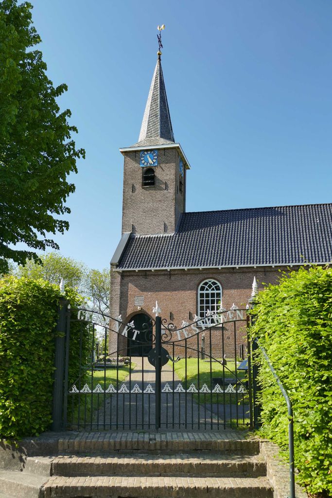
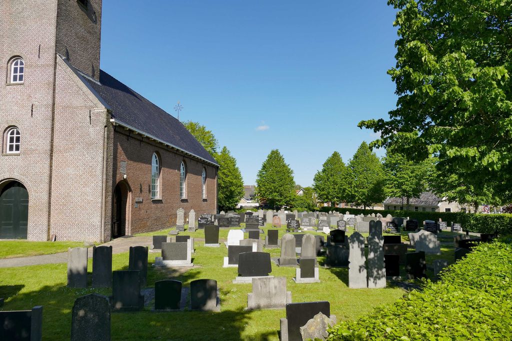
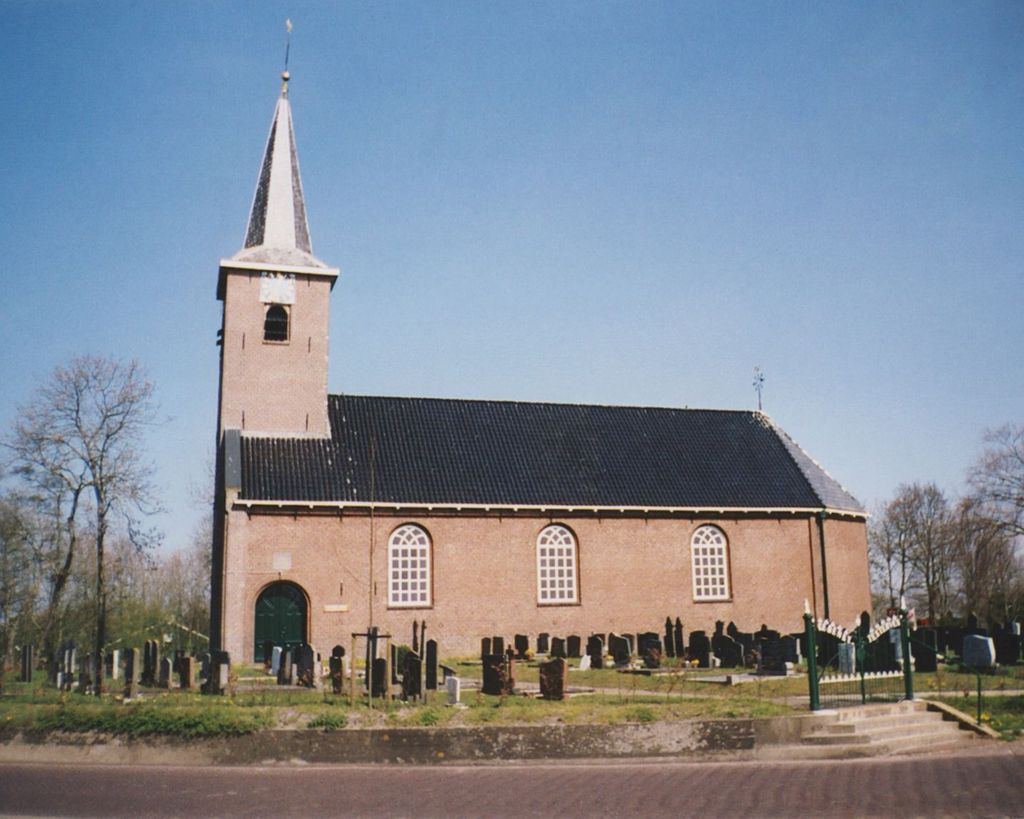
| Description | : | Saint Peter's Church cemetery, Garyp / Garijp, Tytsjerksteradiel Municipality, Friesland, Netherlands |
frequently asked questions (FAQ):
-
Where is Begraafplaats Petruskerk Garyp?
Begraafplaats Petruskerk Garyp is located at Tsjerkepaed 18 Garijp, Tytsjerksteradiel Municipality ,Friesland ,Netherlands.
-
Begraafplaats Petruskerk Garyp cemetery's updated grave count on graveviews.com?
0 memorials
-
Where are the coordinates of the Begraafplaats Petruskerk Garyp?
Latitude: 53.1668001
Longitude: 5.9658672

Nearby Cemetories:
1. Kerkhof Nederlands Hervormde Kerk
Suwâld, Tytsjerksteradiel Municipality, Netherlands
Coordinate: 53.1791922, 5.9273043
2. Bergum Protestant Churchyard
Bergum, Tytsjerksteradiel Municipality, Netherlands
Coordinate: 53.1958500, 6.0016300
3. Kerkhof Hervormde Kerk Wartena
Wartena, Leeuwarden Municipality, Netherlands
Coordinate: 53.1495985, 5.8972222
4. Wartena General Cemetery
Wartena, Leeuwarden Municipality, Netherlands
Coordinate: 53.1489700, 5.8919100
5. Begraafplaats Sint-Vituskerk
Tytsjerk, Tytsjerksteradiel Municipality, Netherlands
Coordinate: 53.2062242, 5.9142663
6. Hoftsjerke begraafplaats
Hurdegaryp, Tytsjerksteradiel Municipality, Netherlands
Coordinate: 53.2175817, 5.9445193
7. Rijperkerk Nederlands Hervormd Kerkhof
Rijperkerk, Tytsjerksteradiel Municipality, Netherlands
Coordinate: 53.2221200, 5.9183300
8. It Heechsân Cemetery
Eastermar, Tytsjerksteradiel Municipality, Netherlands
Coordinate: 53.1851321, 6.0703815
9. Feanwâlden Bûtefjild Cemetery
Feanwâlden, Dantumadeel Municipality, Netherlands
Coordinate: 53.2378864, 5.9815750
10. Begraafplaats te Veenwouden Cemetery
Feanwâlden, Dantumadeel Municipality, Netherlands
Coordinate: 53.2390761, 5.9921180
11. Begraafplaats Tillebuorren
Kootstertille, Achtkarspelen Municipality, Netherlands
Coordinate: 53.2116548, 6.0919066
12. Begraafplaats De Westereen
Zwaagwesteinde, Dantumadeel Municipality, Netherlands
Coordinate: 53.2497819, 6.0273741
13. Begraafplaats Twijzelerheide
Twijzelerheide, Achtkarspelen Municipality, Netherlands
Coordinate: 53.2413444, 6.0525175
14. Giekerk Martinuskerk
Giekerk, Tytsjerksteradiel Municipality, Netherlands
Coordinate: 53.2411660, 5.8785276
15. It Readtsjerkje hôf
Readtsjerk, Dantumadeel Municipality, Netherlands
Coordinate: 53.2562756, 5.9332706
16. Agnestsjerke
Goutum, Leeuwarden Municipality, Netherlands
Coordinate: 53.1786867, 5.8068433
17. Marijetsjerke Begraafplaats
Oenkerk, Tytsjerksteradiel Municipality, Netherlands
Coordinate: 53.2537643, 5.8927362
18. Begraafplaats Alde Dyk
Kootstertille, Achtkarspelen Municipality, Netherlands
Coordinate: 53.2191071, 6.1040850
19. Wirdum Protestant Churchyard
Wirdum, Leeuwarden Municipality, Netherlands
Coordinate: 53.1497300, 5.8036500
20. Begraafplaats Zwaagwesteinde
Zwaagwesteinde, Dantumadeel Municipality, Netherlands
Coordinate: 53.2580833, 6.0351062
21. Kerkhof Nederlands Hervormde kerk De Westereen
Zwaagwesteinde, Dantumadeel Municipality, Netherlands
Coordinate: 53.2583297, 6.0348107
22. Algemene Begraafplaats
Nij Beets, Opsterland Municipality, Netherlands
Coordinate: 53.0667908, 6.0042301
23. Nederlands Hervormde begraafplaats Twizel
Twijzel, Achtkarspelen Municipality, Netherlands
Coordinate: 53.2388004, 6.0948838
24. Lekkum Churchyard
Lekkum, Leeuwarden Municipality, Netherlands
Coordinate: 53.2263300, 5.8194900