
| Memorials | : | 1 |
| Location | : | Bracht, Kenton County, USA |
| Coordinate | : | 38.8288800, -84.5402777 |
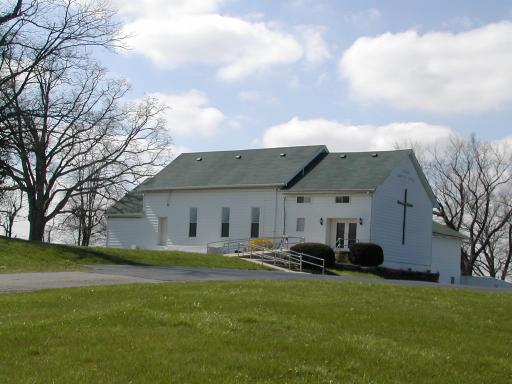
| Description | : | On April 12, 1849, Ezra Fish, donated the existing land for the development of Goshen Christian Church and School. The original building was a log structure that sat in what is now the cemetery. There are no surviving records of early members or burials. |
frequently asked questions (FAQ):
-
Where is Goshen Christian Church Cemetery?
Goshen Christian Church Cemetery is located at Bracht, Kenton County ,Kentucky ,USA.
-
Goshen Christian Church Cemetery cemetery's updated grave count on graveviews.com?
1 memorials
-
Where are the coordinates of the Goshen Christian Church Cemetery?
Latitude: 38.8288800
Longitude: -84.5402777
Nearby Cemetories:
1. Tucker Cemetery
Piner, Kenton County, USA
Coordinate: 38.8286018, -84.5432968
2. Fishback Cemetery
Kenton County, USA
Coordinate: 38.8100014, -84.5453033
3. Mann Cemetery
Piner, Kenton County, USA
Coordinate: 38.8175000, -84.5625000
4. Carlisle Cemetery
Kenton County, USA
Coordinate: 38.8227770, -84.5691600
5. Jones Cemetery
Piner, Kenton County, USA
Coordinate: 38.8400000, -84.5752780
6. Northcutt Cemetery
Kenton County, USA
Coordinate: 38.8493996, -84.5717010
7. Wilmington Baptist Church Cemetery
Fiskburg, Kenton County, USA
Coordinate: 38.8106500, -84.5047400
8. Watkins Cemetery
Kenton County, USA
Coordinate: 38.7982840, -84.5692530
9. Peebles Cemetery
Bracht, Kenton County, USA
Coordinate: 38.8055030, -84.5790020
10. Webster Cemetery
Piner, Kenton County, USA
Coordinate: 38.8388890, -84.5877780
11. Current Cemetery
Bracht, Kenton County, USA
Coordinate: 38.8205986, -84.5886002
12. Young Cemetery
Morning View, Kenton County, USA
Coordinate: 38.8664017, -84.5239029
13. Sayers Cemetery
Bracht, Kenton County, USA
Coordinate: 38.8133011, -84.5886002
14. Mullins Cemetery
Kenton County, USA
Coordinate: 38.8152778, -84.4908333
15. Doud Cemetery
Grant County, USA
Coordinate: 38.7877998, -84.5511017
16. Byland Cemetery
Kenton County, USA
Coordinate: 38.8577995, -84.5824966
17. Carters Chapel Cemetery
Gardnersville, Pendleton County, USA
Coordinate: 38.7859000, -84.5131900
18. Powers Cemetery
Kenton County, USA
Coordinate: 38.8232994, -84.6082993
19. Menefee Cemetery
Flingsville, Grant County, USA
Coordinate: 38.7748730, -84.5446770
20. Bravard Cemetery
Independence, Kenton County, USA
Coordinate: 38.8780560, -84.5100000
21. Cook-Smith Cemetery
Grant County, USA
Coordinate: 38.7756004, -84.5558014
22. Cruises Creek Baptist Church Cemetery
Kenton County, USA
Coordinate: 38.8788730, -84.5694070
23. Collins Cemetery
Kenton County, USA
Coordinate: 38.7966995, -84.5975037
24. Ragan Cemetery
Kenton, Kenton County, USA
Coordinate: 38.8569440, -84.4791670