
| Memorials | : | 0 |
| Location | : | Kenton County, USA |
| Coordinate | : | 38.8788730, -84.5694070 |
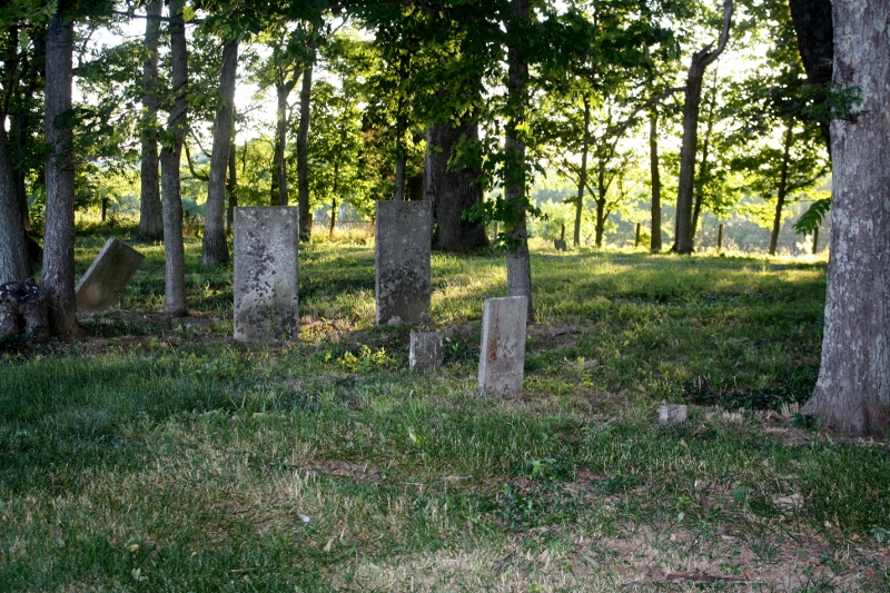
| Description | : | On PRIVATE PROPERTY and no access available. Cemetery was recorded in 1960: 17 markers were found and several fieldstones. The U.S. Geological Survey (USGS) Geographic Names Information System (GNIS) feature ID for the cemetery is 2089850 (Cruises Creek Baptist Church Cemetery). |
frequently asked questions (FAQ):
-
Where is Cruises Creek Baptist Church Cemetery?
Cruises Creek Baptist Church Cemetery is located at 12420 Green Road Kenton County ,Kentucky , 41094USA.
-
Cruises Creek Baptist Church Cemetery cemetery's updated grave count on graveviews.com?
0 memorials
-
Where are the coordinates of the Cruises Creek Baptist Church Cemetery?
Latitude: 38.8788730
Longitude: -84.5694070
Nearby Cemetories:
1. Percival Cemetery
Bank Lick, Kenton County, USA
Coordinate: 38.8875000, -84.5913890
2. Byland Cemetery
Kenton County, USA
Coordinate: 38.8577995, -84.5824966
3. Ross Cemetery
Walton, Boone County, USA
Coordinate: 38.8697230, -84.6033330
4. Northcutt Cemetery
Kenton County, USA
Coordinate: 38.8493996, -84.5717010
5. Armstrong Cemetery #1
Nicholson, Kenton County, USA
Coordinate: 38.8961111, -84.5338889
6. Robinson Cemetery
Walton, Boone County, USA
Coordinate: 38.8888890, -84.6100000
7. Callen Cemetery
Independence, Kenton County, USA
Coordinate: 38.8850000, -84.5266670
8. Bird Cemetery
Independence, Kenton County, USA
Coordinate: 38.9027780, -84.5327780
9. Young Cemetery
Morning View, Kenton County, USA
Coordinate: 38.8664017, -84.5239029
10. Jones Cemetery
Piner, Kenton County, USA
Coordinate: 38.8400000, -84.5752780
11. Finnell-Burton-Roberts Cemetery
Walton, Boone County, USA
Coordinate: 38.8665940, -84.6216130
12. Webster Cemetery
Piner, Kenton County, USA
Coordinate: 38.8388890, -84.5877780
13. Bravard Cemetery
Independence, Kenton County, USA
Coordinate: 38.8780560, -84.5100000
14. Faulkner Cemetery
Independence, Kenton County, USA
Coordinate: 38.9166670, -84.5333330
15. Lampton Family Cemetery
Richwood, Boone County, USA
Coordinate: 38.9104350, -84.6151260
16. Hoffman Cemetery
Independence, Kenton County, USA
Coordinate: 38.9102777, -84.5200000
17. Hudson Cemetery
Walton, Boone County, USA
Coordinate: 38.8872220, -84.6375000
18. Rector Cemetery
Atwood, Kenton County, USA
Coordinate: 38.8822900, -84.5001830
19. Tucker Cemetery
Piner, Kenton County, USA
Coordinate: 38.8286018, -84.5432968
20. Salem Predestinarian Baptist Church Cemetery
Boone County, USA
Coordinate: 38.8500595, -84.6287766
21. Goshen Christian Church Cemetery
Bracht, Kenton County, USA
Coordinate: 38.8288800, -84.5402777
22. Senour Family Burying Ground
Walton, Boone County, USA
Coordinate: 38.8844770, -84.6396230
23. Carlisle Cemetery
Kenton County, USA
Coordinate: 38.8227770, -84.5691600
24. Glackin Family Cemetery
Richwood, Boone County, USA
Coordinate: 38.9130050, -84.6302180