
| Memorials | : | 5 |
| Location | : | Scarborough, Scarborough Borough, England |
| Coordinate | : | 54.2850360, -0.3950300 |
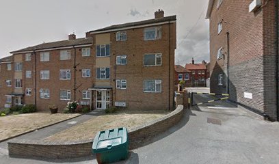
| Description | : | Franciscan Friars (under the Custody of York) founded 1239 community and buildings transferred to new site at Hatterboard (Scalby) 1245; transferred from Scalby 1272; dissolved 1539. The map coordinates are approximate as the site has been covered by more modern construction. |
frequently asked questions (FAQ):
-
Where is Greyfriars Abbey?
Greyfriars Abbey is located at Scarborough, Scarborough Borough ,North Yorkshire ,England.
-
Greyfriars Abbey cemetery's updated grave count on graveviews.com?
5 memorials
-
Where are the coordinates of the Greyfriars Abbey?
Latitude: 54.2850360
Longitude: -0.3950300
Nearby Cemetories:
1. Quaker House Church
Scarborough Borough, England
Coordinate: 54.2844280, -0.3941730
2. St. Mary's Churchyard
Scarborough, Scarborough Borough, England
Coordinate: 54.2864850, -0.3936260
3. Scarborough Castle
Scarborough, Scarborough Borough, England
Coordinate: 54.2875810, -0.3895485
4. Dean Road and Manor Road Cemetery
Scarborough, Scarborough Borough, England
Coordinate: 54.2843690, -0.4184140
5. Woodlands Cemetery and Crematorium
Scarborough, Scarborough Borough, England
Coordinate: 54.2766640, -0.4428030
6. St Laurence Churchyard
Scalby, Scarborough Borough, England
Coordinate: 54.2988160, -0.4507520
7. St. John the Baptist Churchyard
Cayton, Scarborough Borough, England
Coordinate: 54.2346470, -0.3805180
8. Cayton Cemetery
Cayton, Scarborough Borough, England
Coordinate: 54.2314030, -0.3755910
9. St Martin Churchyard
Seamer, Scarborough Borough, England
Coordinate: 54.2361500, -0.4437100
10. Cloughton Church Cemetery
Cloughton, Scarborough Borough, England
Coordinate: 54.3322500, -0.4511900
11. St. John the Baptist Churchyard
East Ayton, Scarborough Borough, England
Coordinate: 54.2508900, -0.4792900
12. St Peter Churchyard
Hackness, Scarborough Borough, England
Coordinate: 54.3012880, -0.5127850
13. St Matthew Churchyard
Hutton Buscel, Scarborough Borough, England
Coordinate: 54.2426410, -0.5071200
14. St John The Evangelist Churchyard
Folkton, Scarborough Borough, England
Coordinate: 54.2020400, -0.3865200
15. Flixton Cemetery New
Folkton, Scarborough Borough, England
Coordinate: 54.2006600, -0.3934700
16. St. Helen’s & All Saints Churchyard
Wykeham, Scarborough Borough, England
Coordinate: 54.2372000, -0.5212000
17. St. Peter's Churchyard
Willerby, Ryedale District, England
Coordinate: 54.1984200, -0.4558500
18. All Saints Churchyard
Muston, Scarborough Borough, England
Coordinate: 54.2011600, -0.3187500
19. St Oswald Churchyard
Filey, Scarborough Borough, England
Coordinate: 54.2128590, -0.2869060
20. St Peter Churchyard
Langdale End, Scarborough Borough, England
Coordinate: 54.3065050, -0.5557030
21. St Margaret Churchyard
Harwood Dale, Scarborough Borough, England
Coordinate: 54.3470030, -0.5238540
22. The Lawns Cemetery
Filey, Scarborough Borough, England
Coordinate: 54.2049300, -0.2953600
23. Staintondale Churchyard
Staintondale, Scarborough Borough, England
Coordinate: 54.3752645, -0.4795295
24. St Margaret Churchyard (Ruins)
Harwood Dale, Scarborough Borough, England
Coordinate: 54.3558170, -0.5365790