
| Memorials | : | 72 |
| Location | : | Willerby, Ryedale District, England |
| Coordinate | : | 54.1984200, -0.4558500 |
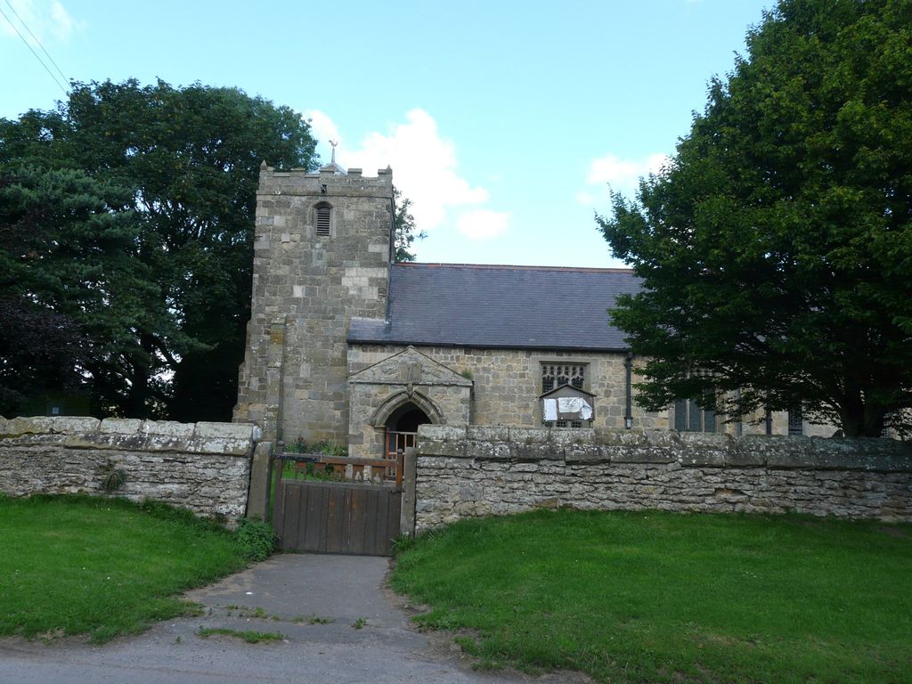
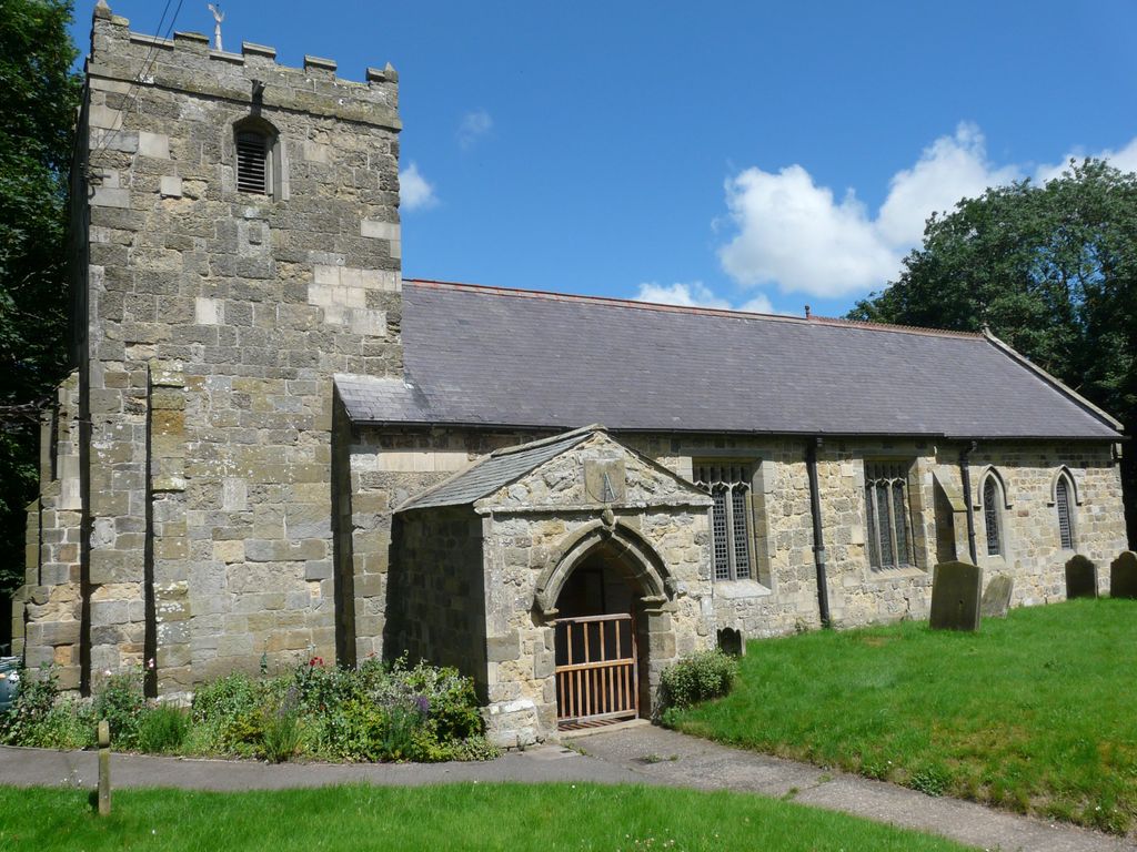
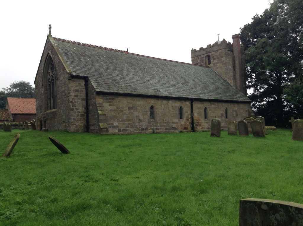
| Description | : | The stone built St Peters Church is reputed to be 11th century, but it is possible that a place of worship existed on the site in the 7th century. This could have been of timber construction. The church has suffered periods of decay, none more-so than in the late 16th and early 17th century, when the windows were open to the weather, and the north side of the building had to be propped up to prevent collapse. In 1721 the north wall was repaired along with several other alterations. In 1783 and 1793 the chancel was reduced in size... Read More |
frequently asked questions (FAQ):
-
Where is St. Peter's Churchyard?
St. Peter's Churchyard is located at Willerby, Ryedale District ,North Yorkshire ,England.
-
St. Peter's Churchyard cemetery's updated grave count on graveviews.com?
72 memorials
-
Where are the coordinates of the St. Peter's Churchyard?
Latitude: 54.1984200
Longitude: -0.4558500
Nearby Cemetories:
1. St Nicholas Churchyard
Ganton, Ryedale District, England
Coordinate: 54.1846000, -0.4846000
2. Flixton Cemetery New
Folkton, Scarborough Borough, England
Coordinate: 54.2006600, -0.3934700
3. St Martin Churchyard
Seamer, Scarborough Borough, England
Coordinate: 54.2361500, -0.4437100
4. St John The Evangelist Churchyard
Folkton, Scarborough Borough, England
Coordinate: 54.2020400, -0.3865200
5. St. Hilda Churchyard
Sherburn, Ryedale District, England
Coordinate: 54.1837400, -0.5311200
6. Fordon Churchyard
East Riding of Yorkshire Unitary Authority, England
Coordinate: 54.1610140, -0.3939100
7. St Matthew Churchyard
Hutton Buscel, Scarborough Borough, England
Coordinate: 54.2426410, -0.5071200
8. St. John the Baptist Churchyard
East Ayton, Scarborough Borough, England
Coordinate: 54.2508900, -0.4792900
9. St. Helen’s & All Saints Churchyard
Wykeham, Scarborough Borough, England
Coordinate: 54.2372000, -0.5212000
10. St. John the Baptist Churchyard
Cayton, Scarborough Borough, England
Coordinate: 54.2346470, -0.3805180
11. Cayton Cemetery
Cayton, Scarborough Borough, England
Coordinate: 54.2314030, -0.3755910
12. All Saints Church Cemetery
Brompton-by-Sawdon, Scarborough Borough, England
Coordinate: 54.2223100, -0.5500900
13. All Saints Churchyard
Brompton-by-Sawdon, Scarborough Borough, England
Coordinate: 54.2262550, -0.5549320
14. St Nicholas Churchyard
Foxholes, Ryedale District, England
Coordinate: 54.1297000, -0.4843000
15. St. Andrew's Churchyard
East Heslerton, Ryedale District, England
Coordinate: 54.1772500, -0.5825000
16. Woodlands Cemetery and Crematorium
Scarborough, Scarborough Borough, England
Coordinate: 54.2766640, -0.4428030
17. All Saints Churchyard
Hunmanby, Scarborough Borough, England
Coordinate: 54.1813770, -0.3219840
18. All Saints Churchyard
Muston, Scarborough Borough, England
Coordinate: 54.2011600, -0.3187500
19. St Andrew Churchyard
Weaverthorpe, Ryedale District, England
Coordinate: 54.1267400, -0.5226800
20. St Stephen Churchyard
Snainton, Scarborough Borough, England
Coordinate: 54.2286490, -0.5913720
21. God's Acre Cemetery
Hunmanby, Scarborough Borough, England
Coordinate: 54.1742830, -0.3167530
22. Dean Road and Manor Road Cemetery
Scarborough, Scarborough Borough, England
Coordinate: 54.2843690, -0.4184140
23. Octon Crematorium
Langtoft, East Riding of Yorkshire Unitary Authority, England
Coordinate: 54.1089720, -0.4506760
24. St Cuthbert Churchyard
Burton Fleming, East Riding of Yorkshire Unitary Authority, England
Coordinate: 54.1357420, -0.3431860