
| Memorials | : | 0 |
| Location | : | Osage Bluff, Cole County, USA |
| Coordinate | : | 38.4497910, -92.2513809 |
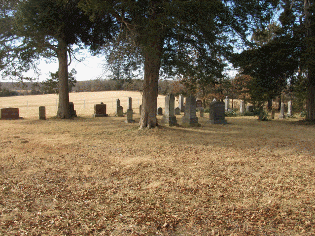
| Description | : | From Jefferson City, Missouri take Highway 54 West to State Highway E. Turn left on E, and where Highway H and Highway E intersect, continue on E (a 90* turn to the left) for approximately 3 miles. The cemetery is not marked, just off the road to the left. If you reach Honey Creek Road, you've gone too far. There are no buildings around this cemetery, except for the homes across the highway. The driveway is difficult to see until you're on top of it. The cemetery is very well maintained, and several of the stones are written... Read More |
frequently asked questions (FAQ):
-
Where is Osage Bluff Methodist Cemetery?
Osage Bluff Methodist Cemetery is located at Osage Bluff, Cole County ,Missouri ,USA.
-
Osage Bluff Methodist Cemetery cemetery's updated grave count on graveviews.com?
0 memorials
-
Where are the coordinates of the Osage Bluff Methodist Cemetery?
Latitude: 38.4497910
Longitude: -92.2513809
Nearby Cemetories:
1. Immanuel Lutheran Church Cemetery
Honey Creek, Cole County, USA
Coordinate: 38.4617500, -92.2432600
2. Sommerer Farm Cemetery
Brazito, Cole County, USA
Coordinate: 38.4546500, -92.2801800
3. Peace Lutheran Cemetery
Brazito, Cole County, USA
Coordinate: 38.4676600, -92.2889300
4. Hedler Cemetery
Jefferson City, Cole County, USA
Coordinate: 38.4814000, -92.2705700
5. Clarenbach and Wright Cemetery
Brazito, Cole County, USA
Coordinate: 38.4482400, -92.2968000
6. Arnhold Burial Ground
Brazito, Cole County, USA
Coordinate: 38.4478370, -92.3005870
7. Friedens Cemetery
Brazito, Cole County, USA
Coordinate: 38.4446182, -92.3035660
8. Johnston Cemetery
Brazito, Cole County, USA
Coordinate: 38.4928017, -92.2910995
9. Raithel Cemetery
Brazito, Cole County, USA
Coordinate: 38.4420300, -92.3272400
10. Islamic Cemetery of Mid Missouri
Jefferson City, Cole County, USA
Coordinate: 38.5117410, -92.2512620
11. Rouschelback Cemetery
Cole County, USA
Coordinate: 38.5116997, -92.2382965
12. Pleasant Hill Cemetery
Brazito, Cole County, USA
Coordinate: 38.4810300, -92.3224000
13. Fowler Farm Burial Ground
Bass, Cole County, USA
Coordinate: 38.4193750, -92.3235020
14. Enloe Cemetery
Wardsville, Cole County, USA
Coordinate: 38.4780360, -92.1772050
15. Ott Burial Ground
Wardsville, Cole County, USA
Coordinate: 38.4955560, -92.1930280
16. Saint Stanislaus Catholic Church Cemetery
Wardsville, Cole County, USA
Coordinate: 38.4863450, -92.1756730
17. Eberhardt Cemetery
Cole County, USA
Coordinate: 38.5257988, -92.2668991
18. Helton Farm Burial Ground
Hickory Hill, Cole County, USA
Coordinate: 38.4288500, -92.3464100
19. Henley Cemetery
Henley, Cole County, USA
Coordinate: 38.3907200, -92.3164800
20. Ward Burial Grounds
Wardsville, Cole County, USA
Coordinate: 38.4912500, -92.1656900
21. Saint Thomas Cemetery
Saint Thomas, Cole County, USA
Coordinate: 38.3689003, -92.2335968
22. Bethel Cemetery
Hickory Hill, Cole County, USA
Coordinate: 38.4122400, -92.3465900
23. Zion Lutheran Cemetery
Cole County, USA
Coordinate: 38.5360985, -92.2521973
24. Rice-Sone Cemetery
Jefferson City, Cole County, USA
Coordinate: 38.5115900, -92.1658000