
| Memorials | : | 0 |
| Location | : | Hepworth, Metropolitan Borough of Kirklees, England |
| Coordinate | : | 53.5620500, -1.7528000 |
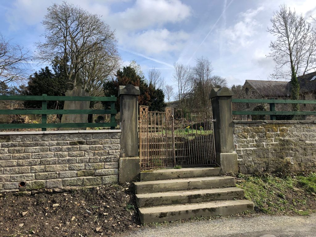
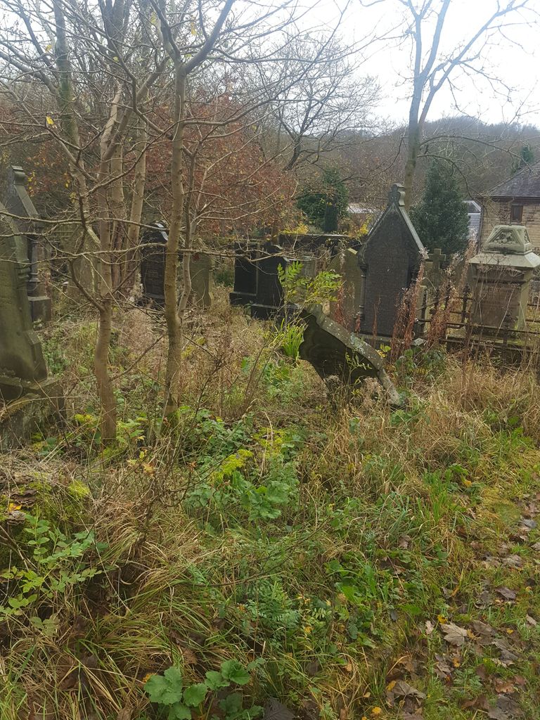
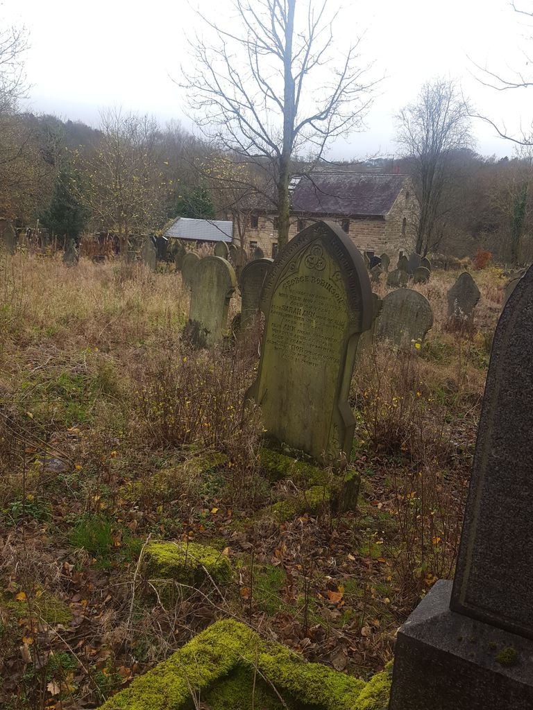
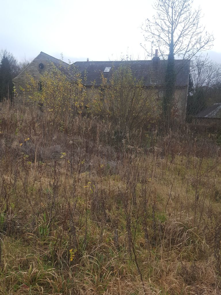
| Description | : | The chapel along the road to Jackson Bridge was opened in 1809 on land acquired by Uriah Tinker of Meal Hill. Declining congregations and structural issues led to the chapel closing in 1969 and then being demolished in 1975. The adjoining burial ground was closed in 1977. Burial registers 1858-1980 and grave registers 1852-1975 are held at the West Yorkshire Archive Service in Kirklees. There are four Commonwealth War Grave Commission burials in the chapelyard. |
frequently asked questions (FAQ):
-
Where is Hepworth Wesleyan Methodist Chapelyard?
Hepworth Wesleyan Methodist Chapelyard is located at Chapel Bank Hepworth, Metropolitan Borough of Kirklees ,West Yorkshire , HD9England.
-
Hepworth Wesleyan Methodist Chapelyard cemetery's updated grave count on graveviews.com?
0 memorials
-
Where are the coordinates of the Hepworth Wesleyan Methodist Chapelyard?
Latitude: 53.5620500
Longitude: -1.7528000
Nearby Cemetories:
1. Holy Trinity Churchyard
Hepworth, Metropolitan Borough of Kirklees, England
Coordinate: 53.5590200, -1.7558900
2. Christ Church Churchyard
New Mill, Metropolitan Borough of Kirklees, England
Coordinate: 53.5747000, -1.7506220
3. Gatehead Primitive Methodist Chapelyard
Hepworth, Metropolitan Borough of Kirklees, England
Coordinate: 53.5494500, -1.7369400
4. Gatehead Methodist Chapelyard
Hepworth, Metropolitan Borough of Kirklees, England
Coordinate: 53.5497100, -1.7359500
5. Lydgate Chapel (Unitarian)
Holmfirth, Metropolitan Borough of Kirklees, England
Coordinate: 53.5787110, -1.7606200
6. Wooldale Friends Burial Ground
Holmfirth, Metropolitan Borough of Kirklees, England
Coordinate: 53.5782550, -1.7700500
7. Holmeside Memorial Garden
Holmfirth, Metropolitan Borough of Kirklees, England
Coordinate: 53.5711900, -1.7850100
8. Holmfirth Methodist Churchyard
Holmfirth, Metropolitan Borough of Kirklees, England
Coordinate: 53.5715660, -1.7863020
9. Holy Trinity Church Cemetery
Holmfirth, Metropolitan Borough of Kirklees, England
Coordinate: 53.5661190, -1.7909940
10. Hade Edge Methodist Chapelyard
Holmfirth, Metropolitan Borough of Kirklees, England
Coordinate: 53.5446890, -1.7814530
11. Lane Congregational Burial Ground
Holmfirth, Metropolitan Borough of Kirklees, England
Coordinate: 53.5685100, -1.7936000
12. Lane United Reformed Church Upper Graveyard
Holmfirth, Metropolitan Borough of Kirklees, England
Coordinate: 53.5686300, -1.7937400
13. St. John the Evangelist Churchyard
Upperthong, Metropolitan Borough of Kirklees, England
Coordinate: 53.5690140, -1.7948420
14. Holmfirth Methodist Burial Ground
Netherthong, Metropolitan Borough of Kirklees, England
Coordinate: 53.5811900, -1.7894200
15. All Saints Churchyard
Netherthong, Metropolitan Borough of Kirklees, England
Coordinate: 53.5829400, -1.7900900
16. St. Thomas Churchyard
Thurstonland, Metropolitan Borough of Kirklees, England
Coordinate: 53.5932710, -1.7501120
17. St Paul Churchyard
Shepley, Metropolitan Borough of Kirklees, England
Coordinate: 53.5836620, -1.7120400
18. Shepley Methodist Chapelyard
Shepley, Metropolitan Borough of Kirklees, England
Coordinate: 53.5844400, -1.7105900
19. St. George's Churchyard
Brockholes, Metropolitan Borough of Kirklees, England
Coordinate: 53.5955900, -1.7724400
20. Hinchcliffe Mill Wesleyan Chapelyard
Holmbridge, Metropolitan Borough of Kirklees, England
Coordinate: 53.5590200, -1.8160100
21. St David Churchyard
Holmbridge, Metropolitan Borough of Kirklees, England
Coordinate: 53.5571000, -1.8192900
22. Friends Meeting House
Penistone, Metropolitan Borough of Barnsley, England
Coordinate: 53.5627869, -1.6817849
23. Quaker Bottom Burial Ground
Huddersfield, Metropolitan Borough of Kirklees, England
Coordinate: 53.5633390, -1.6809182
24. St. Nicholas' Churchyard
Upper Cumberworth, Metropolitan Borough of Kirklees, England
Coordinate: 53.5755000, -1.6827450