
| Memorials | : | 0 |
| Location | : | Holmfirth, Metropolitan Borough of Kirklees, England |
| Coordinate | : | 53.5686300, -1.7937400 |
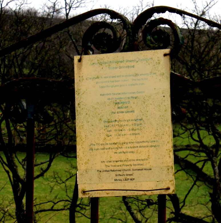
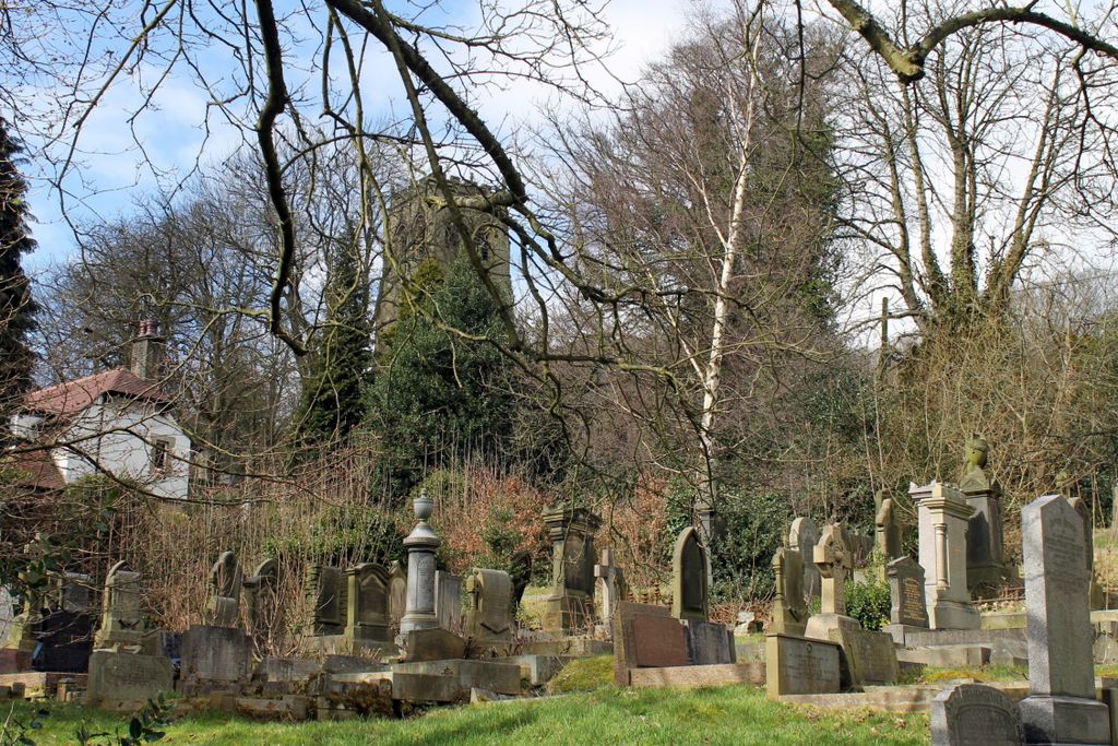
| Description | : | The Lane United Reformed Church declined in membership and the building which formerly housed the church has been turned into apartments. This cemetery which has one side on Upperthong Lane has often been mistaken for part of St John the Evangelist Churchyard. Sign on the gate which says in part Lane United Reformed Church Holmfrith Upper Graveyard The church is now closed and to preserve the amanity of the graveyard it has been locked. The key to the Upperthong Land gate is available from Holmfirth Tourist Information Center 49-51 Huddersfield Road West Yorkshire HD9 3JP ... Read More |
frequently asked questions (FAQ):
-
Where is Lane United Reformed Church Upper Graveyard?
Lane United Reformed Church Upper Graveyard is located at Holmfirth, Metropolitan Borough of Kirklees ,West Yorkshire ,England.
-
Lane United Reformed Church Upper Graveyard cemetery's updated grave count on graveviews.com?
0 memorials
-
Where are the coordinates of the Lane United Reformed Church Upper Graveyard?
Latitude: 53.5686300
Longitude: -1.7937400
Nearby Cemetories:
1. Lane Congregational Burial Ground
Holmfirth, Metropolitan Borough of Kirklees, England
Coordinate: 53.5685100, -1.7936000
2. St. John the Evangelist Churchyard
Upperthong, Metropolitan Borough of Kirklees, England
Coordinate: 53.5690140, -1.7948420
3. Holy Trinity Church Cemetery
Holmfirth, Metropolitan Borough of Kirklees, England
Coordinate: 53.5661190, -1.7909940
4. Holmfirth Methodist Churchyard
Holmfirth, Metropolitan Borough of Kirklees, England
Coordinate: 53.5715660, -1.7863020
5. Holmeside Memorial Garden
Holmfirth, Metropolitan Borough of Kirklees, England
Coordinate: 53.5711900, -1.7850100
6. Holmfirth Methodist Burial Ground
Netherthong, Metropolitan Borough of Kirklees, England
Coordinate: 53.5811900, -1.7894200
7. All Saints Churchyard
Netherthong, Metropolitan Borough of Kirklees, England
Coordinate: 53.5829400, -1.7900900
8. Hinchcliffe Mill Wesleyan Chapelyard
Holmbridge, Metropolitan Borough of Kirklees, England
Coordinate: 53.5590200, -1.8160100
9. Wooldale Friends Burial Ground
Holmfirth, Metropolitan Borough of Kirklees, England
Coordinate: 53.5782550, -1.7700500
10. St David Churchyard
Holmbridge, Metropolitan Borough of Kirklees, England
Coordinate: 53.5571000, -1.8192900
11. Lydgate Chapel (Unitarian)
Holmfirth, Metropolitan Borough of Kirklees, England
Coordinate: 53.5787110, -1.7606200
12. Holy Trinity Churchyard
Hepworth, Metropolitan Borough of Kirklees, England
Coordinate: 53.5590200, -1.7558900
13. Hade Edge Methodist Chapelyard
Holmfirth, Metropolitan Borough of Kirklees, England
Coordinate: 53.5446890, -1.7814530
14. Hepworth Wesleyan Methodist Chapelyard
Hepworth, Metropolitan Borough of Kirklees, England
Coordinate: 53.5620500, -1.7528000
15. St Mary Churchyard
Wilshaw, Metropolitan Borough of Kirklees, England
Coordinate: 53.5846000, -1.8269100
16. Christ Church Churchyard
New Mill, Metropolitan Borough of Kirklees, England
Coordinate: 53.5747000, -1.7506220
17. St. George's Churchyard
Brockholes, Metropolitan Borough of Kirklees, England
Coordinate: 53.5955900, -1.7724400
18. St. Thomas Churchyard
Thurstonland, Metropolitan Borough of Kirklees, England
Coordinate: 53.5932710, -1.7501120
19. St. Mary the Virgin Churchyard
Honley, Metropolitan Borough of Kirklees, England
Coordinate: 53.6047900, -1.7929600
20. St James Churchyard
Meltham, Metropolitan Borough of Kirklees, England
Coordinate: 53.5947200, -1.8388200
21. St. Mary's Church Cemetery
Honley, Metropolitan Borough of Kirklees, England
Coordinate: 53.6068600, -1.7943750
22. Gatehead Primitive Methodist Chapelyard
Hepworth, Metropolitan Borough of Kirklees, England
Coordinate: 53.5494500, -1.7369400
23. Gatehead Methodist Chapelyard
Hepworth, Metropolitan Borough of Kirklees, England
Coordinate: 53.5497100, -1.7359500
24. Calmlands Cemetery
Meltham, Metropolitan Borough of Kirklees, England
Coordinate: 53.5874570, -1.8518656