
| Memorials | : | 0 |
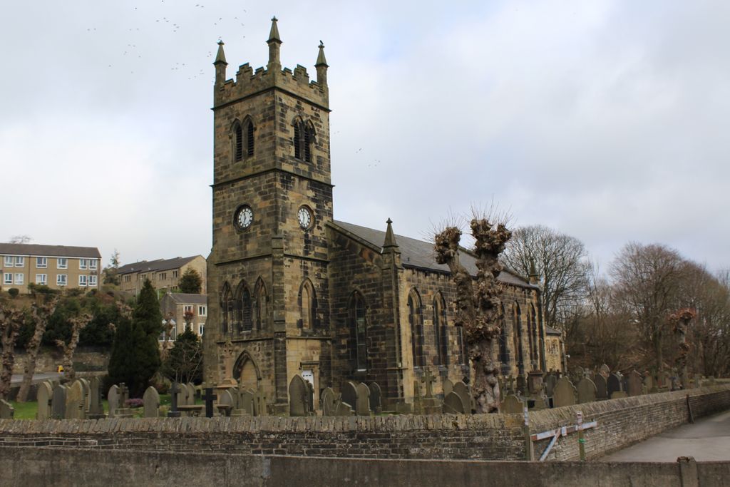
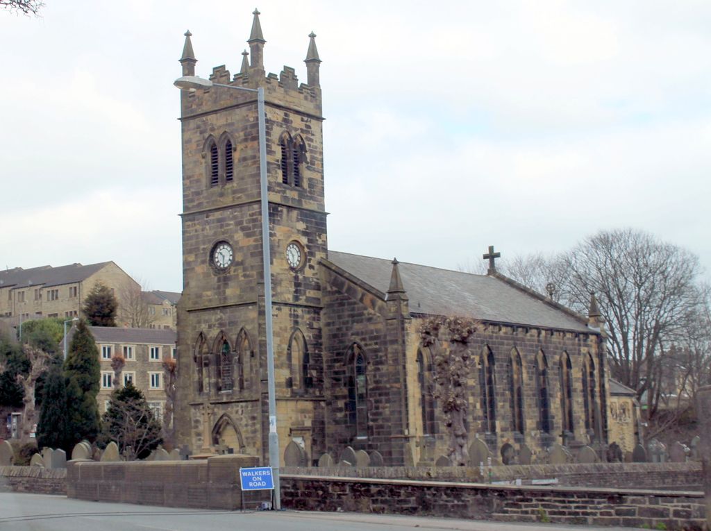
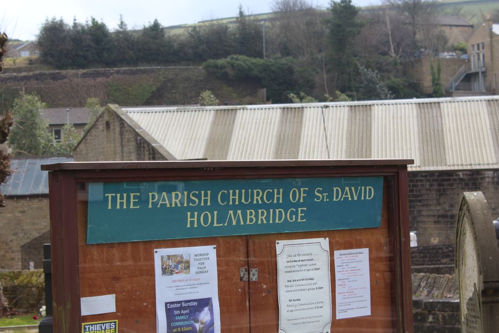
| Location | : | Holmbridge, Metropolitan Borough of Kirklees, England |
| Coordinate | : | 53.5571000, -1.8192900 |
| Description | : | The building of St. David's Church commenced in 1838, and it was consecrated in 1840. The first burial was April 1840 of four year old William Leek. In those days the cost of a morning funeral was 10s. When the Bilberry Resevoir burst its banks on February 5th 1852, the church was flooded to five feet. In the center of the aisle was the body of a goat which had been washed from Upper Digley Mill and witin a few feet of it on the seat of one of the pews, lay the coffin and remains of... Read More |
frequently asked questions (FAQ):
-
Where is St David Churchyard?
St David Churchyard is located at Holmbridge, Metropolitan Borough of Kirklees ,West Yorkshire ,England.
-
St David Churchyard cemetery's updated grave count on graveviews.com?
0 memorials
-
Where are the coordinates of the St David Churchyard?
Latitude: 53.5571000
Longitude: -1.8192900
Nearby Cemetories:
1. Hinchcliffe Mill Wesleyan Chapelyard
Holmbridge, Metropolitan Borough of Kirklees, England
Coordinate: 53.5590200, -1.8160100
2. St. John the Evangelist Churchyard
Upperthong, Metropolitan Borough of Kirklees, England
Coordinate: 53.5690140, -1.7948420
3. Lane Congregational Burial Ground
Holmfirth, Metropolitan Borough of Kirklees, England
Coordinate: 53.5685100, -1.7936000
4. Lane United Reformed Church Upper Graveyard
Holmfirth, Metropolitan Borough of Kirklees, England
Coordinate: 53.5686300, -1.7937400
5. Holy Trinity Church Cemetery
Holmfirth, Metropolitan Borough of Kirklees, England
Coordinate: 53.5661190, -1.7909940
6. Holmfirth Methodist Churchyard
Holmfirth, Metropolitan Borough of Kirklees, England
Coordinate: 53.5715660, -1.7863020
7. Holmeside Memorial Garden
Holmfirth, Metropolitan Borough of Kirklees, England
Coordinate: 53.5711900, -1.7850100
8. Hade Edge Methodist Chapelyard
Holmfirth, Metropolitan Borough of Kirklees, England
Coordinate: 53.5446890, -1.7814530
9. St Mary Churchyard
Wilshaw, Metropolitan Borough of Kirklees, England
Coordinate: 53.5846000, -1.8269100
10. Holmfirth Methodist Burial Ground
Netherthong, Metropolitan Borough of Kirklees, England
Coordinate: 53.5811900, -1.7894200
11. All Saints Churchyard
Netherthong, Metropolitan Borough of Kirklees, England
Coordinate: 53.5829400, -1.7900900
12. Calmlands Cemetery
Meltham, Metropolitan Borough of Kirklees, England
Coordinate: 53.5874570, -1.8518656
13. Wooldale Friends Burial Ground
Holmfirth, Metropolitan Borough of Kirklees, England
Coordinate: 53.5782550, -1.7700500
14. Holy Trinity Churchyard
Hepworth, Metropolitan Borough of Kirklees, England
Coordinate: 53.5590200, -1.7558900
15. St James Churchyard
Meltham, Metropolitan Borough of Kirklees, England
Coordinate: 53.5947200, -1.8388200
16. Hepworth Wesleyan Methodist Chapelyard
Hepworth, Metropolitan Borough of Kirklees, England
Coordinate: 53.5620500, -1.7528000
17. St Bartholomew Churchyard
Meltham, Metropolitan Borough of Kirklees, England
Coordinate: 53.5920720, -1.8513500
18. Meltham Methodist Burial Ground
Meltham, Metropolitan Borough of Kirklees, England
Coordinate: 53.5926860, -1.8535554
19. Lydgate Chapel (Unitarian)
Holmfirth, Metropolitan Borough of Kirklees, England
Coordinate: 53.5787110, -1.7606200
20. Meltham Methodist Church
Meltham, Metropolitan Borough of Kirklees, England
Coordinate: 53.5930087, -1.8530680
21. Christ Church Churchyard
New Mill, Metropolitan Borough of Kirklees, England
Coordinate: 53.5747000, -1.7506220
22. St. George's Churchyard
Brockholes, Metropolitan Borough of Kirklees, England
Coordinate: 53.5955900, -1.7724400
23. Christ Church Churchyard
Helme, Metropolitan Borough of Kirklees, England
Coordinate: 53.6031000, -1.8487000
24. Gatehead Primitive Methodist Chapelyard
Hepworth, Metropolitan Borough of Kirklees, England
Coordinate: 53.5494500, -1.7369400