
| Memorials | : | 0 |
| Location | : | Gendringen, Oude Ijsselstreek Municipality, Netherlands |
| Coordinate | : | 51.8710900, 6.3661700 |
frequently asked questions (FAQ):
-
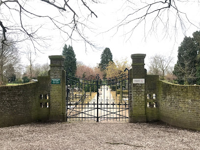
Where is Hervormde Begraafplaats?
Hervormde Begraafplaats is located at Wiekenseweg Gendringen, Oude Ijsselstreek Municipality ,Gelderland ,Netherlands.
-
Hervormde Begraafplaats cemetery's updated grave count on graveviews.com?
0 memorials
-
Where are the coordinates of the Hervormde Begraafplaats?
Latitude: 51.8710900
Longitude: 6.3661700
Nearby Cemetories:
1. Gendringen Roman Catholic Cemetery
Gendringen, Oude Ijsselstreek Municipality, Netherlands
Coordinate: 51.8741900, 6.3785500
2. Joodse Begraafsplaats Oude Ijsselstreek
Gendringen, Oude Ijsselstreek Municipality, Netherlands
Coordinate: 51.8782250, 6.3860750
3. Joodse Begraafplaats
Terborg, Oude Ijsselstreek Municipality, Netherlands
Coordinate: 51.9177220, 6.3725280
4. Emmerich-Praest
Emmerich, Kreis Kleve, Germany
Coordinate: 51.8207211, 6.3454678
5. Emmerich-Dornick
Emmerich, Kreis Kleve, Germany
Coordinate: 51.8110340, 6.3060959
6. Joodse Begraafplaats
Dinxperlo, Aalten Municipality, Netherlands
Coordinate: 51.8587400, 6.4797200
7. Dinxperlo General Cemetery
Dinxperlo, Aalten Municipality, Netherlands
Coordinate: 51.8636700, 6.4893000
8. Zeddam Protestant Cemetery
Zeddam, Montferland Municipality, Netherlands
Coordinate: 51.9078900, 6.2566400
9. Jüdischer Friedhof
Emmerich, Kreis Kleve, Germany
Coordinate: 51.8370156, 6.2535498
10. Friedhof Emmerich
Emmerich, Kreis Kleve, Germany
Coordinate: 51.8393300, 6.2479200
11. Nieuwe Begraafplaats
Dinxperlo, Aalten Municipality, Netherlands
Coordinate: 51.8688335, 6.4971512
12. Varsseveld General Cemetery
Varsseveld, Oude Ijsselstreek Municipality, Netherlands
Coordinate: 51.9402100, 6.4632300
13. Begraafplaats Kommendijk
Doetinchem Municipality, Netherlands
Coordinate: 51.9640325, 6.3423601
14. Friedhof Haus Aspel
Aspel, Kreis Kleve, Germany
Coordinate: 51.7734610, 6.4325830
15. Kilder Roman Catholic Cemetery
Kilder, Montferland Municipality, Netherlands
Coordinate: 51.9373400, 6.2321900
16. Joodse Begraafplaats
Doetinchem Municipality, Netherlands
Coordinate: 51.9719000, 6.2936000
17. Doetinchem General Cemetery, Loolaan
Doetinchem, Doetinchem Municipality, Netherlands
Coordinate: 51.9716500, 6.2851300
18. Beek Roman Catholic Churchyard
Beek, Montferland Municipality, Netherlands
Coordinate: 51.9078300, 6.1895100
19. Halle Protestant Cemetery
Halle, Bronckhorst Municipality, Netherlands
Coordinate: 51.9921000, 6.4249400
20. Friedhof Griethausen
Sinstorf, Harburg, Germany
Coordinate: 51.8213100, 6.1664800
21. Jüdischer Friedhof
Kalkar, Kreis Kleve, Germany
Coordinate: 51.7405871, 6.2954199
22. Zelhem General Cemetery
Zelhem, Bronckhorst Municipality, Netherlands
Coordinate: 52.0097400, 6.3484600
23. Aalten Rooms-Katholieke Begraafplaats
Aalten, Aalten Municipality, Netherlands
Coordinate: 51.9218500, 6.5784000
24. Friedhof Obermörmter
Xanten, Kreis Wesel, Germany
Coordinate: 51.7337798, 6.4144710