
| Memorials | : | 0 |
| Location | : | Terborg, Oude Ijsselstreek Municipality, Netherlands |
| Coordinate | : | 51.9177220, 6.3725280 |
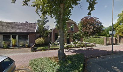
| Description | : | The Jewish community in Terborg buried its dead at three cemeteries, one located in the village of Varsseveld and the other two located on the Silvoldseweg. The first of the two cemeteries on the Silvoldseweg was established 1742; the other in 1928. In 1959, a memorial to the Jews of Terborg murdered during the war was unveiled at the entrance to the new cemetery. In 2002, care of the new Jewish cemetery on the Silvoldseweg was taken over by the municipality of Wisch. |
frequently asked questions (FAQ):
-
Where is Joodse Begraafplaats?
Joodse Begraafplaats is located at Silvoldseweg Terborg, Oude Ijsselstreek Municipality ,Gelderland , 7061DRNetherlands.
-
Joodse Begraafplaats cemetery's updated grave count on graveviews.com?
0 memorials
-
Where are the coordinates of the Joodse Begraafplaats?
Latitude: 51.9177220
Longitude: 6.3725280
Nearby Cemetories:
1. Joodse Begraafsplaats Oude Ijsselstreek
Gendringen, Oude Ijsselstreek Municipality, Netherlands
Coordinate: 51.8782250, 6.3860750
2. Gendringen Roman Catholic Cemetery
Gendringen, Oude Ijsselstreek Municipality, Netherlands
Coordinate: 51.8741900, 6.3785500
3. Hervormde Begraafplaats
Gendringen, Oude Ijsselstreek Municipality, Netherlands
Coordinate: 51.8710900, 6.3661700
4. Begraafplaats Kommendijk
Doetinchem Municipality, Netherlands
Coordinate: 51.9640325, 6.3423601
5. Varsseveld General Cemetery
Varsseveld, Oude Ijsselstreek Municipality, Netherlands
Coordinate: 51.9402100, 6.4632300
6. Zeddam Protestant Cemetery
Zeddam, Montferland Municipality, Netherlands
Coordinate: 51.9078900, 6.2566400
7. Joodse Begraafplaats
Doetinchem Municipality, Netherlands
Coordinate: 51.9719000, 6.2936000
8. Doetinchem General Cemetery, Loolaan
Doetinchem, Doetinchem Municipality, Netherlands
Coordinate: 51.9716500, 6.2851300
9. Halle Protestant Cemetery
Halle, Bronckhorst Municipality, Netherlands
Coordinate: 51.9921000, 6.4249400
10. Joodse Begraafplaats
Dinxperlo, Aalten Municipality, Netherlands
Coordinate: 51.8587400, 6.4797200
11. Kilder Roman Catholic Cemetery
Kilder, Montferland Municipality, Netherlands
Coordinate: 51.9373400, 6.2321900
12. Dinxperlo General Cemetery
Dinxperlo, Aalten Municipality, Netherlands
Coordinate: 51.8636700, 6.4893000
13. Nieuwe Begraafplaats
Dinxperlo, Aalten Municipality, Netherlands
Coordinate: 51.8688335, 6.4971512
14. Zelhem General Cemetery
Zelhem, Bronckhorst Municipality, Netherlands
Coordinate: 52.0097400, 6.3484600
15. Emmerich-Praest
Emmerich, Kreis Kleve, Germany
Coordinate: 51.8207211, 6.3454678
16. Jüdischer Friedhof
Emmerich, Kreis Kleve, Germany
Coordinate: 51.8370156, 6.2535498
17. Friedhof Emmerich
Emmerich, Kreis Kleve, Germany
Coordinate: 51.8393300, 6.2479200
18. Beek Roman Catholic Churchyard
Beek, Montferland Municipality, Netherlands
Coordinate: 51.9078300, 6.1895100
19. Emmerich-Dornick
Emmerich, Kreis Kleve, Germany
Coordinate: 51.8110340, 6.3060959
20. Hummelo-en-Keppel General Cemetery
Hummelo, Bronckhorst Municipality, Netherlands
Coordinate: 52.0024000, 6.2432600
21. Berkenhove General Cemetery
Aalten, Aalten Municipality, Netherlands
Coordinate: 51.9342100, 6.5758700
22. Oude Begraafplaats
Aalten, Aalten Municipality, Netherlands
Coordinate: 51.9283288, 6.5776327
23. Aalten Rooms-Katholieke Begraafplaats
Aalten, Aalten Municipality, Netherlands
Coordinate: 51.9218500, 6.5784000
24. Hengelo Gelderland General Cemetery
Hengelo, Bronckhorst Municipality, Netherlands
Coordinate: 52.0497300, 6.3137100