
| Memorials | : | 0 |
| Location | : | Dinxperlo, Aalten Municipality, Netherlands |
| Coordinate | : | 51.8636700, 6.4893000 |
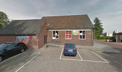
| Description | : | The town of Dinxperlo is situated to the south-east of Doetinchem off the E35 motorway on the border with Germany. From the E35 motorway, which runs between Arnhem and Oberhausen, turn off at Bocholt-Rees and follow the direction for Anholt. On reaching Anholt follow the road to the right in the direction of Dinxperlo/Bocholt. At Sudderwick crossroads turn left in the direction of Dinxperlo. In the town follow the main road, called Heelweg, and by the church turn right into Kwikkelstraat. Take the second turning right into Hogestraat and then the first turning right into Kerkhofpad, and the cemetery is... Read More |
frequently asked questions (FAQ):
-
Where is Dinxperlo General Cemetery?
Dinxperlo General Cemetery is located at Dinxperlo, Aalten Municipality ,Gelderland ,Netherlands.
-
Dinxperlo General Cemetery cemetery's updated grave count on graveviews.com?
0 memorials
-
Where are the coordinates of the Dinxperlo General Cemetery?
Latitude: 51.8636700
Longitude: 6.4893000
Nearby Cemetories:
1. Nieuwe Begraafplaats
Dinxperlo, Aalten Municipality, Netherlands
Coordinate: 51.8688335, 6.4971512
2. Joodse Begraafplaats
Dinxperlo, Aalten Municipality, Netherlands
Coordinate: 51.8587400, 6.4797200
3. Joodse Begraafsplaats Oude Ijsselstreek
Gendringen, Oude Ijsselstreek Municipality, Netherlands
Coordinate: 51.8782250, 6.3860750
4. Gendringen Roman Catholic Cemetery
Gendringen, Oude Ijsselstreek Municipality, Netherlands
Coordinate: 51.8741900, 6.3785500
5. Hervormde Begraafplaats
Gendringen, Oude Ijsselstreek Municipality, Netherlands
Coordinate: 51.8710900, 6.3661700
6. Varsseveld General Cemetery
Varsseveld, Oude Ijsselstreek Municipality, Netherlands
Coordinate: 51.9402100, 6.4632300
7. Aalten Rooms-Katholieke Begraafplaats
Aalten, Aalten Municipality, Netherlands
Coordinate: 51.9218500, 6.5784000
8. Oude Begraafplaats
Aalten, Aalten Municipality, Netherlands
Coordinate: 51.9283288, 6.5776327
9. Berkenhove General Cemetery
Aalten, Aalten Municipality, Netherlands
Coordinate: 51.9342100, 6.5758700
10. Joodse Begraafplaats
Terborg, Oude Ijsselstreek Municipality, Netherlands
Coordinate: 51.9177220, 6.3725280
11. Joodse Begraafplaats
Aalten, Aalten Municipality, Netherlands
Coordinate: 51.9252900, 6.5988300
12. Grafheuvel Nannielaantje
Aalten, Aalten Municipality, Netherlands
Coordinate: 51.9285000, 6.5957200
13. Friedhof Haus Aspel
Aspel, Kreis Kleve, Germany
Coordinate: 51.7734610, 6.4325830
14. Emmerich-Praest
Emmerich, Kreis Kleve, Germany
Coordinate: 51.8207211, 6.3454678
15. Joodse Begraafplaats
Bredevoort, Aalten Municipality, Netherlands
Coordinate: 51.9408108, 6.6189064
16. Oude Begraafplaats
Bredevoort, Aalten Municipality, Netherlands
Coordinate: 51.9409683, 6.6195741
17. Kloosterhof
Bredevoort, Aalten Municipality, Netherlands
Coordinate: 51.9461994, 6.6127766
18. Emmerich-Dornick
Emmerich, Kreis Kleve, Germany
Coordinate: 51.8110340, 6.3060959
19. Halle Protestant Cemetery
Halle, Bronckhorst Municipality, Netherlands
Coordinate: 51.9921000, 6.4249400
20. Begraafplaats Kommendijk
Doetinchem Municipality, Netherlands
Coordinate: 51.9640325, 6.3423601
21. Friedhof Obermörmter
Xanten, Kreis Wesel, Germany
Coordinate: 51.7337798, 6.4144710
22. Lichtenvoorde General Cemetery
Lichtenvoorde, Oost Gelre Municipality, Netherlands
Coordinate: 51.9886300, 6.5968600
23. Jüdischer Friedhof
Emmerich, Kreis Kleve, Germany
Coordinate: 51.8370156, 6.2535498
24. Zeddam Protestant Cemetery
Zeddam, Montferland Municipality, Netherlands
Coordinate: 51.9078900, 6.2566400