
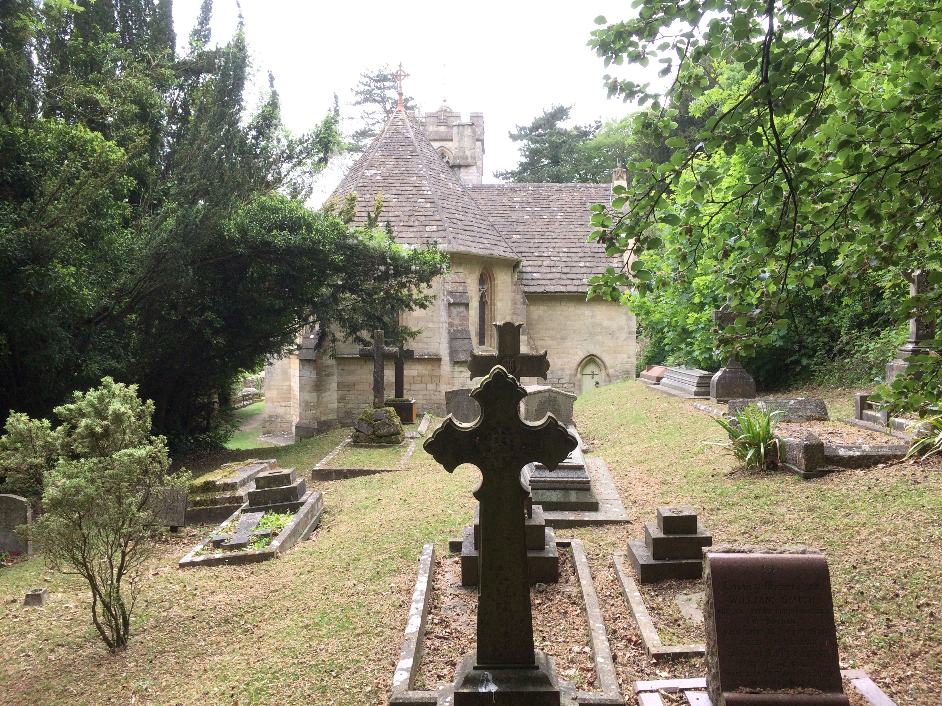
| Memorials | : | 41 |
| Location | : | Owlpen, Stroud District, England |
| Coordinate | : | 51.6841176, -2.2912175 |
frequently asked questions (FAQ):
-
Where is Holy Cross Churchyard?
Holy Cross Churchyard is located at Blacknest Owlpen, Stroud District ,Gloucestershire , GL11 5BZEngland.
-
Holy Cross Churchyard cemetery's updated grave count on graveviews.com?
41 memorials
-
Where are the coordinates of the Holy Cross Churchyard?
Latitude: 51.6841176
Longitude: -2.2912175
Nearby Cemetories:
1. St Giles Churchyard
Uley, Stroud District, England
Coordinate: 51.6853115, -2.3038214
2. St. John the Baptist Churchyard
Kingscote, Cotswold District, England
Coordinate: 51.6644230, -2.2640480
3. St Marks Churchyard
Dursley, Stroud District, England
Coordinate: 51.6777900, -2.3499800
4. St James the Great Church
Dursley, Stroud District, England
Coordinate: 51.6812840, -2.3530000
5. St. George Churchyard
Cam, Stroud District, England
Coordinate: 51.6923120, -2.3524570
6. Cam Congregational Church
Cam, Stroud District, England
Coordinate: 51.6914518, -2.3530424
7. Dursley Tabernacle URC
Dursley, Stroud District, England
Coordinate: 51.6823727, -2.3571669
8. Dursley Town Cemetery
Dursley, Stroud District, England
Coordinate: 51.6893700, -2.3623400
9. Priory Church of the Annunciation Churchyard
Woodchester, Stroud District, England
Coordinate: 51.7080680, -2.2305250
10. Saint Andrew's Churchyard
Frocester, Stroud District, England
Coordinate: 51.7273322, -2.3129734
11. St Nicholas Churchyard
Ozleworth, Cotswold District, England
Coordinate: 51.6380070, -2.2986530
12. Kings Stanley Baptist Cemetery
Kings Stanley, Stroud District, England
Coordinate: 51.7269460, -2.2621780
13. St. Bartholomew's Churchyard
Dursley, Stroud District, England
Coordinate: 51.7012900, -2.3653000
14. St Peters Churchyard
Frocester, Stroud District, England
Coordinate: 51.7277690, -2.3329860
15. Amberley Church Cemetery
Amberley, Stroud District, England
Coordinate: 51.7091900, -2.2196100
16. Holy Trinity Churchyard
Amberley, Stroud District, England
Coordinate: 51.7087660, -2.2177170
17. St George's Churchyard
Kings Stanley, Stroud District, England
Coordinate: 51.7352650, -2.2765210
18. Amberley Methodist Church - Littleworth Wesleyan C
Amberley, Stroud District, England
Coordinate: 51.7123580, -2.2202540
19. St Mary's Churchyard
Woodchester, Stroud District, England
Coordinate: 51.7224900, -2.2333920
20. All Saints Churchyard
Selsley, Stroud District, England
Coordinate: 51.7327800, -2.2487900
21. The Quarry United Reformed Church
Cam, Stroud District, England
Coordinate: 51.6968858, -2.3789270
22. St. Mary the Virgin Churchyard
Wotton-under-Edge, Stroud District, England
Coordinate: 51.6390390, -2.3480250
23. North Nibley Cemetery
North Nibley, Stroud District, England
Coordinate: 51.6584100, -2.3768600
24. St. Cyr Churchyard
Stonehouse, Stroud District, England
Coordinate: 51.7433750, -2.2917980