
| Memorials | : | 3 |
| Location | : | Kings Stanley, Stroud District, England |
| Coordinate | : | 51.7352650, -2.2765210 |
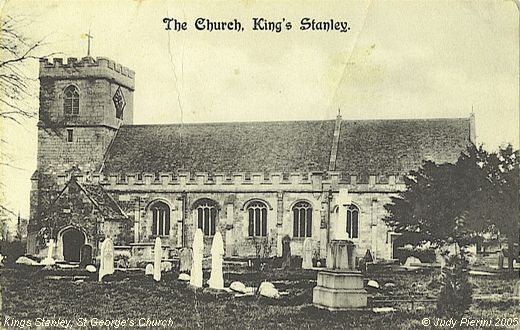
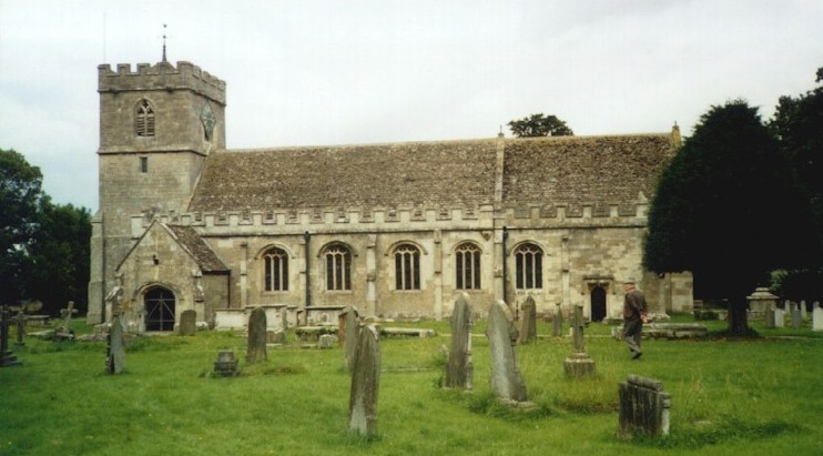
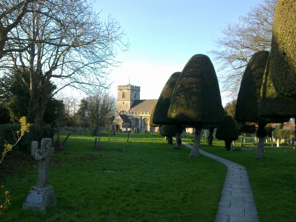
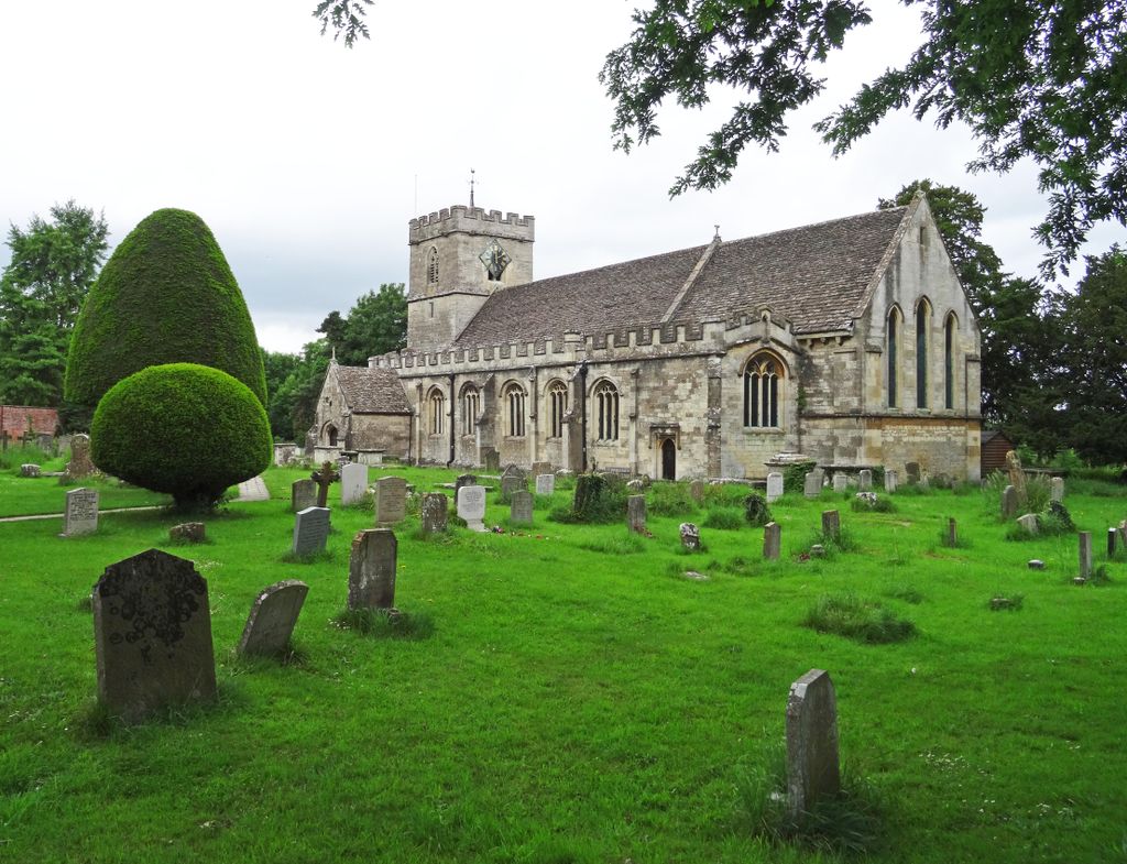
| Description | : | St. George's church has been a centre of Christian worship for more than 800 years. Remnants of Norman doorways and windows can be seen, though now the interior is Gothic in style, re-created in 1876, with well-made carved chancel fittings and a painted barrel-vault ceiling. The Victorian organ made by a local craftsman is particularly fine in both appearance and tone. The extensive churchyard with its avenue of clipped yew-trees has many 17th to 19th century tombstones. A full survey of the inscriptions is available in the church. The church is located about 800m north of the junction of St George's... Read More |
frequently asked questions (FAQ):
-
Where is St George's Churchyard?
St George's Churchyard is located at St George's Avenue north side, 800m north of the village green Kings Stanley, Stroud District ,Gloucestershire , GL10 3LHEngland.
-
St George's Churchyard cemetery's updated grave count on graveviews.com?
3 memorials
-
Where are the coordinates of the St George's Churchyard?
Latitude: 51.7352650
Longitude: -2.2765210
Nearby Cemetories:
1. Kings Stanley Baptist Cemetery
Kings Stanley, Stroud District, England
Coordinate: 51.7269460, -2.2621780
2. St. Cyr Churchyard
Stonehouse, Stroud District, England
Coordinate: 51.7433750, -2.2917980
3. All Saints Churchyard
Selsley, Stroud District, England
Coordinate: 51.7327800, -2.2487900
4. Saint Matthews Churchyard
Cainscross, Stroud District, England
Coordinate: 51.7430640, -2.2469780
5. Saint Andrew's Churchyard
Frocester, Stroud District, England
Coordinate: 51.7273322, -2.3129734
6. St. John the Baptist Churchyard
Randwick, Stroud District, England
Coordinate: 51.7587400, -2.2514000
7. St. Michael and All Angels Churchyard
Eastington, Stroud District, England
Coordinate: 51.7501680, -2.3161330
8. St Mary's Churchyard
Woodchester, Stroud District, England
Coordinate: 51.7224900, -2.2333920
9. St. Mary Magdalene Churchyard
Rodborough, Stroud District, England
Coordinate: 51.7384180, -2.2284060
10. Rodborough Tabernacle
Rodborough, Stroud District, England
Coordinate: 51.7345300, -2.2245700
11. St Peters Churchyard
Frocester, Stroud District, England
Coordinate: 51.7277690, -2.3329860
12. St Paul Churchyard
Whiteshill, Stroud District, England
Coordinate: 51.7597750, -2.2321540
13. St. Laurence Churchyard
Stroud, Stroud District, England
Coordinate: 51.7459470, -2.2153950
14. Priory Church of the Annunciation Churchyard
Woodchester, Stroud District, England
Coordinate: 51.7080680, -2.2305250
15. Stroud Old Cemetery
Stroud, Stroud District, England
Coordinate: 51.7337658, -2.2094599
16. Amberley Methodist Church - Littleworth Wesleyan C
Amberley, Stroud District, England
Coordinate: 51.7123580, -2.2202540
17. Amberley Church Cemetery
Amberley, Stroud District, England
Coordinate: 51.7091900, -2.2196100
18. Holy Trinity Churchyard
Amberley, Stroud District, England
Coordinate: 51.7087660, -2.2177170
19. Stroud Hill Cemetery
Stroud, Stroud District, England
Coordinate: 51.7415670, -2.2002660
20. Holy Cross Churchyard
Owlpen, Stroud District, England
Coordinate: 51.6841176, -2.2912175
21. St John the Baptist Churchyard
Pitchcombe, Stroud District, England
Coordinate: 51.7727590, -2.2166790
22. St Giles Churchyard
Uley, Stroud District, England
Coordinate: 51.6853115, -2.3038214
23. Brimscombe Cemetery
Brimscombe, Stroud District, England
Coordinate: 51.7165900, -2.1900600
24. St. Peter's Churchyard
Haresfield, Stroud District, England
Coordinate: 51.7921323, -2.2767870