
| Memorials | : | 2 |
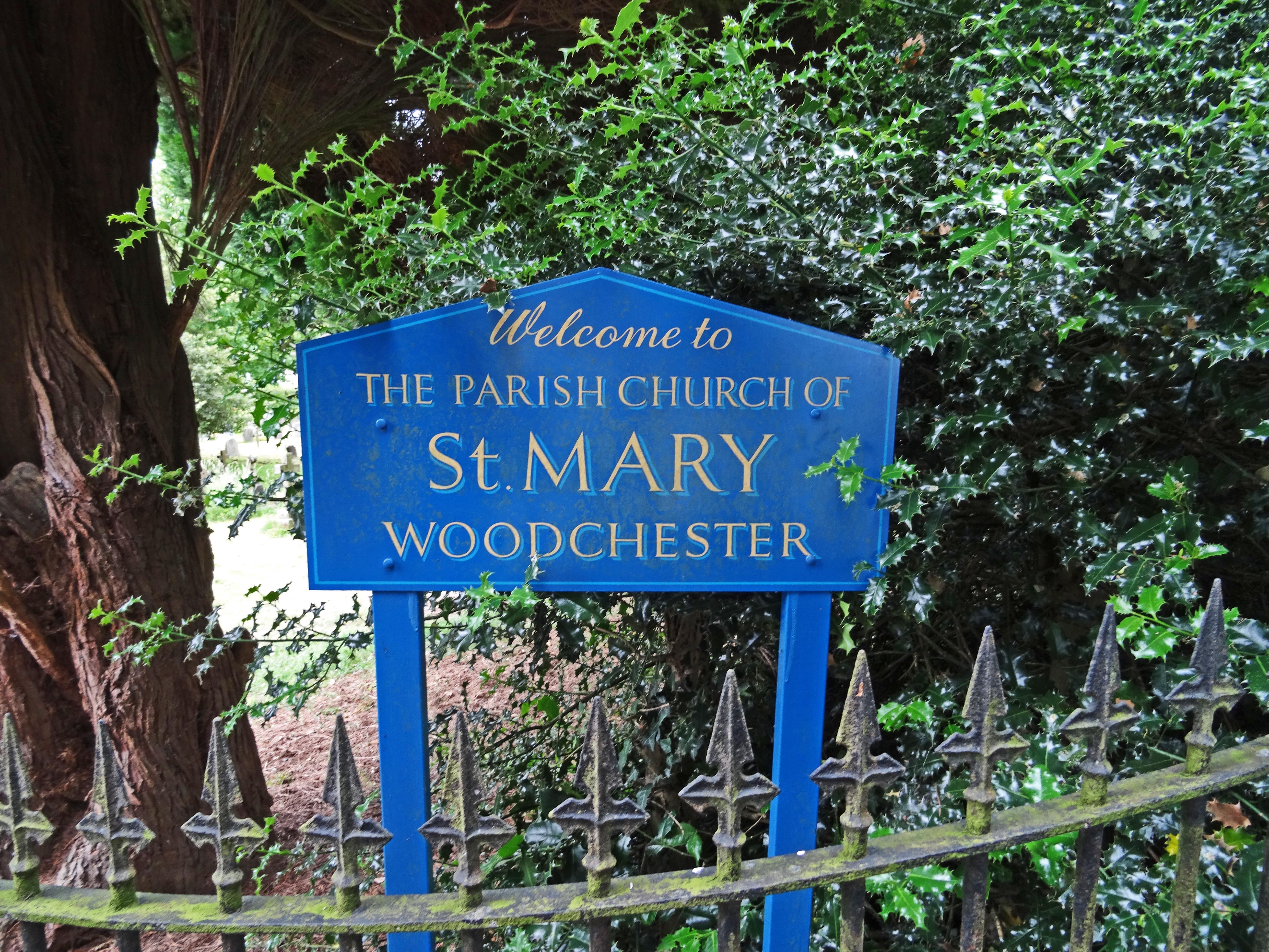
| Location | : | Woodchester, Stroud District, England |
| Coordinate | : | 51.7224900, -2.2333920 |
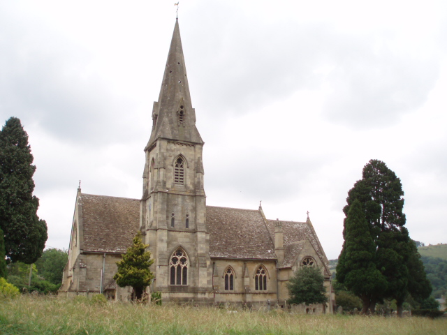
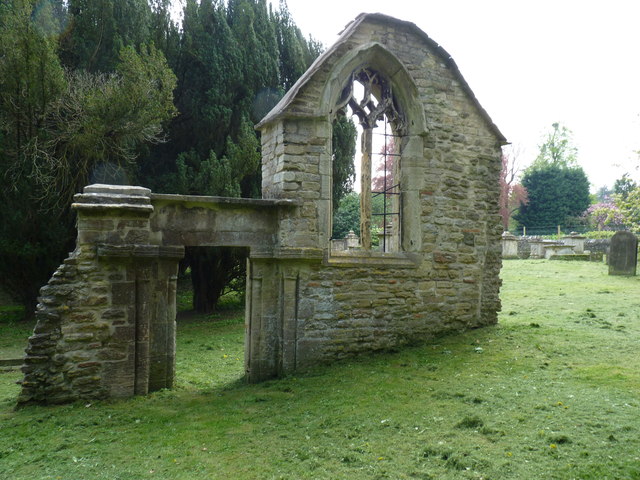
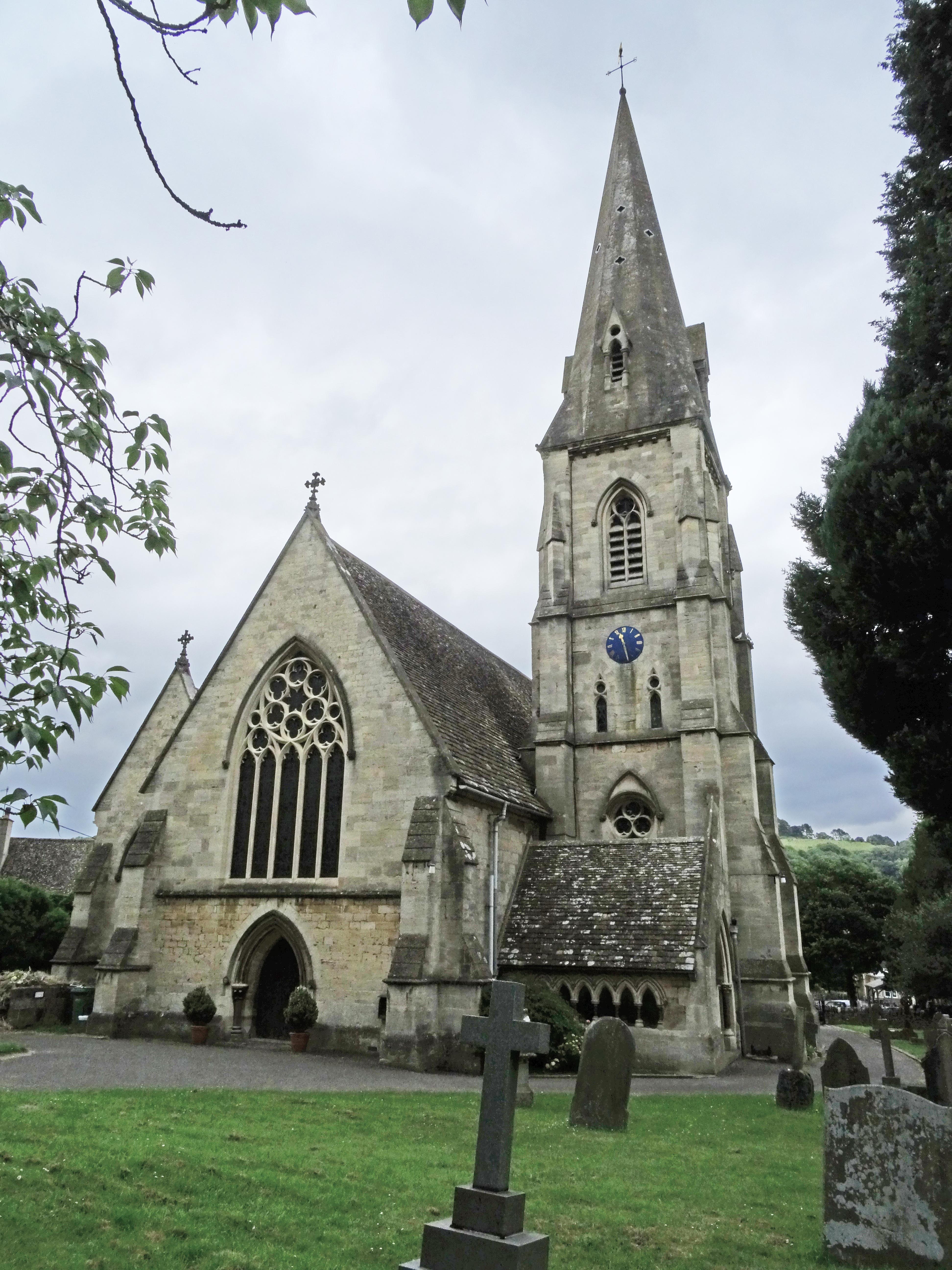
| Description | : | The old St. Marys church in Woodchester was torn down in 1861 when it was decided that it was too small to continue serving the parish, and the cost of needed repairs were too high. The new church, which was consecrated in 1863, is built on a different site, more central to the parish. Several stone monuments in the new building were transferred from the old one, and the old churchyard, which contains an interesting pyramid-shaped monument to the Dunn family, also remains. |
frequently asked questions (FAQ):
-
Where is St Mary's Churchyard?
St Mary's Churchyard is located at Church Road, North Woodchester Woodchester, Stroud District ,Gloucestershire , GL5 5PDEngland.
-
St Mary's Churchyard cemetery's updated grave count on graveviews.com?
2 memorials
-
Where are the coordinates of the St Mary's Churchyard?
Latitude: 51.7224900
Longitude: -2.2333920
Nearby Cemetories:
1. Amberley Methodist Church - Littleworth Wesleyan C
Amberley, Stroud District, England
Coordinate: 51.7123580, -2.2202540
2. Rodborough Tabernacle
Rodborough, Stroud District, England
Coordinate: 51.7345300, -2.2245700
3. All Saints Churchyard
Selsley, Stroud District, England
Coordinate: 51.7327800, -2.2487900
4. Priory Church of the Annunciation Churchyard
Woodchester, Stroud District, England
Coordinate: 51.7080680, -2.2305250
5. Amberley Church Cemetery
Amberley, Stroud District, England
Coordinate: 51.7091900, -2.2196100
6. St. Mary Magdalene Churchyard
Rodborough, Stroud District, England
Coordinate: 51.7384180, -2.2284060
7. Holy Trinity Churchyard
Amberley, Stroud District, England
Coordinate: 51.7087660, -2.2177170
8. Kings Stanley Baptist Cemetery
Kings Stanley, Stroud District, England
Coordinate: 51.7269460, -2.2621780
9. Stroud Old Cemetery
Stroud, Stroud District, England
Coordinate: 51.7337658, -2.2094599
10. Saint Matthews Churchyard
Cainscross, Stroud District, England
Coordinate: 51.7430640, -2.2469780
11. St. Laurence Churchyard
Stroud, Stroud District, England
Coordinate: 51.7459470, -2.2153950
12. Brimscombe Cemetery
Brimscombe, Stroud District, England
Coordinate: 51.7165900, -2.1900600
13. Stroud Hill Cemetery
Stroud, Stroud District, England
Coordinate: 51.7415670, -2.2002660
14. St George's Churchyard
Kings Stanley, Stroud District, England
Coordinate: 51.7352650, -2.2765210
15. Holy Trinity Churchyard
Minchinhampton, Stroud District, England
Coordinate: 51.7063600, -2.1860700
16. Minchinhampton Baptist Churchyard
Minchinhampton, Stroud District, England
Coordinate: 51.7039614, -2.1853756
17. St Paul Churchyard
Whiteshill, Stroud District, England
Coordinate: 51.7597750, -2.2321540
18. St. John the Baptist Churchyard
Randwick, Stroud District, England
Coordinate: 51.7587400, -2.2514000
19. St. Mary of the Angels Churchyard
Chalford, Stroud District, England
Coordinate: 51.7219000, -2.1708000
20. St. Michael's and All Angels Churchyard
Bisley, Stroud District, England
Coordinate: 51.7301150, -2.1715900
21. St. Cyr Churchyard
Stonehouse, Stroud District, England
Coordinate: 51.7433750, -2.2917980
22. Christ Church Churchyard
Chalford, Stroud District, England
Coordinate: 51.7214500, -2.1577900
23. Eastcombe Baptist Churchyard
Eastcombe, Stroud District, England
Coordinate: 51.7378009, -2.1606789
24. Saint Andrew's Churchyard
Frocester, Stroud District, England
Coordinate: 51.7273322, -2.3129734