
| Memorials | : | 0 |
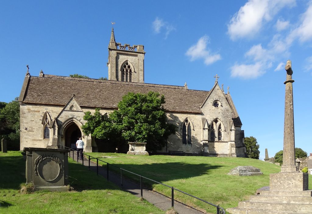
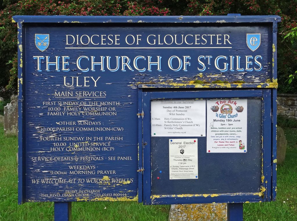
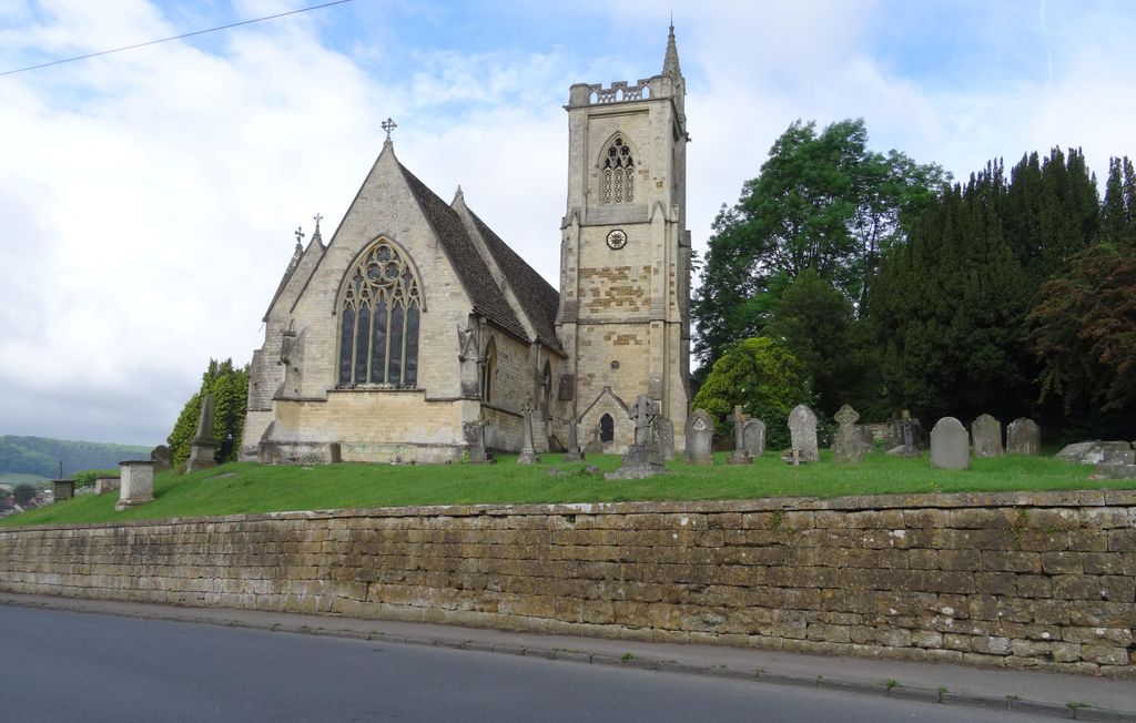
| Location | : | Uley, Stroud District, England |
| Coordinate | : | 51.6853115, -2.3038214 |
| Description | : | The old church of St. Giles consisted of a nave with north aisle, a porch on the south side of the church with a parvise over, and a chancel with a chapel on the north. The tower, it will be seen, was placed against the north aisle near the east end, and this unusual arrangement has been perpetuated in the modern church. The most interesting feature of the church was the north chapel - Bassett's chapel, the burying place of that ancient family. Here, according to Sir Robert Atkyns, existed in his time, i.e., about 1709, the monument of... Read More |
frequently asked questions (FAQ):
-
Where is St Giles Churchyard?
St Giles Churchyard is located at Uley, Stroud District ,Gloucestershire , GL11 5SJEngland.
-
St Giles Churchyard cemetery's updated grave count on graveviews.com?
0 memorials
-
Where are the coordinates of the St Giles Churchyard?
Latitude: 51.6853115
Longitude: -2.3038214
Nearby Cemetories:
1. Holy Cross Churchyard
Owlpen, Stroud District, England
Coordinate: 51.6841176, -2.2912175
2. St Marks Churchyard
Dursley, Stroud District, England
Coordinate: 51.6777900, -2.3499800
3. St James the Great Church
Dursley, Stroud District, England
Coordinate: 51.6812840, -2.3530000
4. St. George Churchyard
Cam, Stroud District, England
Coordinate: 51.6923120, -2.3524570
5. Cam Congregational Church
Cam, Stroud District, England
Coordinate: 51.6914518, -2.3530424
6. St. John the Baptist Churchyard
Kingscote, Cotswold District, England
Coordinate: 51.6644230, -2.2640480
7. Dursley Tabernacle URC
Dursley, Stroud District, England
Coordinate: 51.6823727, -2.3571669
8. Dursley Town Cemetery
Dursley, Stroud District, England
Coordinate: 51.6893700, -2.3623400
9. St. Bartholomew's Churchyard
Dursley, Stroud District, England
Coordinate: 51.7012900, -2.3653000
10. Saint Andrew's Churchyard
Frocester, Stroud District, England
Coordinate: 51.7273322, -2.3129734
11. St Peters Churchyard
Frocester, Stroud District, England
Coordinate: 51.7277690, -2.3329860
12. St Nicholas Churchyard
Ozleworth, Cotswold District, England
Coordinate: 51.6380070, -2.2986530
13. The Quarry United Reformed Church
Cam, Stroud District, England
Coordinate: 51.6968858, -2.3789270
14. Kings Stanley Baptist Cemetery
Kings Stanley, Stroud District, England
Coordinate: 51.7269460, -2.2621780
15. Priory Church of the Annunciation Churchyard
Woodchester, Stroud District, England
Coordinate: 51.7080680, -2.2305250
16. North Nibley Cemetery
North Nibley, Stroud District, England
Coordinate: 51.6584100, -2.3768600
17. St George's Churchyard
Kings Stanley, Stroud District, England
Coordinate: 51.7352650, -2.2765210
18. St. Mary the Virgin Churchyard
Wotton-under-Edge, Stroud District, England
Coordinate: 51.6390390, -2.3480250
19. St Martin Churchyard
North Nibley, Stroud District, England
Coordinate: 51.6629860, -2.3836650
20. St. Cyr's Churchyard
Stinchcombe, Stroud District, England
Coordinate: 51.6881090, -2.3927490
21. Wotton Baptist Churchyard
Wotton-under-Edge, Stroud District, England
Coordinate: 51.6371850, -2.3531940
22. St Mary's Churchyard
Woodchester, Stroud District, England
Coordinate: 51.7224900, -2.2333920
23. Amberley Church Cemetery
Amberley, Stroud District, England
Coordinate: 51.7091900, -2.2196100
24. Holy Trinity Churchyard
Amberley, Stroud District, England
Coordinate: 51.7087660, -2.2177170