
| Memorials | : | 22 |
| Location | : | Abbey Dore, Herefordshire Unitary Authority, England |
| Coordinate | : | 51.9686570, -2.8936760 |
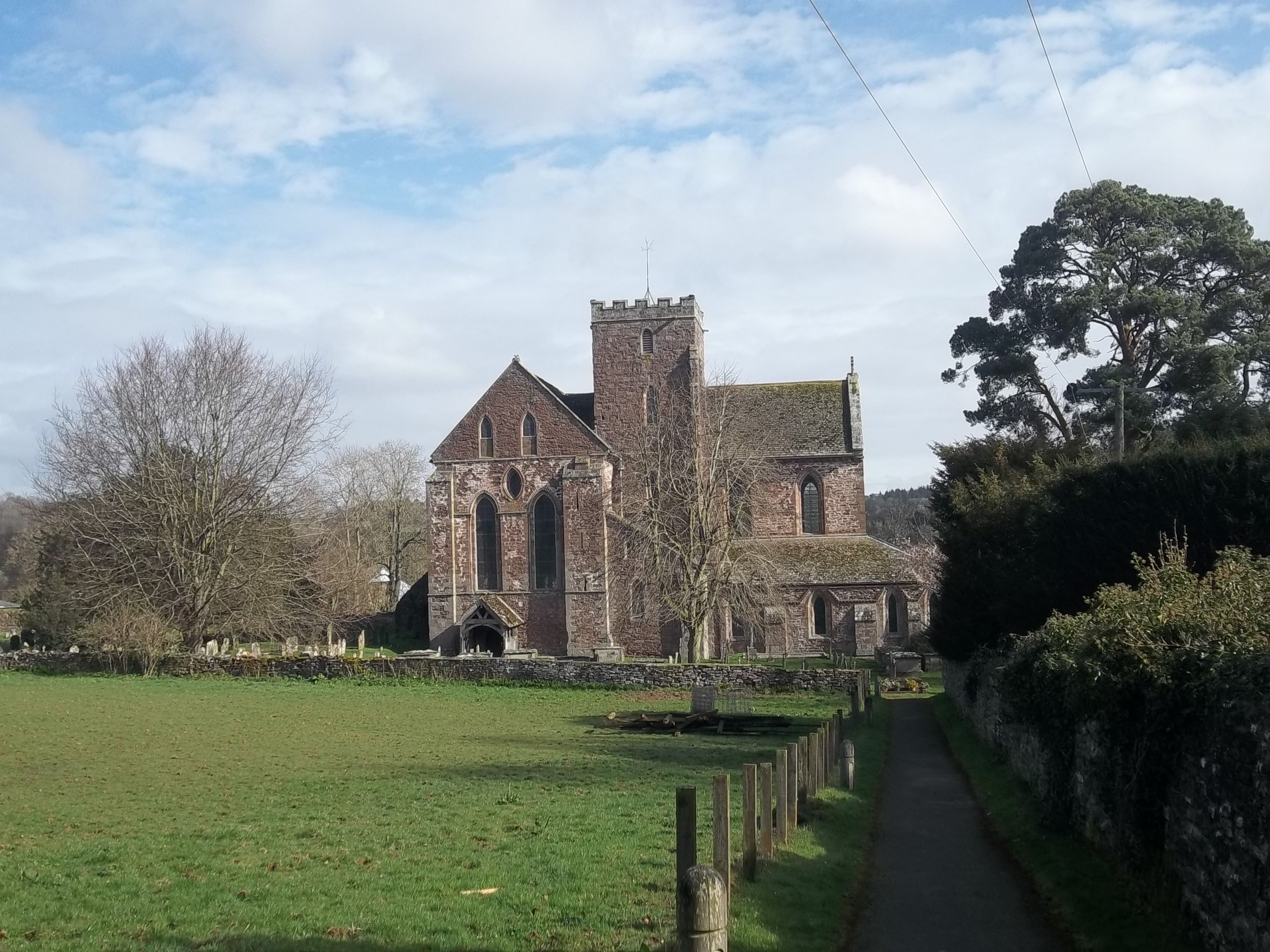
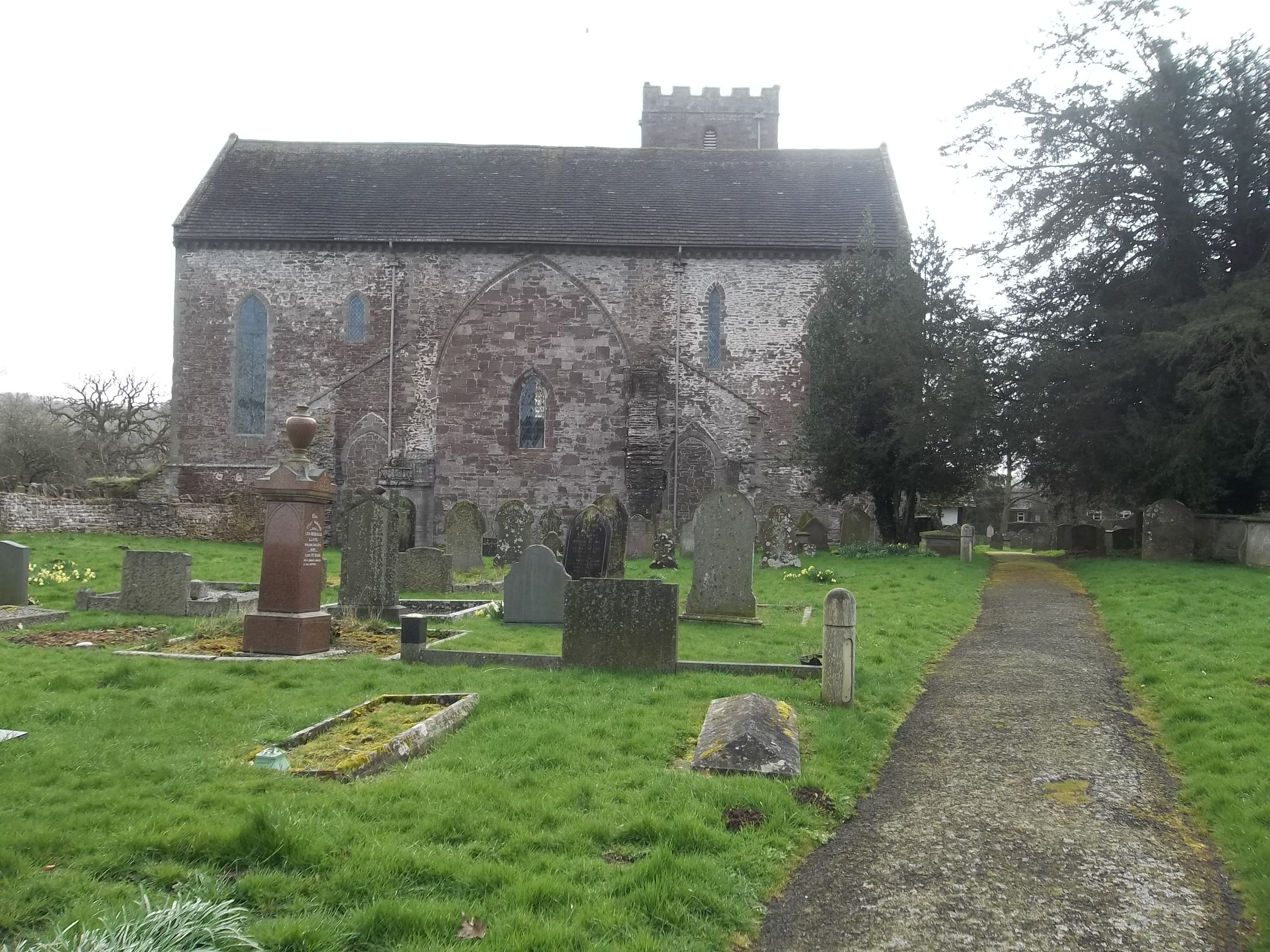
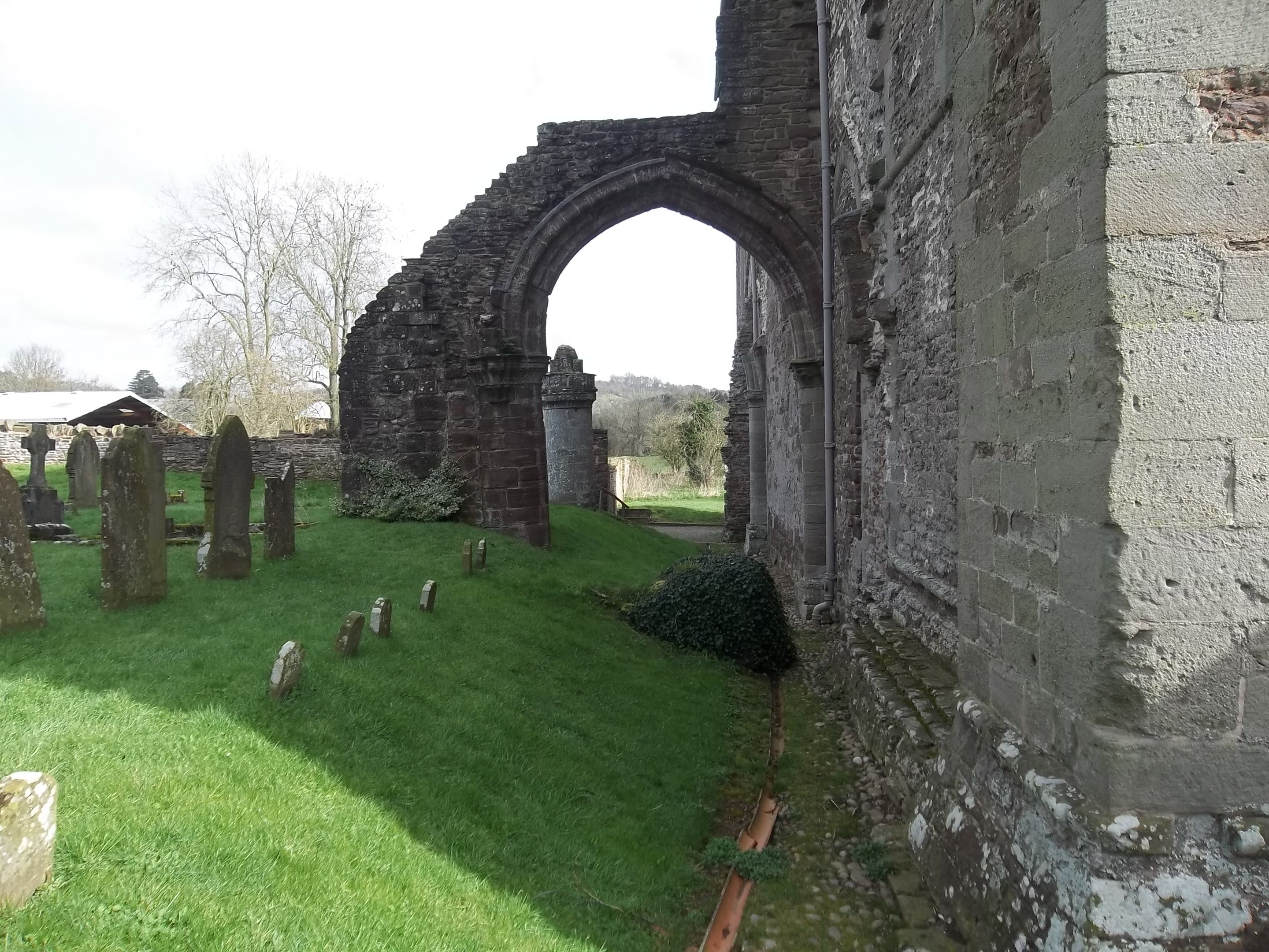
| Description | : | Dore Abbey in Herefordshire, near the village of Abbey Dore in the Golden Valley is a former Cistercian Abbey. It was founded in 1147 by Lord Robert d'Ewyas and, in 1282, dedicated to the Holy Trinity and Saint Mary, by D'Ewyas' brother in law, Thomas Cantilupe, a Bishop of Hereford. It is located in the Golden Valley of the River Dore. The abbey was dissolved in 1536. Part of the original abbey church, begun in about 1180, is still in use. The surviving building, constructed of Herefordshire Old Red Sandstone, lacks its original nave. It was restored in the 1630s,... Read More |
frequently asked questions (FAQ):
-
Where is Holy Trinity and St Mary Churchyard?
Holy Trinity and St Mary Churchyard is located at Abbey Dore, Herefordshire Unitary Authority ,Herefordshire ,England.
-
Holy Trinity and St Mary Churchyard cemetery's updated grave count on graveviews.com?
21 memorials
-
Where are the coordinates of the Holy Trinity and St Mary Churchyard?
Latitude: 51.9686570
Longitude: -2.8936760


Nearby Cemetories:
1. St. Michael and All Angels Churchyard
Ewyas Harold, Herefordshire Unitary Authority, England
Coordinate: 51.9539100, -2.8926070
2. Ewyas Harold Priory (Defunct)
Ewyas Harold, Herefordshire Unitary Authority, England
Coordinate: 51.9539100, -2.8969800
3. St Mary's Churchyard
Kentchurch, Herefordshire Unitary Authority, England
Coordinate: 51.9263169, -2.8456161
4. St. Mary & David Churchyard
Kilpeck, Herefordshire Unitary Authority, England
Coordinate: 51.9692310, -2.8076150
5. St Michael churchyard
Garway, Herefordshire Unitary Authority, England
Coordinate: 51.8982110, -2.7934460
6. All Saints Church
Clehonger, Herefordshire Unitary Authority, England
Coordinate: 52.0373470, -2.7806970
7. St. Leonard's Churchyard
Blakemere, Herefordshire Unitary Authority, England
Coordinate: 52.0646460, -2.9322980
8. St. John the Baptist Churchyard
Llanwarne, Herefordshire Unitary Authority, England
Coordinate: 51.9501676, -2.7203512
9. Aconbury Hill
Aconbury, Herefordshire Unitary Authority, England
Coordinate: 51.9932540, -2.7212790
10. Belmont Abbey
Hereford, Herefordshire Unitary Authority, England
Coordinate: 52.0393000, -2.7564000
11. Little Birch Churchyard
Little Birch, Herefordshire Unitary Authority, England
Coordinate: 51.9770250, -2.7126530
12. Priory Churchyard
Aconbury, Herefordshire Unitary Authority, England
Coordinate: 51.9978900, -2.7052160
13. St. David's Churchyard
Little Dewchurch, Herefordshire Unitary Authority, England
Coordinate: 51.9822934, -2.6865234
14. Hereford Cemetery and Crematorium
Hereford, Herefordshire Unitary Authority, England
Coordinate: 52.0579510, -2.7389730
15. St Martin Churchyard
Hereford, Herefordshire Unitary Authority, England
Coordinate: 52.0450100, -2.7202700
16. St. Mary's Churchyard
Credenhill, Herefordshire Unitary Authority, England
Coordinate: 52.0905490, -2.8037610
17. Credenhill Military Cemetery
Credenhill, Herefordshire Unitary Authority, England
Coordinate: 52.0869980, -2.7899910
18. St Andrew Churchyard
Bredwardine, Herefordshire Unitary Authority, England
Coordinate: 52.0948000, -2.9725000
19. Barton Hall Cemetery
Hereford, Herefordshire Unitary Authority, England
Coordinate: 52.0541484, -2.7227701
20. Church of the Grey Friars
Hereford, Herefordshire Unitary Authority, England
Coordinate: 52.0528480, -2.7209559
21. St. Nicholas' Churchyard
Hereford, Herefordshire Unitary Authority, England
Coordinate: 52.0542540, -2.7207160
22. Hereford Cathedral
Hereford, Herefordshire Unitary Authority, England
Coordinate: 52.0541810, -2.7162690
23. St Peter with St Owen Churchyard
Hereford, Herefordshire Unitary Authority, England
Coordinate: 52.0561280, -2.7126470
24. Hoarwithy Church of England
Hentland, Herefordshire Unitary Authority, England
Coordinate: 51.9612740, -2.6625310