
| Memorials | : | 88 |
| Location | : | Blakemere, Herefordshire Unitary Authority, England |
| Coordinate | : | 52.0646460, -2.9322980 |
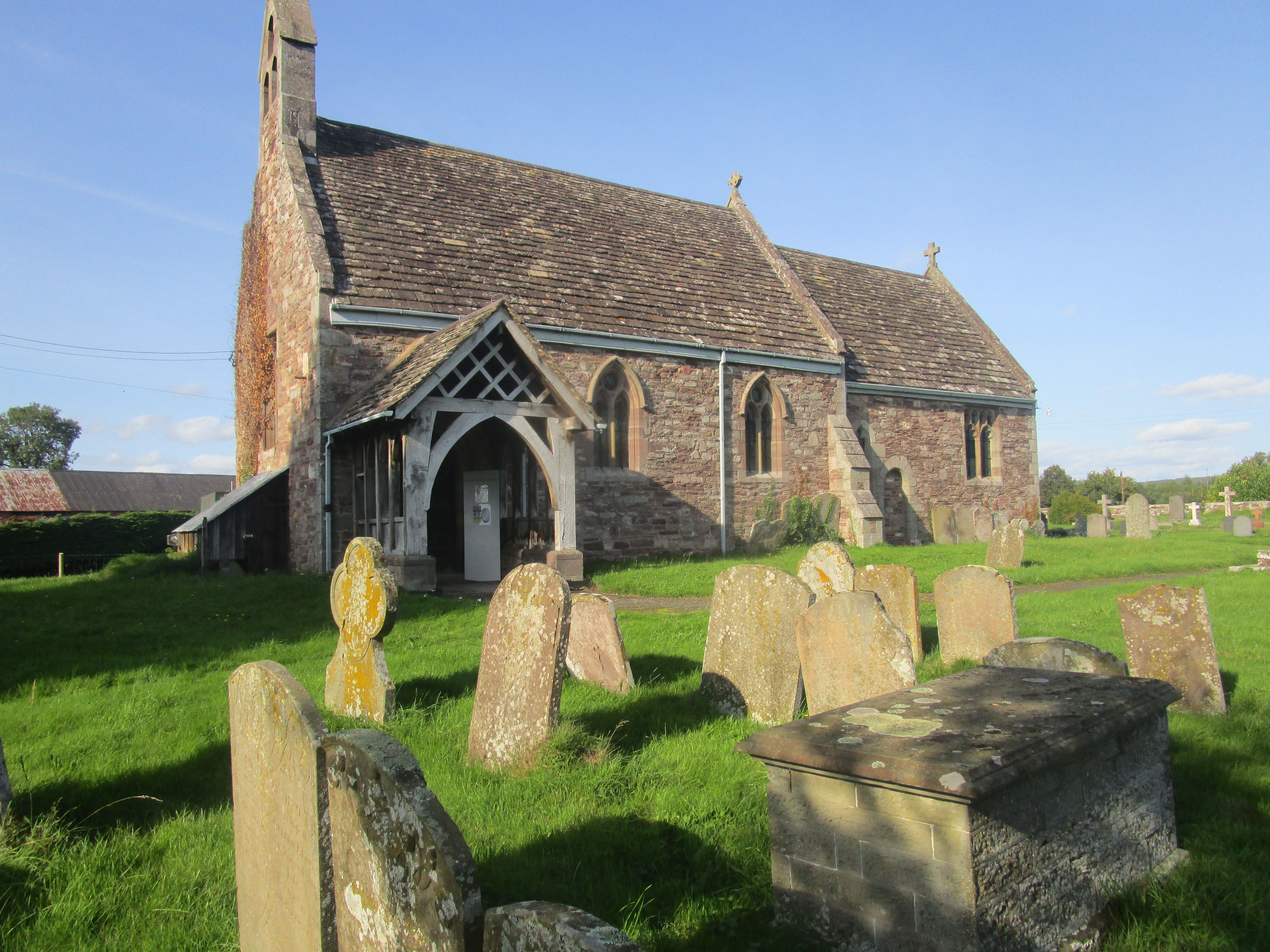
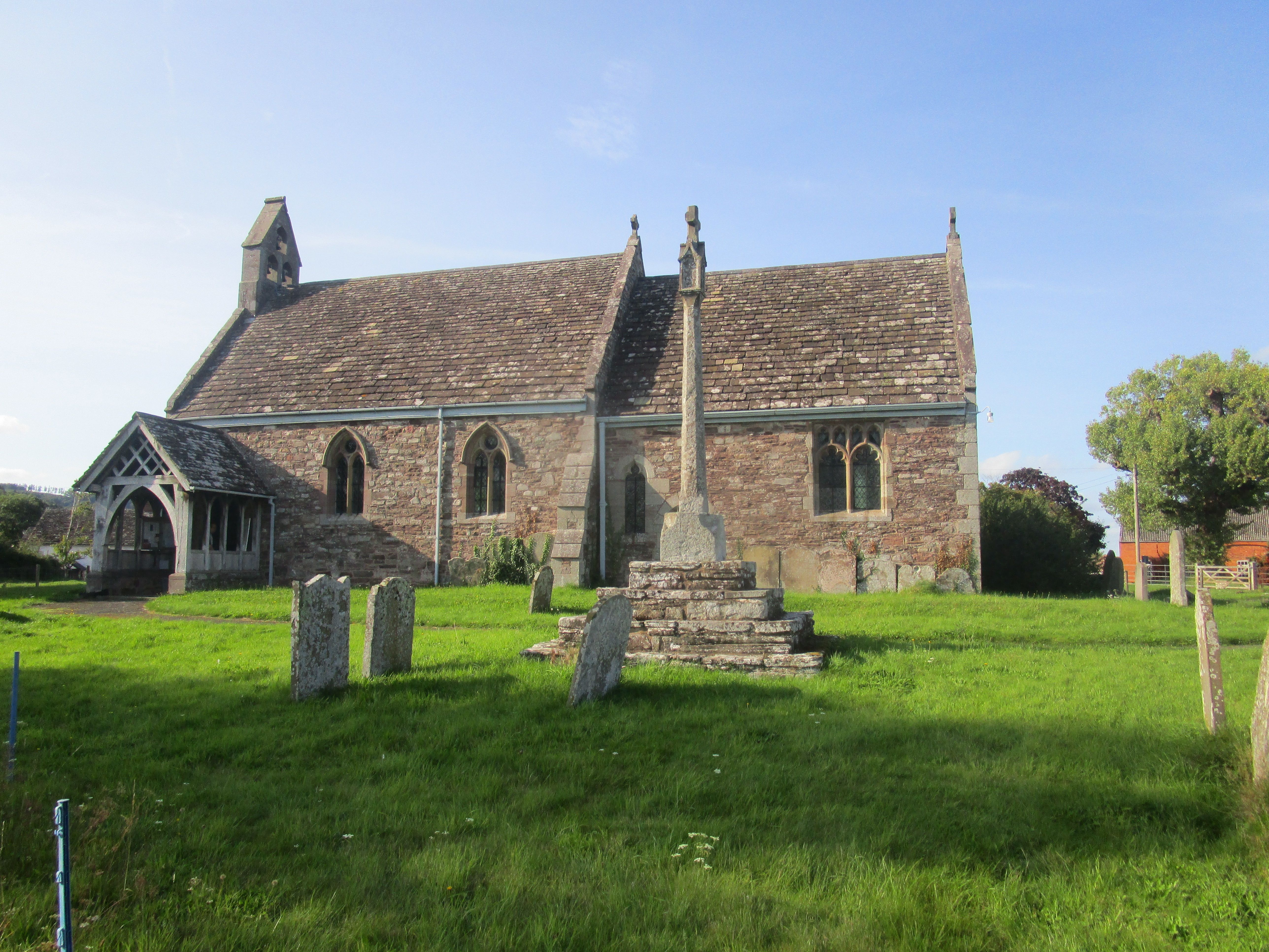
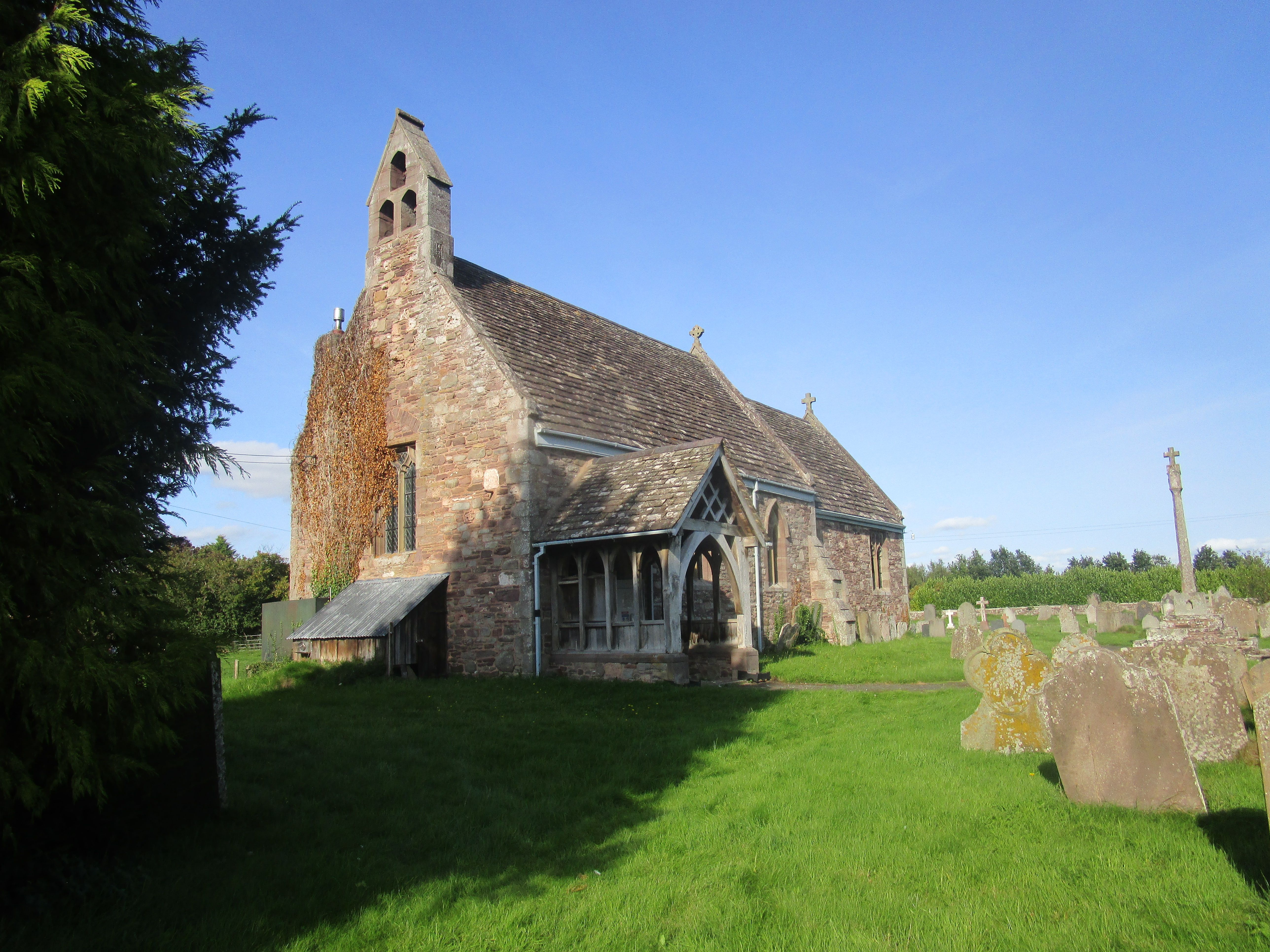
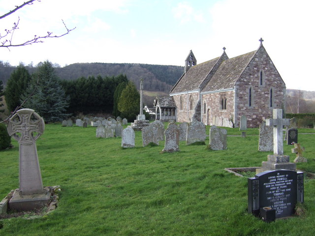
| Description | : | St. Leonards Church is located in the River Wye valley midway between Hereford and Hay-on-Wye on the B4352 road. Records show that the building of the original church began in the year 1180 and was completed by approximately 1200 A.D but owing to significant damage by fire it was rebuilt in 1877, at a cost of £1000, as nearly as possible to the same lines as the old church. The stone built church is in the transitional style and consists of a chancel, nave, south porch and a western turret containing three bells. There are stained glass windows, a fine... Read More |
frequently asked questions (FAQ):
-
Where is St. Leonard's Churchyard?
St. Leonard's Churchyard is located at Hay-on-Wye Blakemere, Herefordshire Unitary Authority ,Herefordshire ,England.
-
St. Leonard's Churchyard cemetery's updated grave count on graveviews.com?
33 memorials
-
Where are the coordinates of the St. Leonard's Churchyard?
Latitude: 52.0646460
Longitude: -2.9322980

Nearby Cemetories:
1. St Andrew Churchyard
Bredwardine, Herefordshire Unitary Authority, England
Coordinate: 52.0948000, -2.9725000
2. St. Mary's Churchyard
Credenhill, Herefordshire Unitary Authority, England
Coordinate: 52.0905490, -2.8037610
3. St. Mary Magdalene Churchyard
Eardisley, Herefordshire Unitary Authority, England
Coordinate: 52.1366310, -3.0055730
4. Credenhill Military Cemetery
Credenhill, Herefordshire Unitary Authority, England
Coordinate: 52.0869980, -2.7899910
5. St. Mary's Churchyard
Almeley, Herefordshire Unitary Authority, England
Coordinate: 52.1576900, -2.9767400
6. All Saints Church
Clehonger, Herefordshire Unitary Authority, England
Coordinate: 52.0373470, -2.7806970
7. Holy Trinity and St Mary Churchyard
Abbey Dore, Herefordshire Unitary Authority, England
Coordinate: 51.9686570, -2.8936760
8. Church of St. Mary
Cusop, Herefordshire Unitary Authority, England
Coordinate: 52.0670000, -3.1100000
9. St. Mary the Virgin
Kings Pyon, Herefordshire Unitary Authority, England
Coordinate: 52.1510000, -2.8218000
10. Belmont Abbey
Hereford, Herefordshire Unitary Authority, England
Coordinate: 52.0393000, -2.7564000
11. Ewyas Harold Priory (Defunct)
Ewyas Harold, Herefordshire Unitary Authority, England
Coordinate: 51.9539100, -2.8969800
12. St. Michael and All Angels Churchyard
Ewyas Harold, Herefordshire Unitary Authority, England
Coordinate: 51.9539100, -2.8926070
13. Hereford Cemetery and Crematorium
Hereford, Herefordshire Unitary Authority, England
Coordinate: 52.0579510, -2.7389730
14. St. Mary & David Churchyard
Kilpeck, Herefordshire Unitary Authority, England
Coordinate: 51.9692310, -2.8076150
15. Barton Hall Cemetery
Hereford, Herefordshire Unitary Authority, England
Coordinate: 52.0541484, -2.7227701
16. Church of the Grey Friars
Hereford, Herefordshire Unitary Authority, England
Coordinate: 52.0528480, -2.7209559
17. St. Nicholas' Churchyard
Hereford, Herefordshire Unitary Authority, England
Coordinate: 52.0542540, -2.7207160
18. St Martin Churchyard
Hereford, Herefordshire Unitary Authority, England
Coordinate: 52.0450100, -2.7202700
19. Hereford Cathedral
Hereford, Herefordshire Unitary Authority, England
Coordinate: 52.0541810, -2.7162690
20. St Peter with St Owen Churchyard
Hereford, Herefordshire Unitary Authority, England
Coordinate: 52.0561280, -2.7126470
21. St. Margaret Church Cemetery
Wellington, Telford and Wrekin Unitary Authority, England
Coordinate: 52.1289570, -2.7320440
22. Kington Cemetery
Kington, Herefordshire Unitary Authority, England
Coordinate: 52.1936780, -3.0209970
23. Aconbury Hill
Aconbury, Herefordshire Unitary Authority, England
Coordinate: 51.9932540, -2.7212790
24. St Mary's Churchyard
Kentchurch, Herefordshire Unitary Authority, England
Coordinate: 51.9263169, -2.8456161