
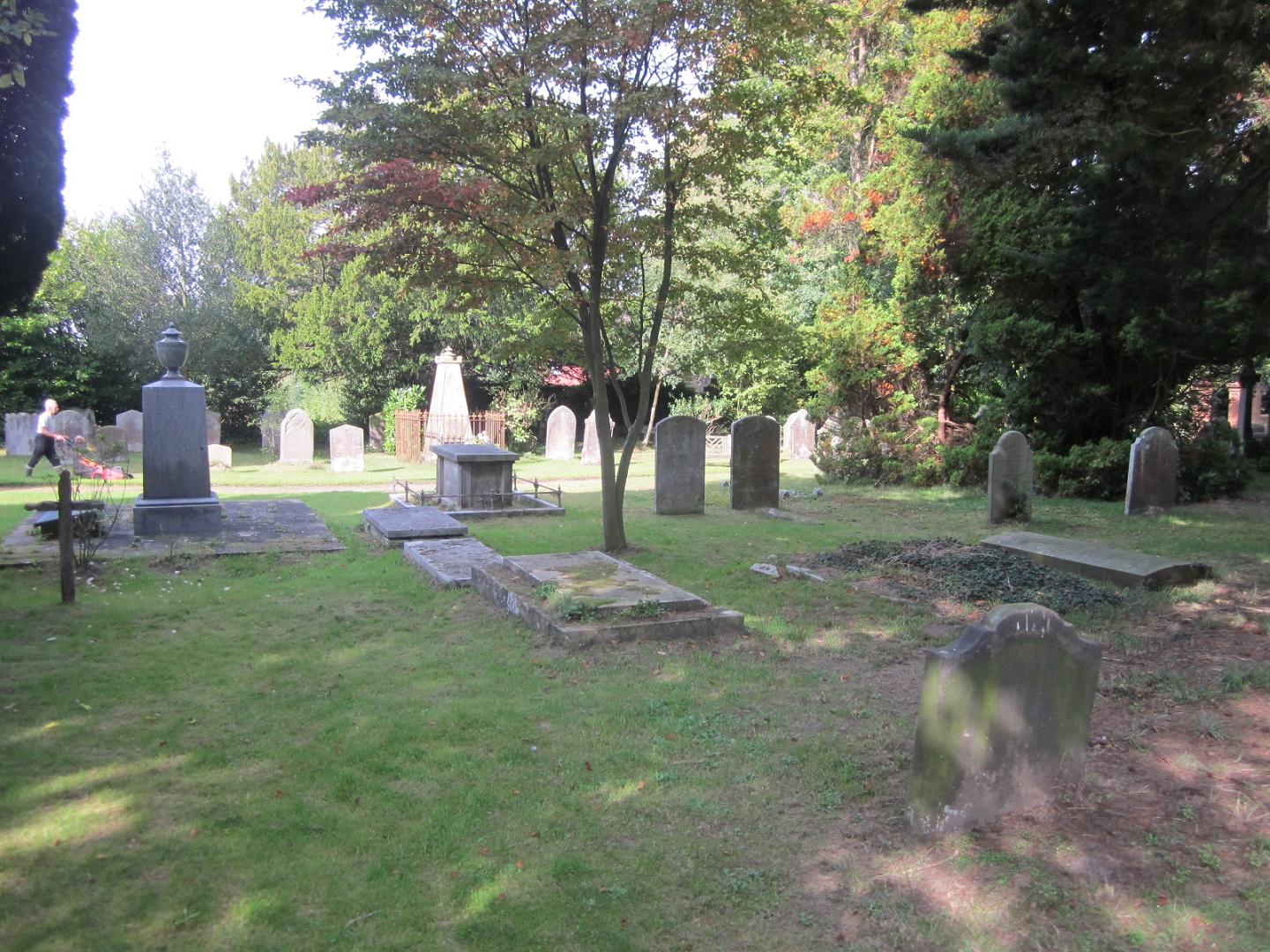
| Memorials | : | 1076 |
| Location | : | Frant, Wealden District, England |
| Coordinate | : | 51.0980580, 0.2698300 |
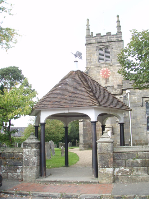
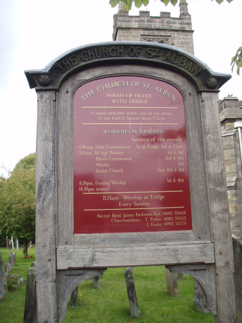
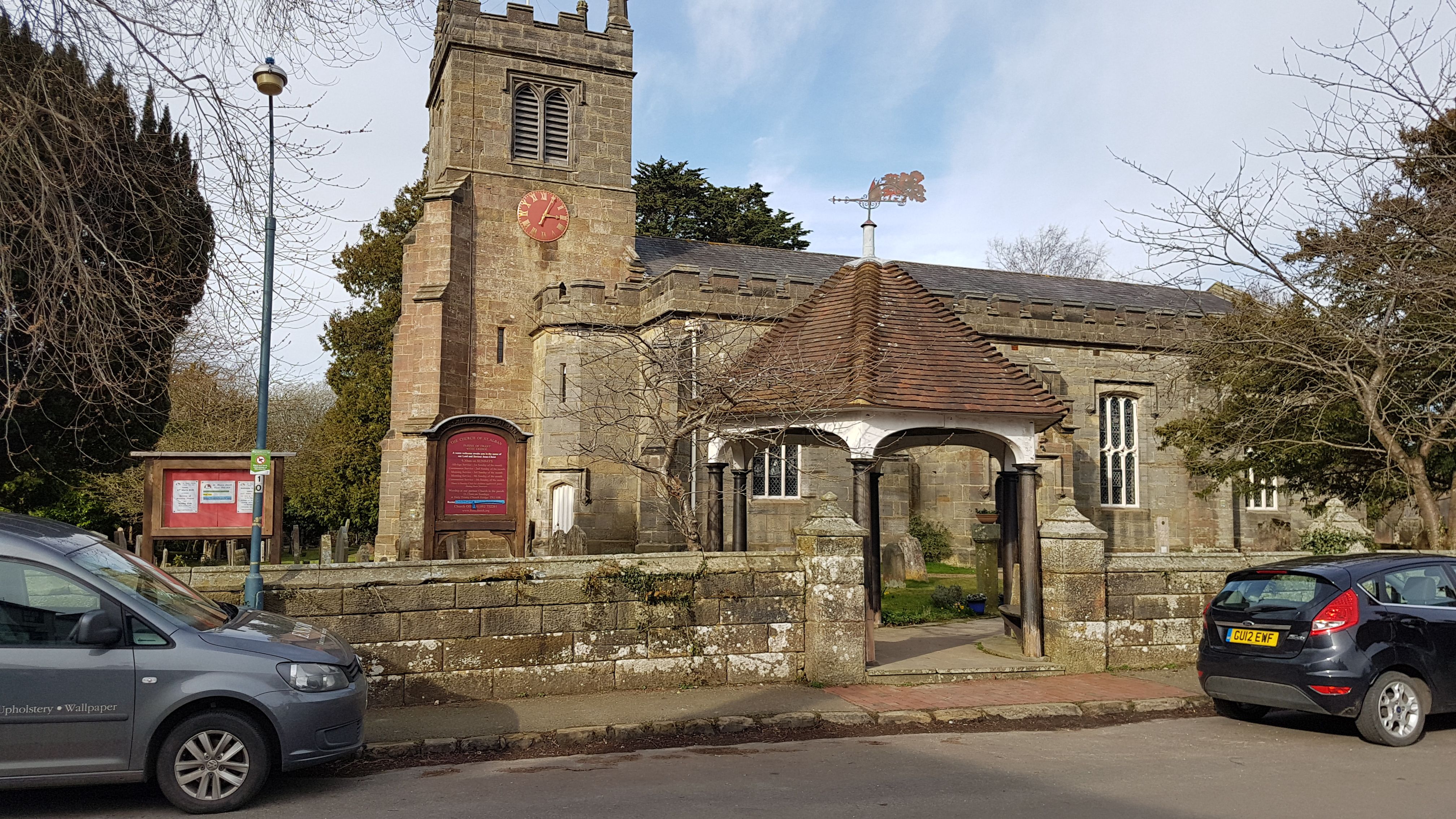
| Description | : | Frant is a village and civil parish in the Wealden District of East Sussex, England. It is located on the Kentish border, about five miles (8 km) south of Tunbridge Wells. The settlements of Bells Yew Green and Eridge are both located within the parish. When the Wealden iron industry was at its height, much of the village was owned by ironmasters. Smuggling occurred here in the 17th and 18th centuries; and one of the turnpike roads (now the A267) came through here at that time. Frant church is dedicated to St Alban Added by A Bysouth |
frequently asked questions (FAQ):
-
Where is St. Alban's Churchyard?
St. Alban's Churchyard is located at Church Lane Frant, Wealden District ,East Sussex , TN3 9DXEngland.
-
St. Alban's Churchyard cemetery's updated grave count on graveviews.com?
1076 memorials
-
Where are the coordinates of the St. Alban's Churchyard?
Latitude: 51.0980580
Longitude: 0.2698300


Nearby Cemetories:
1. Kent and Sussex Cemetery and Crematorium
Royal Tunbridge Wells, Tunbridge Wells Borough, England
Coordinate: 51.1173720, 0.2740330
2. Holy Trinity Churchyard
Eridge Green, Wealden District, England
Coordinate: 51.0989300, 0.2232190
3. Trinity Churchyard
Royal Tunbridge Wells, Tunbridge Wells Borough, England
Coordinate: 51.1328200, 0.2623600
4. Hanover Strict Baptist Chapel
Royal Tunbridge Wells, Tunbridge Wells Borough, England
Coordinate: 51.1356700, 0.2625100
5. St. Paul's Churchyard
Rusthall, Tunbridge Wells Borough, England
Coordinate: 51.1307144, 0.2376710
6. Woodbury Park Cemetery
Royal Tunbridge Wells, Tunbridge Wells Borough, England
Coordinate: 51.1389847, 0.2637900
7. St John's Church
Royal Tunbridge Wells, Tunbridge Wells Borough, England
Coordinate: 51.1402330, 0.2608070
8. St Paul New Churchyard
Rusthall, Tunbridge Wells Borough, England
Coordinate: 51.1401520, 0.2204420
9. Bayham Old Abbey
Lamberhurst, Tunbridge Wells Borough, England
Coordinate: 51.1032690, 0.3541800
10. Rotherfield Cemetery
Rotherfield, Wealden District, England
Coordinate: 51.0553690, 0.2191294
11. All Saints Churchyard
Langton Green, Tunbridge Wells Borough, England
Coordinate: 51.1309738, 0.2022060
12. Pembury Burial Ground
Pembury, Tunbridge Wells Borough, England
Coordinate: 51.1416270, 0.3229290
13. Tidebrook Churchyard
Wadhurst, Wealden District, England
Coordinate: 51.0467700, 0.3013730
14. St. Peter & St. Paul Churchyard
Wadhurst, Wealden District, England
Coordinate: 51.0626960, 0.3400690
15. St John the Evangelist Churchyard
Groombridge, Wealden District, England
Coordinate: 51.1179771, 0.1854370
16. St. Denys Churchyard
Rotherfield, Wealden District, England
Coordinate: 51.0460000, 0.2184000
17. St. Mary the Virgin Churchyard
Speldhurst, Tunbridge Wells Borough, England
Coordinate: 51.1510790, 0.2198230
18. St Peter's New Churchyard
Pembury, Tunbridge Wells Borough, England
Coordinate: 51.1506200, 0.3269600
19. Southborough Cemetery
Southborough, Tunbridge Wells Borough, England
Coordinate: 51.1592860, 0.2420140
20. St. Peter's Churchyard
Southborough, Tunbridge Wells Borough, England
Coordinate: 51.1626549, 0.2520690
21. Southborough War Memorial
Southborough, Tunbridge Wells Borough, England
Coordinate: 51.1639214, 0.2528920
22. St. Lawrence Churchyard
Bidborough, Tunbridge Wells Borough, England
Coordinate: 51.1666950, 0.2371870
23. St. Peter's Churchyard
Fordcombe, Sevenoaks District, England
Coordinate: 51.1422043, 0.1792730
24. All Souls Churchyard
Poundsbridge, Sevenoaks District, England
Coordinate: 51.1540700, 0.1961470