
| Memorials | : | 0 |
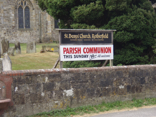
| Location | : | Rotherfield, Wealden District, England |
| Coordinate | : | 51.0460000, 0.2184000 |
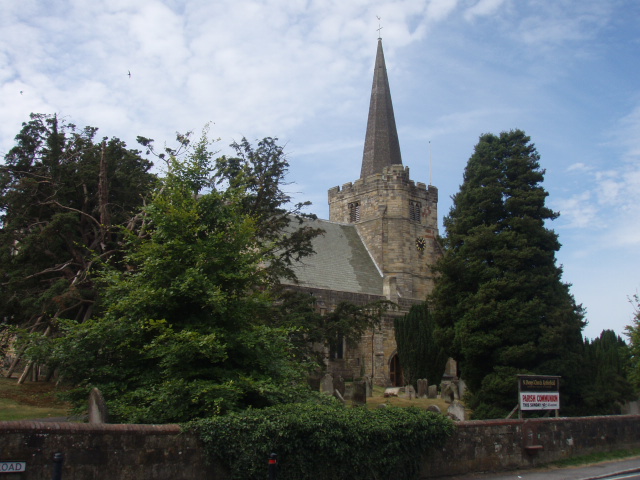
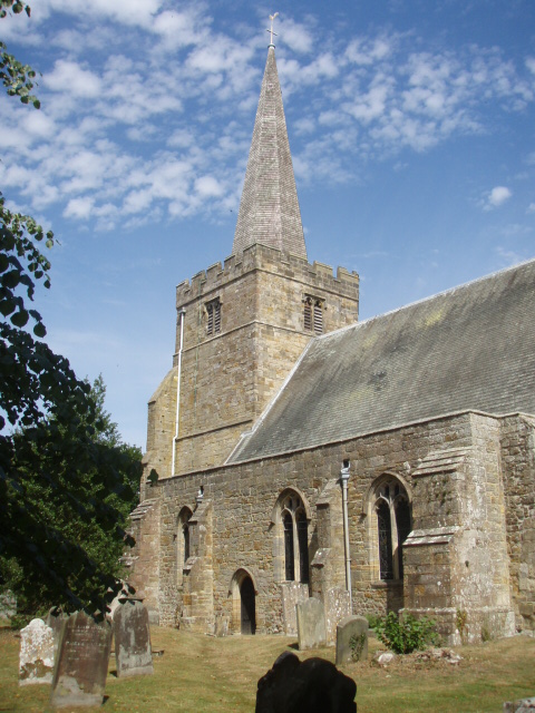
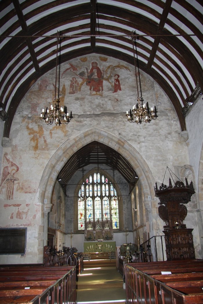
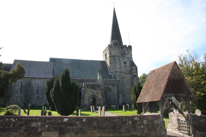
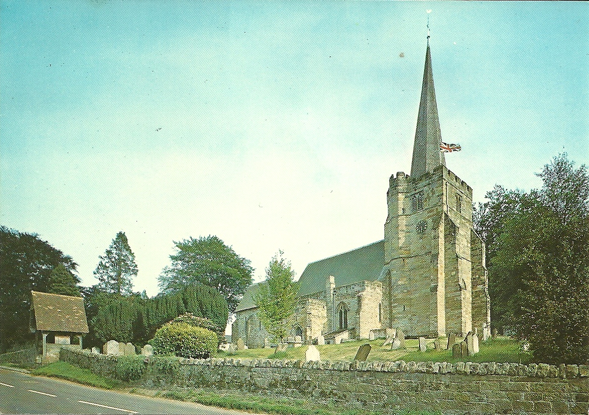
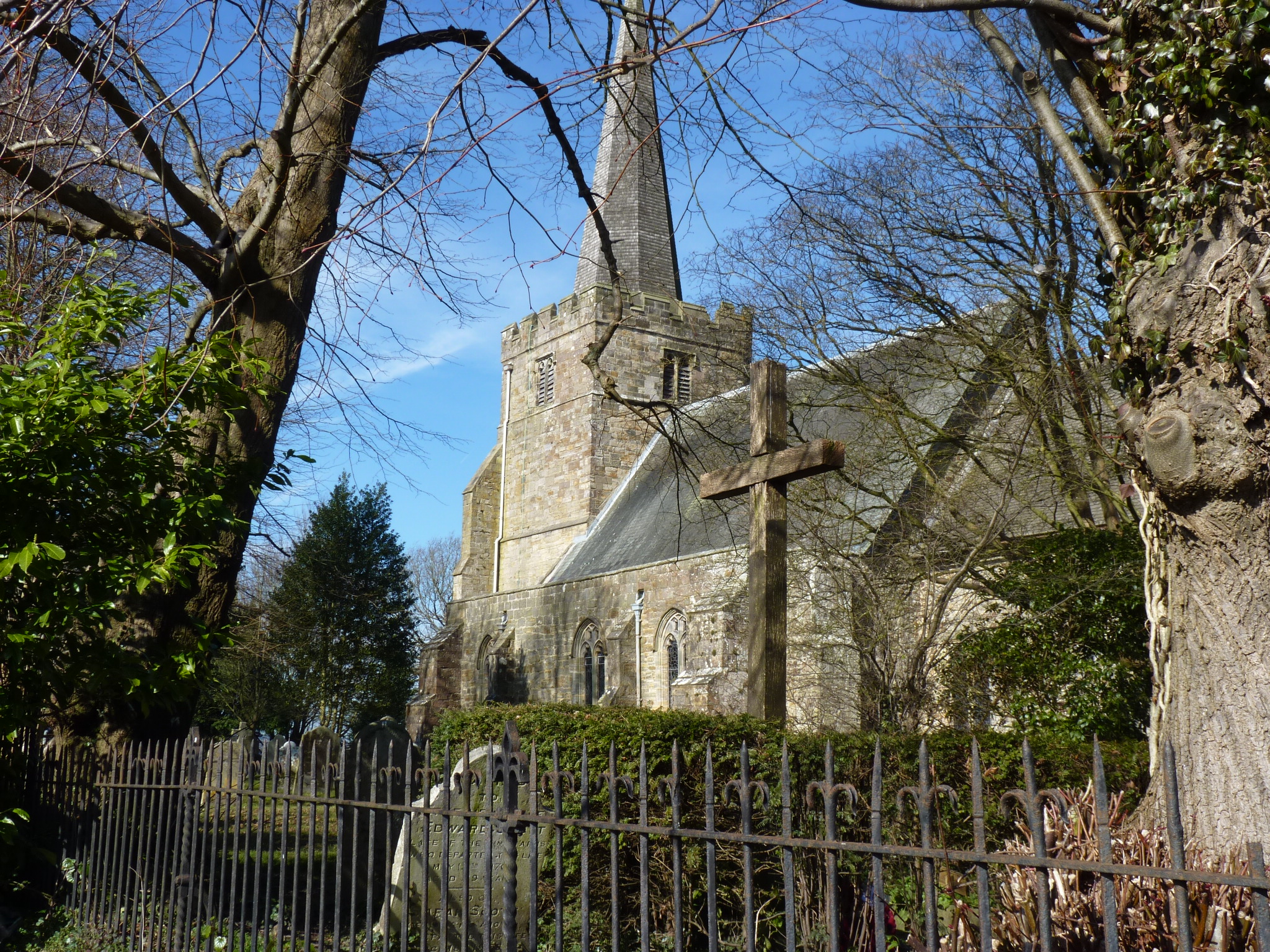
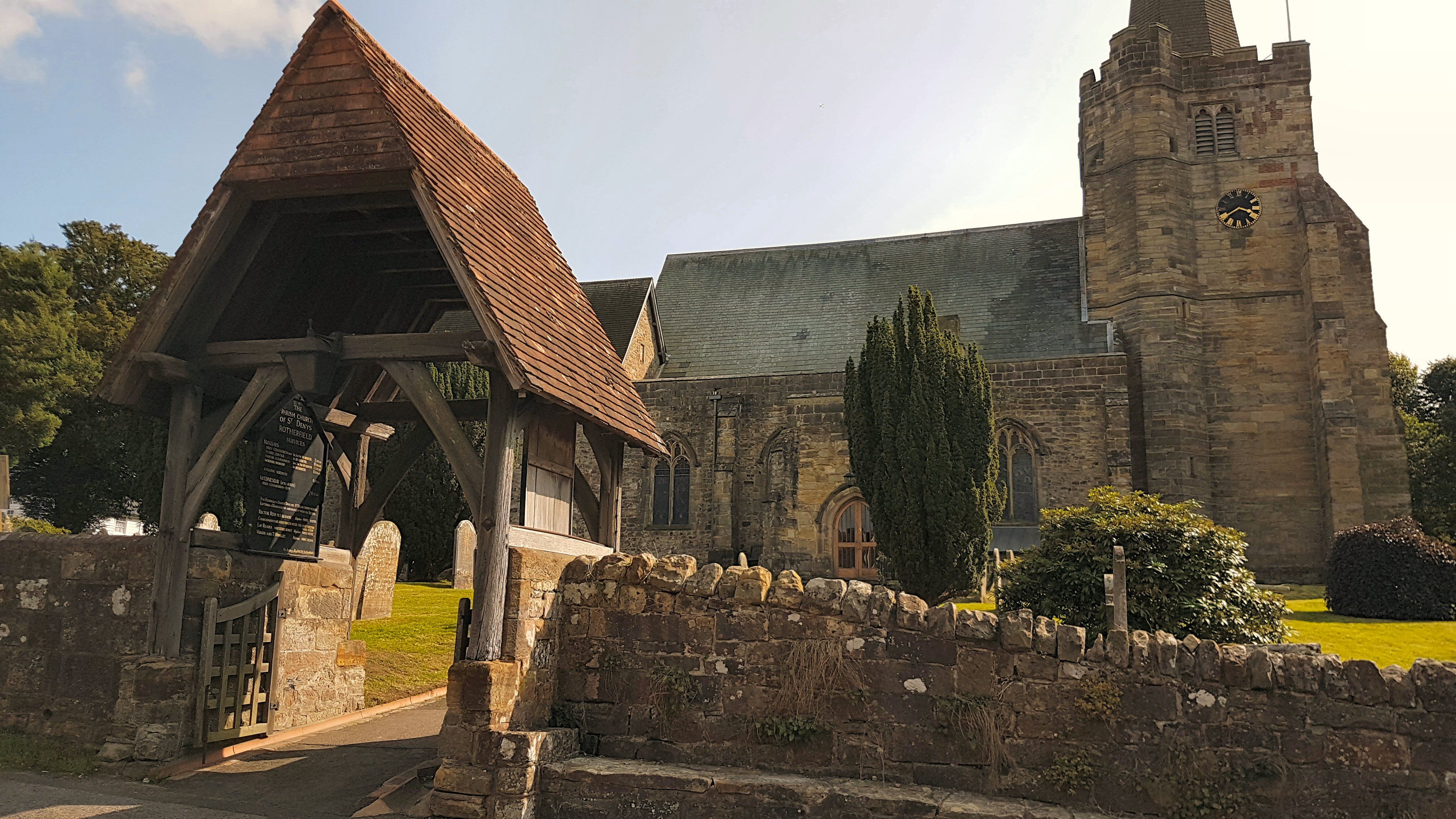
| Description | : | St Denys is a large sandstone church, dating from 1060 with subsequent additions and renovations. The 165 ft spire fell in the 1987 hurricane and was replaced, being lifted into place by helicopter. The churchyard contains an ancient yew said to predate the original 8th century wooden church. There are 369 gravestones in the churchyard with a further 619 gravestones in the extension to the S.W. From 1955 burials have occurred in the Eridge Lane cemetery. |
frequently asked questions (FAQ):
-
Where is St. Denys Churchyard?
St. Denys Churchyard is located at Church Street Rotherfield, Wealden District ,East Sussex , TN6 3LGEngland.
-
St. Denys Churchyard cemetery's updated grave count on graveviews.com?
0 memorials
-
Where are the coordinates of the St. Denys Churchyard?
Latitude: 51.0460000
Longitude: 0.2184000
Nearby Cemetories:
1. Rotherfield Cemetery
Rotherfield, Wealden District, England
Coordinate: 51.0553690, 0.2191294
2. Crowborough Cemetery
Crowborough, Wealden District, England
Coordinate: 51.0472660, 0.1648910
3. All Saints Churchyard
Crowborough, Wealden District, England
Coordinate: 51.0550461, 0.1649020
4. Convent of the Holy Child
Mayfield, Wealden District, England
Coordinate: 51.0216780, 0.2609150
5. St. Dunstan Churchyard
Mayfield, Wealden District, England
Coordinate: 51.0207710, 0.2605280
6. Mayfield School Chapel
Mayfield, Wealden District, England
Coordinate: 51.0212245, 0.2614751
7. Forest Fold Baptist Chapel
Crowborough, Wealden District, England
Coordinate: 51.0715790, 0.1531650
8. St. John the Evangelist Churchyard
Crowborough, Wealden District, England
Coordinate: 51.0656784, 0.1441483
9. Tidebrook Churchyard
Wadhurst, Wealden District, England
Coordinate: 51.0467700, 0.3013730
10. Holy Trinity Churchyard
Eridge Green, Wealden District, England
Coordinate: 51.0989300, 0.2232190
11. St Mark Churchyard
Hadlow Down, Wealden District, England
Coordinate: 50.9967460, 0.1786580
12. St. Alban's Churchyard
Frant, Wealden District, England
Coordinate: 51.0980580, 0.2698300
13. High Hurstwood Holy Trinity Churchyard
Rother District, England
Coordinate: 51.0183300, 0.1296300
14. St. John the Evangelist Churchyard
Uckfield, Wealden District, England
Coordinate: 51.0230540, 0.1114440
15. St John the Evangelist Churchyard
Groombridge, Wealden District, England
Coordinate: 51.1179771, 0.1854370
16. St Bartholomew Churchyard
Wealden District, England
Coordinate: 50.9715490, 0.2338890
17. Holy Cross Priory
Heathfield, Wealden District, England
Coordinate: 50.9715880, 0.1994160
18. St. Mary the Virgin Churchyard
Buxted, Wealden District, England
Coordinate: 50.9912990, 0.1354620
19. St. Michael and All Angels Churchyard
Withyham, Wealden District, England
Coordinate: 51.0999580, 0.1322440
20. St. Peter & St. Paul Churchyard
Wadhurst, Wealden District, England
Coordinate: 51.0626960, 0.3400690
21. Kent and Sussex Cemetery and Crematorium
Royal Tunbridge Wells, Tunbridge Wells Borough, England
Coordinate: 51.1173720, 0.2740330
22. Broad Oak Chapel
Heathfield, Wealden District, England
Coordinate: 50.9783950, 0.2860630
23. Five Ashdown Baptist Chapel
Uckfield, Wealden District, England
Coordinate: 51.0030329, 0.1082754
24. Christ Church Churchyard
Fairwarp, Wealden District, England
Coordinate: 51.0217018, 0.0888000