
| Memorials | : | 43 |
| Location | : | Headington, City of Oxford, England |
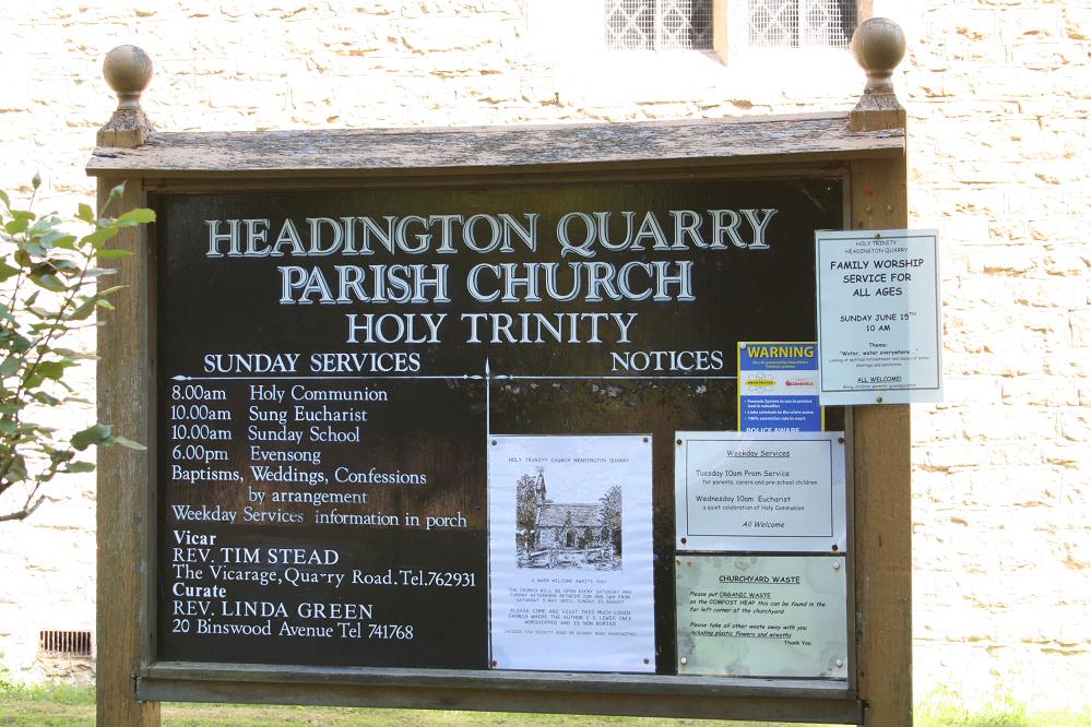
| Phone | : | 44 1865 762931 |
| Coordinate | : | 51.7577500, -1.1979980 |
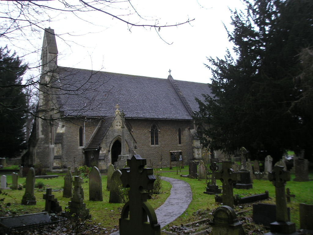
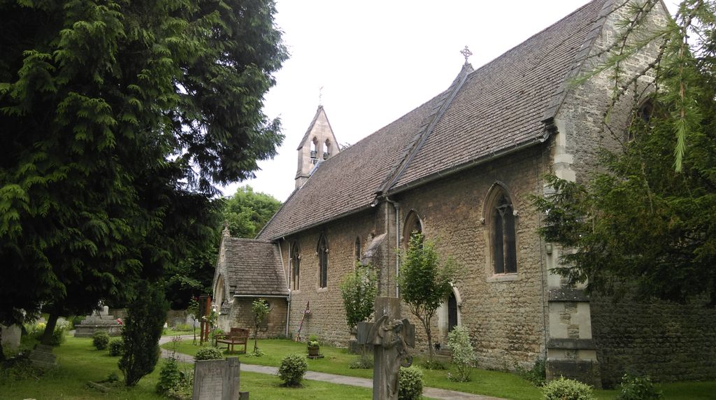
| Description | : | Holy Trinity Church, Headington Quarry, is an active Anglican parish church in the Diocese of Oxford and is located in the district of Headington Quarry, Oxford, England. Designed by George Gilbert Scott, it was built in 1848-49 to serve those working and living in the quarry. Samuel Wilberfoce, the son of William Wilberforce the then Bishop of Oxford, laid the foundation stone 19 June 1948 and upon completion, the church was concentrated by William Wilberforce. In 1930, author C. S. Lewis and his brother Warren, began attending and did so until their deaths. C. S. Lewis was buried in... Read More |
frequently asked questions (FAQ):
-
Where is Holy Trinity Churchyard?
Holy Trinity Churchyard is located at 46 Quarry Road Headington, City of Oxford ,Oxfordshire , OX 8 NUEngland.
-
Holy Trinity Churchyard cemetery's updated grave count on graveviews.com?
41 memorials
-
Where are the coordinates of the Holy Trinity Churchyard?
Latitude: 51.7577500
Longitude: -1.1979980
Nearby Cemetories:
1. Cornerstone Church Cemetery
Headington, City of Oxford, England
Coordinate: 51.7587275, -1.1995588
2. The Priory
Headington, City of Oxford, England
Coordinate: 51.7638260, -1.2108100
3. St Andrew Churchyard
Headington, City of Oxford, England
Coordinate: 51.7647100, -1.2121400
4. St. Aldate's Churchyard
Oxford, City of Oxford, England
Coordinate: 51.7497900, -1.2118500
5. Oxford Crematorium
Headington, City of Oxford, England
Coordinate: 51.7719240, -1.1904020
6. Headington Cemetery
Headington, City of Oxford, England
Coordinate: 51.7668050, -1.2179280
7. St. Giles' Churchyard
Horspath, South Oxfordshire District, England
Coordinate: 51.7397190, -1.1738770
8. St Mary and St John Church
Oxford, City of Oxford, England
Coordinate: 51.7452501, -1.2314021
9. St. Clements Churchyard
Oxford, City of Oxford, England
Coordinate: 51.7527790, -1.2369920
10. St. Nicholas' Church
Forest Hill, South Oxfordshire District, England
Coordinate: 51.7641400, -1.1567200
11. Forest Hill Church Cemetery
Forest Hill, South Oxfordshire District, England
Coordinate: 51.7641700, -1.1567100
12. St Ignatius’ Chapel
Oxford, City of Oxford, England
Coordinate: 51.7503160, -1.2396720
13. Elsfield Road Cemetery
Old Marston, City of Oxford, England
Coordinate: 51.7752940, -1.2332640
14. Greyfriars
Oxford, City of Oxford, England
Coordinate: 51.7437920, -1.2401460
15. St. James Churchyard
Cowley, City of Oxford, England
Coordinate: 51.7305878, -1.2202638
16. St. Nicholas Churchyard
Old Marston, City of Oxford, England
Coordinate: 51.7761340, -1.2373130
17. Saint John the Baptist
Stanton St John, South Oxfordshire District, England
Coordinate: 51.7800350, -1.1642830
18. St Thomas of Canterbury Churchyard
Elsfield, South Oxfordshire District, England
Coordinate: 51.7858680, -1.2178310
19. Rose Hill Cemetery
Oxford, City of Oxford, England
Coordinate: 51.7320960, -1.2254070
20. Magdalen College Chapel
Oxford, City of Oxford, England
Coordinate: 51.7519830, -1.2469820
21. Saint Cross Church
Oxford, City of Oxford, England
Coordinate: 51.7561880, -1.2479120
22. St. Cross Churchyard
Holywell, City of Oxford, England
Coordinate: 51.7558380, -1.2479690
23. St Peter-in-the-East Churchyard
Oxford, City of Oxford, England
Coordinate: 51.7536111, -1.2500000
24. Queens College Chapel
Oxford, City of Oxford, England
Coordinate: 51.7532340, -1.2506990