
| Memorials | : | 0 |
| Location | : | Coalbrookdale, Telford and Wrekin Unitary Authority, England |
| Coordinate | : | 52.6375300, -2.4894000 |
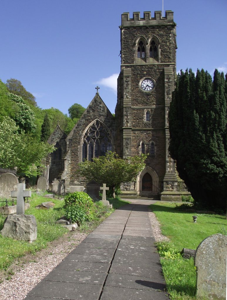
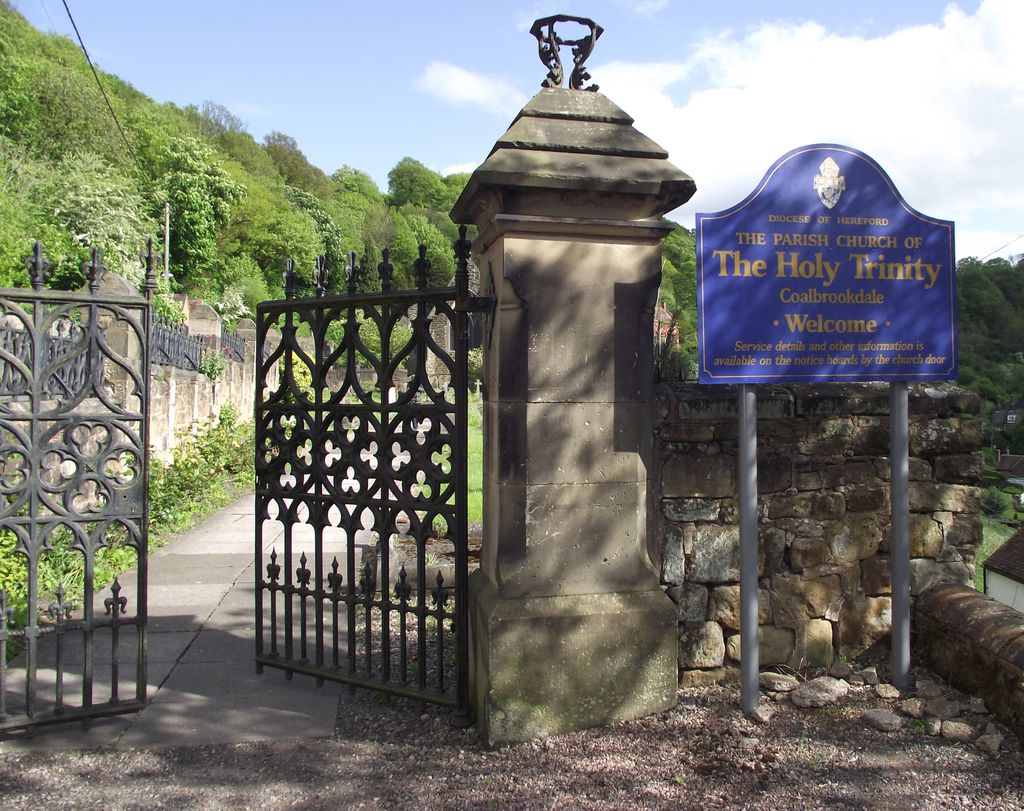
| Description | : | Located on a hillside overlooking the Severn River valley. The gates and railings are ornate cast iron, which was made locally. The western entrance is level and well kept. The churchyard on the east side of the church is fairly steep and the grass between the grave markers was high (as of May 2014). |
frequently asked questions (FAQ):
-
Where is Holy Trinity Churchyard?
Holy Trinity Churchyard is located at Church Road, Coalbrookdale, Shropshire Coalbrookdale, Telford and Wrekin Unitary Authority ,Shropshire , TF8 7NSEngland.
-
Holy Trinity Churchyard cemetery's updated grave count on graveviews.com?
0 memorials
-
Where are the coordinates of the Holy Trinity Churchyard?
Latitude: 52.6375300
Longitude: -2.4894000
Nearby Cemetories:
1. Castle Green Cemetery
Ironbridge, Telford and Wrekin Unitary Authority, England
Coordinate: 52.6346434, -2.4851070
2. Coalbrookdale Quaker Burial Ground
Coalbrookdale, Telford and Wrekin Unitary Authority, England
Coordinate: 52.6417080, -2.4952200
3. St. Luke's Churchyard
Ironbridge, Telford and Wrekin Unitary Authority, England
Coordinate: 52.6285830, -2.4851180
4. The Red Church
Broseley, Shropshire Unitary Authority, England
Coordinate: 52.6205367, -2.4753955
5. St. Luke's Churchyard
Doseley, Telford and Wrekin Unitary Authority, England
Coordinate: 52.6560410, -2.4775480
6. St. Bartholomew Churchyard
Benthall, Shropshire Unitary Authority, England
Coordinate: 52.6198230, -2.5068570
7. Holy Trinity Churchyard
Dawley, Telford and Wrekin Unitary Authority, England
Coordinate: 52.6551528, -2.4637860
8. Broseley Baptist Church
Broseley, Shropshire Unitary Authority, England
Coordinate: 52.6135650, -2.4871190
9. St. Michael's Churchyard
Madeley, Telford and Wrekin Unitary Authority, England
Coordinate: 52.6337300, -2.4503010
10. All Saints Churchyard
Broseley, Shropshire Unitary Authority, England
Coordinate: 52.6105890, -2.4757160
11. St. Lawrence's Churchyard
Little Wenlock, Telford and Wrekin Unitary Authority, England
Coordinate: 52.6582070, -2.5234340
12. Holy Trinity Churchyard
Buildwas, Shropshire Unitary Authority, England
Coordinate: 52.6393710, -2.5380180
13. St James Churchyard
Stirchley, Telford and Wrekin Unitary Authority, England
Coordinate: 52.6575707, -2.4451542
14. St. Leonard's Churchyard
Dawley, Telford and Wrekin Unitary Authority, England
Coordinate: 52.6695331, -2.4609601
15. St Johns Church
Lawley, Telford and Wrekin Unitary Authority, England
Coordinate: 52.6751550, -2.4932670
16. Dawley Baptist Chapel Cemetery
Dawley, Telford and Wrekin Unitary Authority, England
Coordinate: 52.6745400, -2.4689600
17. St. Giles Church Cemetery
Barrow, Shropshire Unitary Authority, England
Coordinate: 52.5969300, -2.5065700
18. St. Mary the Virgin Churchyard
Ketley, Telford and Wrekin Unitary Authority, England
Coordinate: 52.6914797, -2.4701998
19. Red Lake Garden of rest
Telford, Telford and Wrekin Unitary Authority, England
Coordinate: 52.6928969, -2.4715920
20. St. Peters Churchyard
Telford and Wrekin Unitary Authority, England
Coordinate: 52.6871100, -2.4404680
21. Holy Trinity Churchyard
Oakengates, Telford and Wrekin Unitary Authority, England
Coordinate: 52.6925070, -2.4562980
22. Wellington Cemetery
Wellington, Telford and Wrekin Unitary Authority, England
Coordinate: 52.6958280, -2.5246020
23. St Mary's & St Leonard's Church Burial Ground
Wombridge, Telford and Wrekin Unitary Authority, England
Coordinate: 52.7014856, -2.4585662
24. All Saints Churchyard
Wellington, Telford and Wrekin Unitary Authority, England
Coordinate: 52.7020230, -2.5177440