
| Memorials | : | 0 |
| Location | : | Barrow, Shropshire Unitary Authority, England |
| Coordinate | : | 52.5969300, -2.5065700 |
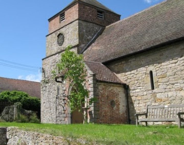
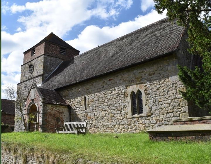
| Description | : | Barrow is a hamlet and civil parish in Shropshire, England, some 5 miles south of Telford between Ironbridge and Much Wenlock. Some parts of the church date back to the 8th Century. It is thought that the little known Welsh St Owain is buried here. St Giles' was originally built as a chapel to Wenlock Abbey The church is designated by English Heritage as a Grade I listed building. It is one of the earliest surviving churches in Shropshire, and contains the county's only Saxon chancel. In the churchyard is the Neoclassical chest tomb of John Rose, the creator of the... Read More |
frequently asked questions (FAQ):
-
Where is St. Giles Church Cemetery?
St. Giles Church Cemetery is located at Wenlock Road Barrow, Shropshire Unitary Authority ,Shropshire ,England.
-
St. Giles Church Cemetery cemetery's updated grave count on graveviews.com?
0 memorials
-
Where are the coordinates of the St. Giles Church Cemetery?
Latitude: 52.5969300
Longitude: -2.5065700
Nearby Cemetories:
1. Broseley Baptist Church
Broseley, Shropshire Unitary Authority, England
Coordinate: 52.6135650, -2.4871190
2. St. Bartholomew Churchyard
Benthall, Shropshire Unitary Authority, England
Coordinate: 52.6198230, -2.5068570
3. All Saints Churchyard
Broseley, Shropshire Unitary Authority, England
Coordinate: 52.6105890, -2.4757160
4. The Red Church
Broseley, Shropshire Unitary Authority, England
Coordinate: 52.6205367, -2.4753955
5. St. Luke's Churchyard
Ironbridge, Telford and Wrekin Unitary Authority, England
Coordinate: 52.6285830, -2.4851180
6. Castle Green Cemetery
Ironbridge, Telford and Wrekin Unitary Authority, England
Coordinate: 52.6346434, -2.4851070
7. Holy Trinity Churchyard
Coalbrookdale, Telford and Wrekin Unitary Authority, England
Coordinate: 52.6375300, -2.4894000
8. St. Mary's Churchyard
Acton Round, Shropshire Unitary Authority, England
Coordinate: 52.5573080, -2.5406470
9. Coalbrookdale Quaker Burial Ground
Coalbrookdale, Telford and Wrekin Unitary Authority, England
Coordinate: 52.6417080, -2.4952200
10. Holy Trinity Churchyard
Buildwas, Shropshire Unitary Authority, England
Coordinate: 52.6393710, -2.5380180
11. St. Michael's Churchyard
Madeley, Telford and Wrekin Unitary Authority, England
Coordinate: 52.6337300, -2.4503010
12. St. Mary's Churchyard
Harley, Shropshire Unitary Authority, England
Coordinate: 52.6094750, -2.5976600
13. St. Calixtus Churchyard
Astley Abbotts, Shropshire Unitary Authority, England
Coordinate: 52.5631160, -2.4312720
14. St. Luke's Churchyard
Doseley, Telford and Wrekin Unitary Authority, England
Coordinate: 52.6560410, -2.4775480
15. St. Lawrence's Churchyard
Little Wenlock, Telford and Wrekin Unitary Authority, England
Coordinate: 52.6582070, -2.5234340
16. Holy Trinity Churchyard
Bourton, Shropshire Unitary Authority, England
Coordinate: 52.5636887, -2.5957174
17. Holy Trinity Churchyard
Dawley, Telford and Wrekin Unitary Authority, England
Coordinate: 52.6551528, -2.4637860
18. Christ Church Churchyard
Cressage, Shropshire Unitary Authority, England
Coordinate: 52.6322770, -2.6040810
19. St James Churchyard
Stirchley, Telford and Wrekin Unitary Authority, England
Coordinate: 52.6575707, -2.4451542
20. St. Leonard's Churchyard
Dawley, Telford and Wrekin Unitary Authority, England
Coordinate: 52.6695331, -2.4609601
21. St Johns Church
Lawley, Telford and Wrekin Unitary Authority, England
Coordinate: 52.6751550, -2.4932670
22. St Leonard Churchyard
Bridgnorth, Shropshire Unitary Authority, England
Coordinate: 52.5371970, -2.4187683
23. Dawley Baptist Chapel Cemetery
Dawley, Telford and Wrekin Unitary Authority, England
Coordinate: 52.6745400, -2.4689600
24. Bridgnorth Cemetery
Bridgnorth, Shropshire Unitary Authority, England
Coordinate: 52.5387350, -2.4078250