
| Memorials | : | 3 |
| Location | : | Binegar, Mendip District, England |
| Phone | : | 44 1749 841182 |
| Website | : | www.binegar-pc.org.uk/med.html |
| Coordinate | : | 51.2425530, -2.5524812 |
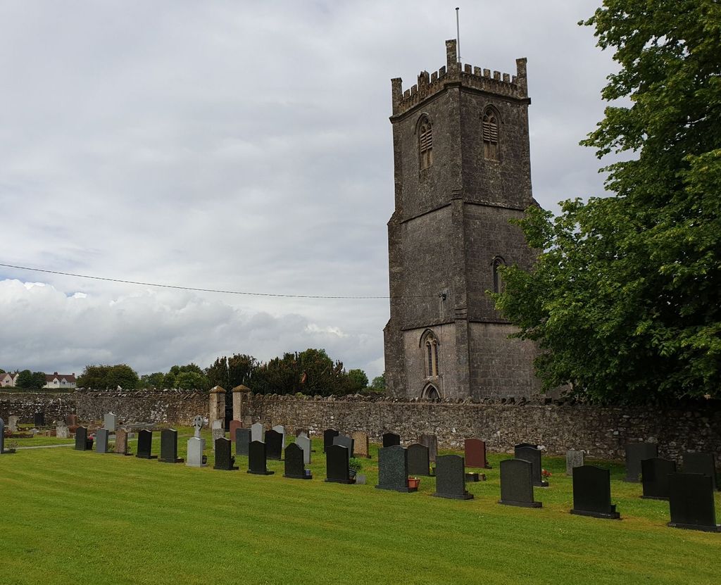
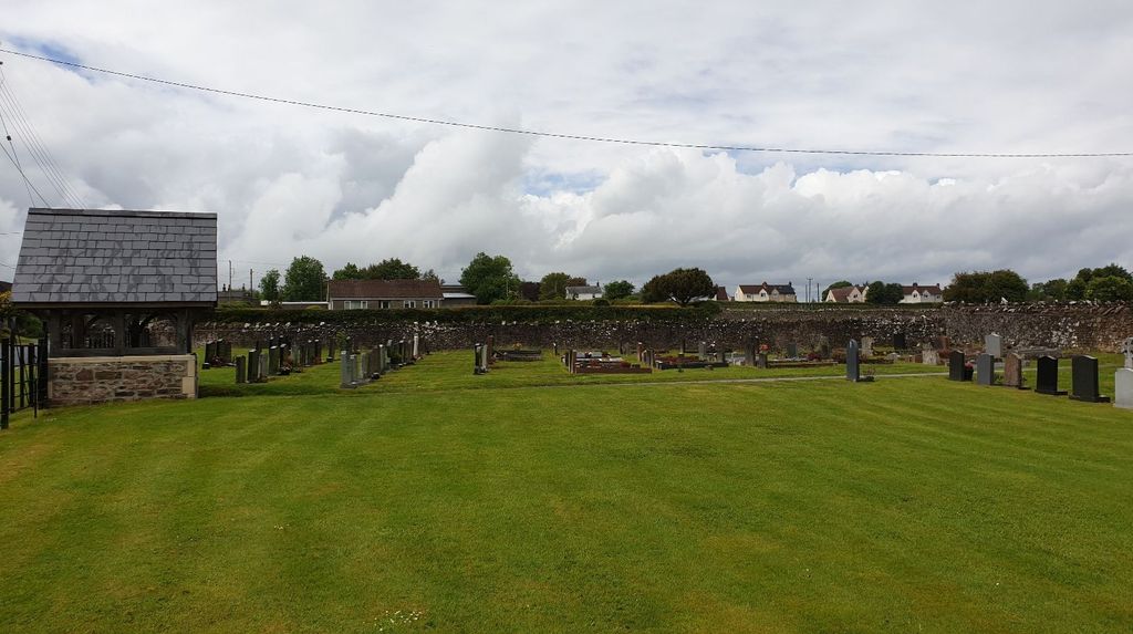
| Description | : | The original Norman church was rebuilt, apart from the tower, in the 15th Century. The Reverend William Meade (buried in the churchyard) carried out a Victorian restoration in 1858. The cemetery is in two parts: the walled graveyard around the church and the cemetery outside the churchyard’s west wall. The newer cemetery, opened in the 1950s, and was consecrated by the Church of England. The walled church graveyard closed to new burials in 1964, and with the aim of reducing future maintenance, many of the existing burial mounds were levelled, and unsafe tombstones removed or reset. The path from the... Read More |
frequently asked questions (FAQ):
-
Where is Holy Trinity Churchyard?
Holy Trinity Churchyard is located at Station Road Binegar, Mendip District ,Somerset , BA3 4UGEngland.
-
Holy Trinity Churchyard cemetery's updated grave count on graveviews.com?
3 memorials
-
Where are the coordinates of the Holy Trinity Churchyard?
Latitude: 51.2425530
Longitude: -2.5524812
Nearby Cemetories:
1. St. Mary the Virgin Churchyard
Emborough, Mendip District, England
Coordinate: 51.2600970, -2.5539150
2. St James Churchyard
Ashwick, Mendip District, England
Coordinate: 51.2320800, -2.5229500
3. Christ Church, Downside
Chilcompton, Mendip District, England
Coordinate: 51.2515150, -2.5153030
4. Christ Church Churchyard
Mendip District, England
Coordinate: 51.2514920, -2.5151540
5. Downside Cemetery
Chilcompton, Mendip District, England
Coordinate: 51.2517300, -2.5152400
6. St Mary The Virgin Churchyard
Ston Easton, Mendip District, England
Coordinate: 51.2788400, -2.5404390
7. Saint Mary the Virgin Church
Ston Easton, Mendip District, England
Coordinate: 51.2789610, -2.5407720
8. St Mary Magdalene Churchyard
Chewton Mendip, Mendip District, England
Coordinate: 51.2760790, -2.5800490
9. Downside Abbey
Stratton-on-the-Fosse, Mendip District, England
Coordinate: 51.2544000, -2.4943000
10. Saint John the Evangelist
East Horrington, Mendip District, England
Coordinate: 51.2180000, -2.6006900
11. St John the Baptist Church Cemetery
Chilcompton, Mendip District, England
Coordinate: 51.2693960, -2.5073780
12. St. Benedict's Churchyard
Stratton-on-the-Fosse, Mendip District, England
Coordinate: 51.2560684, -2.4913545
13. Saint Vigor Churchyard
Stratton-on-the-Fosse, Mendip District, England
Coordinate: 51.2552000, -2.4896000
14. Shepton Mallet Cemetery
Shepton Mallet, Mendip District, England
Coordinate: 51.1948900, -2.5483390
15. St Michael & All Angels
Stoke St Michael, Mendip District, England
Coordinate: 51.2208300, -2.4819900
16. St. Andrew's Churchyard
Holcombe, Mendip District, England
Coordinate: 51.2547850, -2.4760280
17. Saint Mary Churchyard
Croscombe, Mendip District, England
Coordinate: 51.1974000, -2.5872000
18. Saint Mary the Virgin Churchyard
Litton, Mendip District, England
Coordinate: 51.2899860, -2.5838440
19. St Peter and St Paul Church
Shepton Mallet, Mendip District, England
Coordinate: 51.1908700, -2.5454300
20. Mendip crematorium
Mendip District, England
Coordinate: 51.1911487, -2.5797562
21. Saint Michael & All Angels Churchyard
Dinder, Mendip District, England
Coordinate: 51.1994600, -2.6094800
22. Mendip Hospital Cemetery
Wells, Mendip District, England
Coordinate: 51.2106490, -2.6262980
23. St. John the Baptist Churchyard
Farrington Gurney, Bath and North East Somerset Unitary Authority, England
Coordinate: 51.2993710, -2.5248000
24. St Thomas Churchyard
Wells, Mendip District, England
Coordinate: 51.2132380, -2.6370870