
| Memorials | : | 7 |
| Location | : | Stratton-on-the-Fosse, Mendip District, England |
| Coordinate | : | 51.2544000, -2.4943000 |
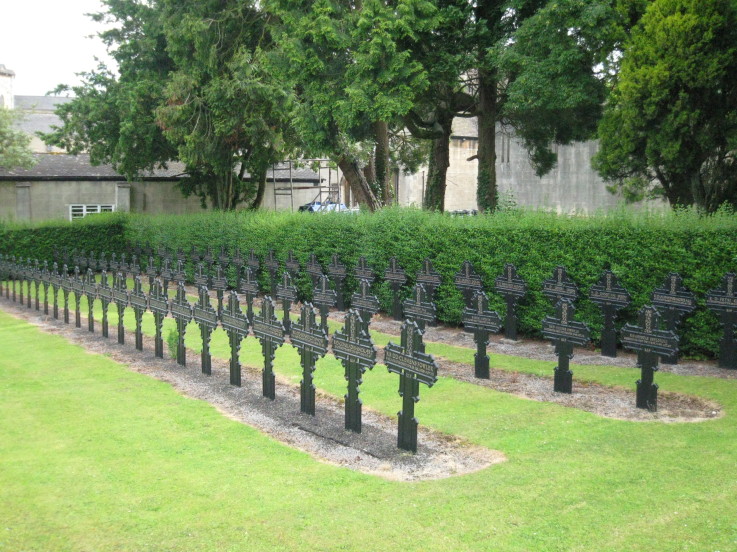
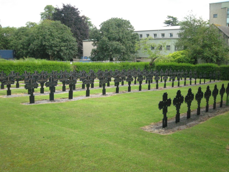
| Description | : | The Basilica of St Gregory the Great at Downside, commonly known as Downside Abbey, is a Catholic Benedictine monastery and the Senior House of the English Benedictine Congregation. One of its main apostolates is a school for children aged nine to eighteen. Its graduates are known as Old Gregorians. Both monastery and school are located at between Westfield and Shepton Mallet in Somerset, south west England. The community was founded at Douai, Flanders, then in the Spanish Netherlands, in 1605, under the patronage of St. Gregory the Great (who had sent St Augustine to England in 597). The founder was Saint John... Read More |
frequently asked questions (FAQ):
-
Where is Downside Abbey?
Downside Abbey is located at Stratton-on-the-Fosse, Mendip District ,Somerset ,England.
-
Downside Abbey cemetery's updated grave count on graveviews.com?
7 memorials
-
Where are the coordinates of the Downside Abbey?
Latitude: 51.2544000
Longitude: -2.4943000
Nearby Cemetories:
1. St. Benedict's Churchyard
Stratton-on-the-Fosse, Mendip District, England
Coordinate: 51.2560684, -2.4913545
2. Saint Vigor Churchyard
Stratton-on-the-Fosse, Mendip District, England
Coordinate: 51.2552000, -2.4896000
3. St. Andrew's Churchyard
Holcombe, Mendip District, England
Coordinate: 51.2547850, -2.4760280
4. Christ Church Churchyard
Mendip District, England
Coordinate: 51.2514920, -2.5151540
5. Downside Cemetery
Chilcompton, Mendip District, England
Coordinate: 51.2517300, -2.5152400
6. Christ Church, Downside
Chilcompton, Mendip District, England
Coordinate: 51.2515150, -2.5153030
7. St John the Baptist Church Cemetery
Chilcompton, Mendip District, England
Coordinate: 51.2693960, -2.5073780
8. St James Churchyard
Ashwick, Mendip District, England
Coordinate: 51.2320800, -2.5229500
9. Holy Trinity Churchyard
Coleford, Mendip District, England
Coordinate: 51.2394100, -2.4503100
10. St. John the Baptist Churchyard
Midsomer Norton, Bath and North East Somerset Unitary Authority, England
Coordinate: 51.2870310, -2.4842190
11. St Michael & All Angels
Stoke St Michael, Mendip District, England
Coordinate: 51.2208300, -2.4819900
12. St. Mary the Virgin Churchyard
Emborough, Mendip District, England
Coordinate: 51.2600970, -2.5539150
13. St Mary The Virgin Churchyard
Ston Easton, Mendip District, England
Coordinate: 51.2788400, -2.5404390
14. Saint Mary the Virgin Church
Ston Easton, Mendip District, England
Coordinate: 51.2789610, -2.5407720
15. Holy Trinity Churchyard
Binegar, Mendip District, England
Coordinate: 51.2425530, -2.5524812
16. St Peter and St Paul Churchyard
Kilmersdon, Mendip District, England
Coordinate: 51.2701480, -2.4372860
17. St. Margaret's Churchyard
Frome, Mendip District, England
Coordinate: 51.2576670, -2.4242260
18. Saint Giles Churchyard
Leigh-on-Mendip, Mendip District, England
Coordinate: 51.2239000, -2.4416000
19. St Edmund's Church Vobster
Mells, Mendip District, England
Coordinate: 51.2418000, -2.4244930
20. St. Nicholas' Churchyard
Radstock, Bath and North East Somerset Unitary Authority, England
Coordinate: 51.2900740, -2.4488510
21. St. John the Baptist Churchyard
Farrington Gurney, Bath and North East Somerset Unitary Authority, England
Coordinate: 51.2993710, -2.5248000
22. Holy Trinity Churchyard
Clandown, Bath and North East Somerset Unitary Authority, England
Coordinate: 51.3024050, -2.4611700
23. Church of the Holy Trinity
Paulton, Bath and North East Somerset Unitary Authority, England
Coordinate: 51.3074740, -2.5033500
24. Paulton Cemetery
Paulton, Bath and North East Somerset Unitary Authority, England
Coordinate: 51.3095671, -2.4988841