
| Memorials | : | 2 |
| Location | : | Wells, Mendip District, England |
| Website | : | www.mendiphospitalcemetery.org.uk/ |
| Coordinate | : | 51.2106490, -2.6262980 |
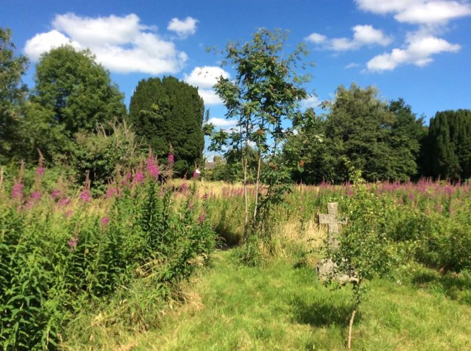
| Description | : | This cemetery was the burial ground for the Somerset and Bath Pauper Lunatic Asylum, later known as the Wells Mental Hospital, and later still, the Mendip Hospital. Here nearly 3000 former patients and staff were laid to rest between 1874 and 1963. The cemetery is now both a nature reserve and a living memorial to the poor souls buried here. Much of the ground is now meadow, the grasses being mown just once a year in the autumn, encouraging insects, birds, and wild flowers to thrive. The pond is also full of life, from frogs in the spring to dragonflies... Read More |
frequently asked questions (FAQ):
-
Where is Mendip Hospital Cemetery?
Mendip Hospital Cemetery is located at Wells, Mendip District ,Somerset ,England.
-
Mendip Hospital Cemetery cemetery's updated grave count on graveviews.com?
2 memorials
-
Where are the coordinates of the Mendip Hospital Cemetery?
Latitude: 51.2106490
Longitude: -2.6262980
Nearby Cemetories:
1. St Thomas Churchyard
Wells, Mendip District, England
Coordinate: 51.2132380, -2.6370870
2. Wells Cathedral
Wells, Mendip District, England
Coordinate: 51.2103610, -2.6433940
3. St. Cuthbert Churchyard
Wells, Mendip District, England
Coordinate: 51.2080930, -2.6502690
4. Saint Michael & All Angels Churchyard
Dinder, Mendip District, England
Coordinate: 51.1994600, -2.6094800
5. Saint John the Evangelist
East Horrington, Mendip District, England
Coordinate: 51.2180000, -2.6006900
6. Wells Cemetery
Wells, Mendip District, England
Coordinate: 51.2088240, -2.6640120
7. Saint Mary Churchyard
Croscombe, Mendip District, England
Coordinate: 51.1974000, -2.5872000
8. Coxley Methodist Churchyard
Coxley, Mendip District, England
Coordinate: 51.1918900, -2.6723700
9. Mendip crematorium
Mendip District, England
Coordinate: 51.1911487, -2.5797562
10. St Peter Churchyard
North Wootton, Mendip District, England
Coordinate: 51.1738520, -2.6252470
11. St. Matthew Churchyard
Wookey, Mendip District, England
Coordinate: 51.2093000, -2.6893000
12. Christ Church
Coxley, Mendip District, England
Coordinate: 51.1869530, -2.6797580
13. St. John The Baptist Churchyard
Pilton, Mendip District, England
Coordinate: 51.1650000, -2.5898000
14. Shepton Mallet Cemetery
Shepton Mallet, Mendip District, England
Coordinate: 51.1948900, -2.5483390
15. St Peter and St Paul Church
Shepton Mallet, Mendip District, England
Coordinate: 51.1908700, -2.5454300
16. Holy Trinity Churchyard
Binegar, Mendip District, England
Coordinate: 51.2425530, -2.5524812
17. St. Lawrence's Churchyard
Priddy, Mendip District, England
Coordinate: 51.2596770, -2.6777600
18. Christ Church Churchyard
Henton, Mendip District, England
Coordinate: 51.2056460, -2.7256380
19. St Lawrence Churchyard
Westbury, Mendip District, England
Coordinate: 51.2354140, -2.7182630
20. St. Mary the Virgin Churchyard
Emborough, Mendip District, England
Coordinate: 51.2600970, -2.5539150
21. St James Churchyard
Ashwick, Mendip District, England
Coordinate: 51.2320800, -2.5229500
22. St Nicholas Churchyard
West Pennard, Mendip District, England
Coordinate: 51.1415596, -2.6413050
23. St Mary Magdalene Churchyard
Chewton Mendip, Mendip District, England
Coordinate: 51.2760790, -2.5800490
24. Holy Trinity Church
Godney, Mendip District, England
Coordinate: 51.1793400, -2.7377400