
| Memorials | : | 122 |
| Location | : | Florence, Boone County, USA |
| Coordinate | : | 39.0005302, -84.6577225 |
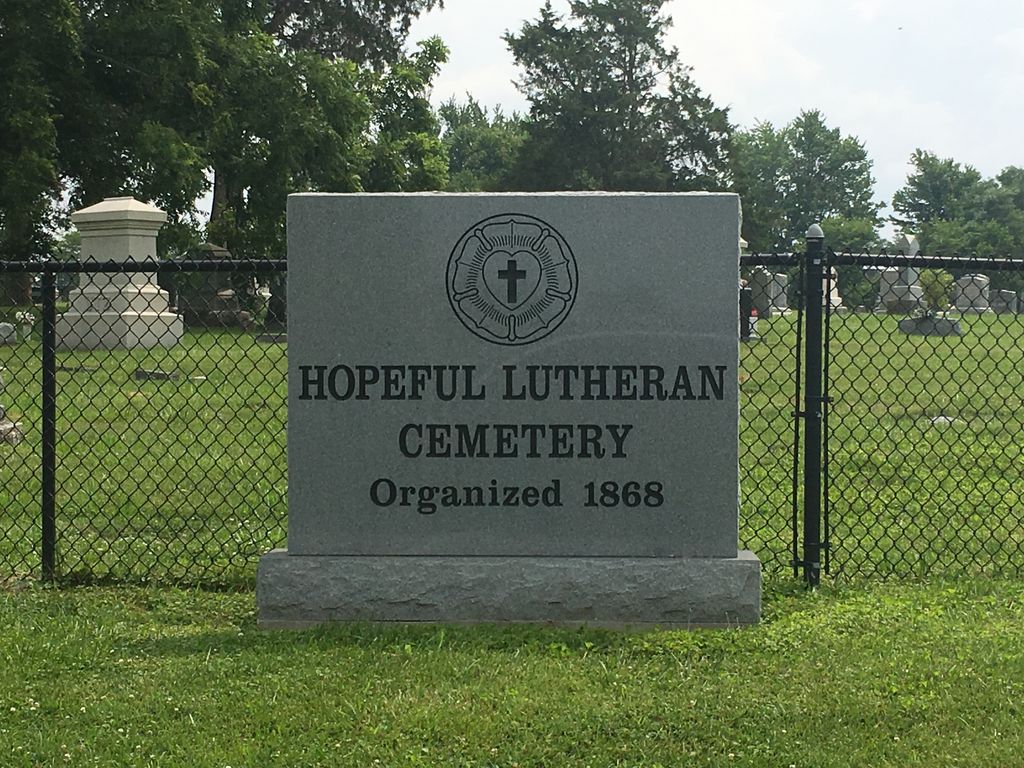
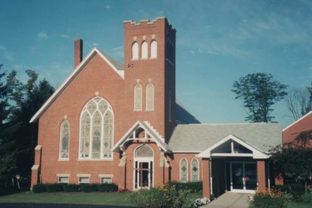
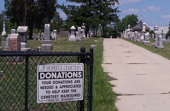
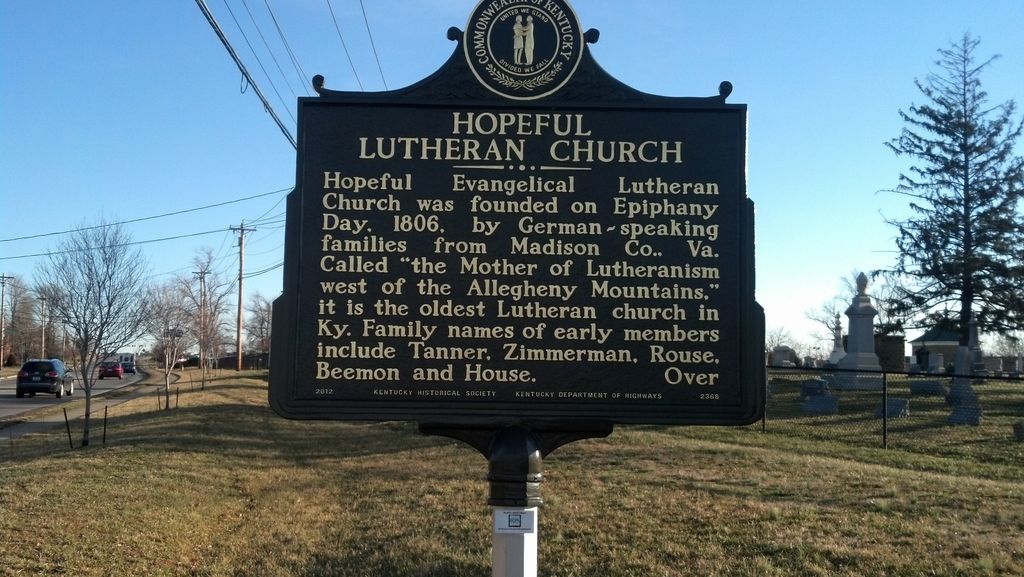
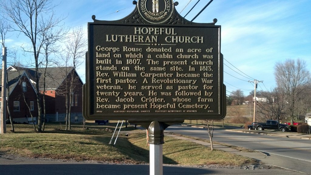
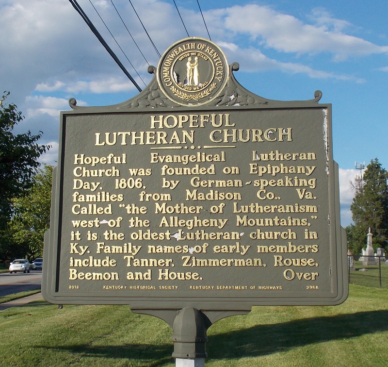
| Description | : | The cemetery is located next to the Hopeful Lutheran Church on the south side of Hopeful Church Road about 0.2 miles northeast of its intersection with Cayton Road. The U.S. Geological Survey (USGS) Geographic Names Information System (GNIS) feature ID for the cemetery is 2090237 (Hopeful Cemetery). The Boone County GIS unique ID assigned to this cemetery is 88 (Hopeful Lutheran Cemetery). The cemetery has an index number of 89 (Hopeful Lutheran) on the Boone County Kentucky Cemetery Map published in 2005 by the Boone County Planning Commission in conjunction with Johnson-Wilson Cemetery Stewards Association. The cemetery is identified as Hopeful Lutheran Church in... Read More |
frequently asked questions (FAQ):
-
Where is Hopeful Lutheran Church Cemetery?
Hopeful Lutheran Church Cemetery is located at Hopeful Church Road (Kentucky State Highway 842) Florence, Boone County ,Kentucky , 41042USA.
-
Hopeful Lutheran Church Cemetery cemetery's updated grave count on graveviews.com?
109 memorials
-
Where are the coordinates of the Hopeful Lutheran Church Cemetery?
Latitude: 39.0005302
Longitude: -84.6577225
Nearby Cemetories:
1. Joshua Zimmerman Cemetery
Florence, Boone County, USA
Coordinate: 39.0074220, -84.6462590
2. Vaughan-Marquis Cemetery
Florence, Boone County, USA
Coordinate: 39.0120470, -84.6527480
3. Milton Beemon Cemetery
Florence, Boone County, USA
Coordinate: 39.0111110, -84.6700000
4. Clore-Connor Cemetery
Oakbrook, Boone County, USA
Coordinate: 38.9979750, -84.6758810
5. Daniel Beemon Cemetery
Florence, Boone County, USA
Coordinate: 39.0141670, -84.6641670
6. Snyder-Blankenbecker Cemetery
Florence, Boone County, USA
Coordinate: 38.9855560, -84.6458330
7. Zimmerman Cemetery (Defunct)
Florence, Boone County, USA
Coordinate: 38.9825000, -84.6616670
8. Barlow–Airport Cemetery (Defunct)
Florence, Boone County, USA
Coordinate: 39.0200560, -84.6594120
9. Holsclaw Cemetery
Florence, Boone County, USA
Coordinate: 38.9802430, -84.6541820
10. Florence Cemetery
Florence, Boone County, USA
Coordinate: 39.0001000, -84.6309800
11. Ephriam Tanner Cemetery
Florence, Boone County, USA
Coordinate: 38.9880810, -84.6350260
12. Clutterbuck Cemetery
Florence, Boone County, USA
Coordinate: 39.0041670, -84.6297230
13. Barlow Family Cemetery
Florence, Boone County, USA
Coordinate: 38.9881990, -84.6827190
14. Carpenter Family Cemetery
Florence, Boone County, USA
Coordinate: 38.9914700, -84.6298610
15. Aylor Cemetery (Defunct)
Florence, Boone County, USA
Coordinate: 39.0169973, -84.6793854
16. Ashbrook-Cheek Cemetery (Defunct)
Florence, Boone County, USA
Coordinate: 39.0116670, -84.6308350
17. William Aylor Cemetery (Defunct)
Florence, Boone County, USA
Coordinate: 39.0203480, -84.6778680
18. Abraham Rouse Cemetery
Florence, Boone County, USA
Coordinate: 38.9758330, -84.6672220
19. Margaret Aylor Cemetery
Florence, Boone County, USA
Coordinate: 38.9765250, -84.6447020
20. Tanner-Utz Cemetery (Defunct)
Florence, Boone County, USA
Coordinate: 38.9736110, -84.6655560
21. Hoffman-Grubbs Cemetery
Florence, Boone County, USA
Coordinate: 38.9841670, -84.6283330
22. Wilhoit Cemetery
Florence, Boone County, USA
Coordinate: 38.9974070, -84.6187990
23. Delph Cemetery
Florence, Boone County, USA
Coordinate: 38.9844440, -84.6911110
24. Popham Cemetery #02 (Defunct)
Limaburg, Boone County, USA
Coordinate: 39.0309770, -84.6647720