
| Memorials | : | 0 |
| Location | : | Harleysville, Montgomery County, USA |
| Coordinate | : | 40.2940102, -75.4046478 |
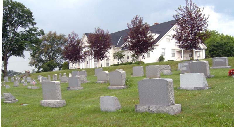
| Description | : | This cemetery is operated by the Indian Creek Church of the Brethren, which also operates the Harley Family Cemetery (also known as Klein Meetinghouse Cemetery) about three miles away. |
frequently asked questions (FAQ):
-
Where is Indian Creek Church of Brethren Cemetery?
Indian Creek Church of Brethren Cemetery is located at Harleysville, Montgomery County ,Pennsylvania ,USA.
-
Indian Creek Church of Brethren Cemetery cemetery's updated grave count on graveviews.com?
0 memorials
-
Where are the coordinates of the Indian Creek Church of Brethren Cemetery?
Latitude: 40.2940102
Longitude: -75.4046478
Nearby Cemetories:
1. Price Cemetery
Harleysville, Montgomery County, USA
Coordinate: 40.2896996, -75.4075012
2. Lower Salford Mennonite Cemetery
Harleysville, Montgomery County, USA
Coordinate: 40.2762489, -75.4020920
3. Delps Cemetery
Harleysville, Montgomery County, USA
Coordinate: 40.2971992, -75.3806000
4. Haman Cemetery
Schwenksville, Montgomery County, USA
Coordinate: 40.2789116, -75.4203186
5. Harley Family Cemetery
Harleysville, Montgomery County, USA
Coordinate: 40.2919006, -75.3750000
6. Living Faith Fellowship Cemetery
Franconia, Montgomery County, USA
Coordinate: 40.2964516, -75.3674164
7. Indian Creek Mennonite Cemetery
Franconia, Montgomery County, USA
Coordinate: 40.3032532, -75.3679428
8. Church of the Holy Spirit Memorial Garden
Harleysville, Montgomery County, USA
Coordinate: 40.3134910, -75.4363990
9. Franconia Mennonite Church Cemetery
Telford, Montgomery County, USA
Coordinate: 40.3054199, -75.3656693
10. Old Goshenhoppen Cemetery
Woxall, Montgomery County, USA
Coordinate: 40.3039703, -75.4483871
11. Lederach Burial Ground
Lower Salford Township, Montgomery County, USA
Coordinate: 40.2583930, -75.4008600
12. Tabor United Methodist Church Cemetery
Woxall, Montgomery County, USA
Coordinate: 40.3113785, -75.4587784
13. Little Zion Lutheran Church Cemetery
Earlington, Montgomery County, USA
Coordinate: 40.3256000, -75.3621000
14. Zion Memorial Gardens
Telford, Montgomery County, USA
Coordinate: 40.3193321, -75.3503876
15. Hollowbush Burial Ground
Zieglerville, Montgomery County, USA
Coordinate: 40.2894783, -75.4690323
16. Salford Schwenkfelder Cemetery
Harleysville, Montgomery County, USA
Coordinate: 40.2698326, -75.3479843
17. Fuhrman's Graveyard
Telford, Montgomery County, USA
Coordinate: 40.3201170, -75.3487760
18. Reiff's Church Cemetery
Skippack, Montgomery County, USA
Coordinate: 40.2499410, -75.3728810
19. Friedens Union Church Cemetery
Sumneytown, Montgomery County, USA
Coordinate: 40.3280602, -75.4566574
20. Christ Reformed Church of Indian Creek Cemetery
Telford, Montgomery County, USA
Coordinate: 40.3227615, -75.3459320
21. Kempfer-Markley Cemetery
Skippack, Montgomery County, USA
Coordinate: 40.2432980, -75.4326360
22. Saint Paul's Lutheran Church Cemetery
Telford, Montgomery County, USA
Coordinate: 40.3208008, -75.3383026
23. Christ Lutheran Church Cemetery
Kulpsville, Montgomery County, USA
Coordinate: 40.2522392, -75.3527908
24. United Church of Christ Cemetery
Kulpsville, Montgomery County, USA
Coordinate: 40.2512970, -75.3530807