
| Memorials | : | 0 |
| Location | : | Lower Salford Township, Montgomery County, USA |
| Coordinate | : | 40.2583930, -75.4008600 |
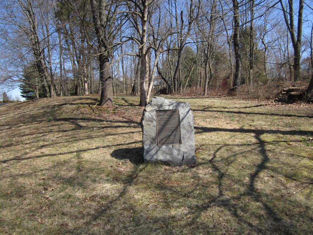
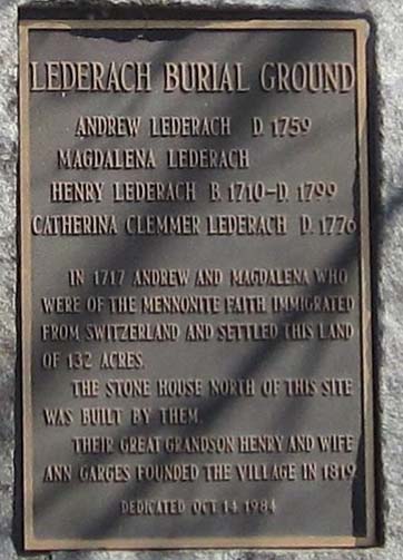
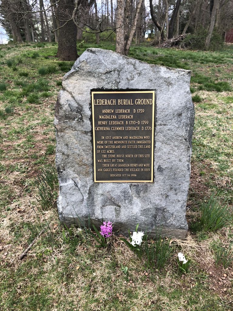
| Description | : | Family graveyard on the Lederach farm, Lower Salford Twp.. During the early 1980s there were 6 tombstones but by 1999 there were only 2 stones left to mark the graves. This old family cemetery is located near the intersection of Morris Road and Andrews Drive, Lederach, Lower Salford Township, Montgomery County, PA. |
frequently asked questions (FAQ):
-
Where is Lederach Burial Ground?
Lederach Burial Ground is located at 699 Andrews Drive Lower Salford Township, Montgomery County ,Pennsylvania , 19438USA.
-
Lederach Burial Ground cemetery's updated grave count on graveviews.com?
0 memorials
-
Where are the coordinates of the Lederach Burial Ground?
Latitude: 40.2583930
Longitude: -75.4008600
Nearby Cemetories:
1. Lower Salford Mennonite Cemetery
Harleysville, Montgomery County, USA
Coordinate: 40.2762489, -75.4020920
2. Reiff's Church Cemetery
Skippack, Montgomery County, USA
Coordinate: 40.2499410, -75.3728810
3. Haman Cemetery
Schwenksville, Montgomery County, USA
Coordinate: 40.2789116, -75.4203186
4. Kempfer-Markley Cemetery
Skippack, Montgomery County, USA
Coordinate: 40.2432980, -75.4326360
5. Trinity Christian United Church Cemetery
Skippack, Montgomery County, USA
Coordinate: 40.2272460, -75.4020210
6. Price Cemetery
Harleysville, Montgomery County, USA
Coordinate: 40.2896996, -75.4075012
7. Upper Skippack Mennonite Church Cemetery
Evansburg, Montgomery County, USA
Coordinate: 40.2252998, -75.4169998
8. Indian Creek Church of Brethren Cemetery
Harleysville, Montgomery County, USA
Coordinate: 40.2940102, -75.4046478
9. United Church of Christ Cemetery
Kulpsville, Montgomery County, USA
Coordinate: 40.2512970, -75.3530807
10. Christ Lutheran Church Cemetery
Kulpsville, Montgomery County, USA
Coordinate: 40.2522392, -75.3527908
11. Harley Family Cemetery
Harleysville, Montgomery County, USA
Coordinate: 40.2919006, -75.3750000
12. Pawling Cemetery
Schwenksville, Montgomery County, USA
Coordinate: 40.2366300, -75.4446030
13. Heinrich Frey Burying Ground
Harleysville, Montgomery County, USA
Coordinate: 40.2259060, -75.3675290
14. Delps Cemetery
Harleysville, Montgomery County, USA
Coordinate: 40.2971992, -75.3806000
15. Salford Schwenkfelder Cemetery
Harleysville, Montgomery County, USA
Coordinate: 40.2698326, -75.3479843
16. Towamencin Mennonite Churchyard
Kulpsville, Montgomery County, USA
Coordinate: 40.2486382, -75.3470993
17. Living Faith Fellowship Cemetery
Franconia, Montgomery County, USA
Coordinate: 40.2964516, -75.3674164
18. Kulpsville Methodist Episcopal Cemetery
Kulpsville, Montgomery County, USA
Coordinate: 40.2438640, -75.3426740
19. Heebner Family Cemetery
Worcester, Montgomery County, USA
Coordinate: 40.2175120, -75.3628660
20. Indian Creek Mennonite Cemetery
Franconia, Montgomery County, USA
Coordinate: 40.3032532, -75.3679428
21. Lower Skippack Mennonite Cemetery
Skippack, Montgomery County, USA
Coordinate: 40.2053500, -75.4069600
22. Wismer Burial Ground
Skippack, Montgomery County, USA
Coordinate: 40.2100200, -75.4304200
23. Eden Mennonite Cemetery
Schwenksville, Montgomery County, USA
Coordinate: 40.2632599, -75.4708786
24. Franconia Mennonite Church Cemetery
Telford, Montgomery County, USA
Coordinate: 40.3054199, -75.3656693