
| Memorials | : | 0 |
| Location | : | McBride, Marshall County, USA |
| Coordinate | : | 33.9289017, -96.6727982 |
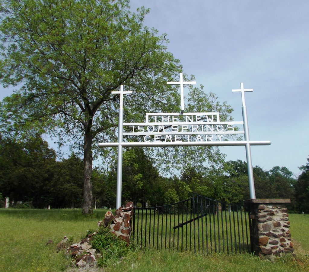
| Description | : | New Isom Springs Cemetery is located approximately six miles south of Kingston in Section 22, Township 7 South, Range 6 East in Marshall County, Oklahoma. During the construction of Lake Texoma, many small cemeteries were removed and the bodies reburied in other cemeteries. Old Isom Springs Cemetery was moved to its new location during this time and named New Isom Springs Cemetery. The new cemetery also received numerous burials from other cemeteries. Cemeteries moved to the New Isom Springs Cemetery include the following: Adams Trust (Indian) Cemetery – Section 31, Township 7 South, Range 6 East Commerce Trust Company Cemetery – Section... Read More |
frequently asked questions (FAQ):
-
Where is Isom Springs Cemetery?
Isom Springs Cemetery is located at McBride, Marshall County ,Oklahoma ,USA.
-
Isom Springs Cemetery cemetery's updated grave count on graveviews.com?
0 memorials
-
Where are the coordinates of the Isom Springs Cemetery?
Latitude: 33.9289017
Longitude: -96.6727982

Nearby Cemetories:
1. Woodville Cemetery
McBride, Marshall County, USA
Coordinate: 33.9392014, -96.6369019
2. Hainline Cemetery
McBride, Marshall County, USA
Coordinate: 33.9444300, -96.6392400
3. Old Woodville Cemetery
McBride, Marshall County, USA
Coordinate: 33.9343300, -96.6195300
4. Kingston Rural Cemetery
Kingston, Marshall County, USA
Coordinate: 33.9335814, -96.6189436
5. Potts Slave Cemetery
Pottsboro, Grayson County, USA
Coordinate: 33.8770870, -96.6526780
6. Mayrant Cemetery
Grayson County, USA
Coordinate: 33.8752800, -96.6520600
7. Preston Bend Cemetery
Pottsboro, Grayson County, USA
Coordinate: 33.8822098, -96.6345367
8. Knob Hill Cemetery
Marshall County, USA
Coordinate: 33.9963303, -96.6745682
9. Bald Knob Cemetery
Kingston, Marshall County, USA
Coordinate: 33.9967003, -96.6735992
10. Massey-Steel Cemetery
Preston, Grayson County, USA
Coordinate: 33.8517820, -96.6803960
11. Kingston Cemetery
Kingston, Marshall County, USA
Coordinate: 34.0022300, -96.7175900
12. Shay Cemetery
Shay, Marshall County, USA
Coordinate: 33.9281006, -96.7780991
13. Yarbrough Cemetery
Bryan County, USA
Coordinate: 33.8656006, -96.5824966
14. Lark Cemetery
Kingston, Marshall County, USA
Coordinate: 33.8492012, -96.7455978
15. Cliff Cemetery
Kingston, Marshall County, USA
Coordinate: 34.0317001, -96.6917038
16. Love Cemetery
Bryan County, USA
Coordinate: 33.9522018, -96.5449982
17. Aylesworth Cemetery
Aylesworth, Marshall County, USA
Coordinate: 34.0275200, -96.6173600
18. Moore Burney Cemetery
Aylesworth, Marshall County, USA
Coordinate: 34.0377800, -96.6388900
19. Sandy Cemetery
Cartwright, Bryan County, USA
Coordinate: 33.8694010, -96.5529860
20. Platter Cemetery
Platter, Bryan County, USA
Coordinate: 33.9253006, -96.5317001
21. Brogdon Cemetery
Grayson County, USA
Coordinate: 33.8087130, -96.7244060
22. Government Cemetery
Grayson County, USA
Coordinate: 33.8008990, -96.6642650
23. Franklin Cemetery
Bryan County, USA
Coordinate: 33.9636002, -96.5222015
24. Black Family Cemetery
Pottsboro, Grayson County, USA
Coordinate: 33.7962400, -96.7164700