
| Memorials | : | 0 |
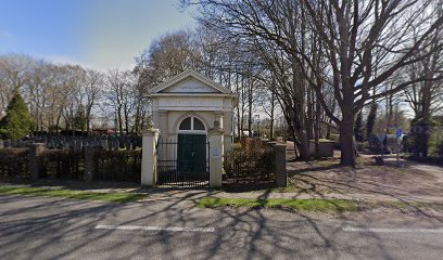
| Location | : | Meppel, Meppel Municipality, Netherlands |
| Coordinate | : | 52.7134680, 6.1898920 |
| Description | : | Established 1819 and expanded in 1850. |
frequently asked questions (FAQ):
-
Where is Israëlitische Begraafplaats?
Israëlitische Begraafplaats is located at Steenwijkerstraatweg and Bunskamp Meppel, Meppel Municipality ,Drenthe , 7942 HNNetherlands.
-
Israëlitische Begraafplaats cemetery's updated grave count on graveviews.com?
0 memorials
-
Where are the coordinates of the Israëlitische Begraafplaats?
Latitude: 52.7134680
Longitude: 6.1898920
Nearby Cemetories:
1. Nijeveen Old Protestant Churchyard
Nijeveen, Meppel Municipality, Netherlands
Coordinate: 52.7324800, 6.1639500
2. Ruinerwold General Cemetery
Ruinerwold, De Wolden Municipality, Netherlands
Coordinate: 52.7133700, 6.2489200
3. Begraafplaats Berghuizen
Berghuizen, De Wolden Municipality, Netherlands
Coordinate: 52.7145874, 6.2876037
4. Begraafplaats Havelte
Havelte, Westerveld Municipality, Netherlands
Coordinate: 52.7741442, 6.2472284
5. Giethoorn Kerkhof
Giethoorn, Steenwijkerland Municipality, Netherlands
Coordinate: 52.7397600, 6.0764900
6. De Wijk General Cemetery
De Wijk, De Wolden Municipality, Netherlands
Coordinate: 52.6679600, 6.2860500
7. Kallenkote Old General Cemetery
Kallenkote, Steenwijkerland Municipality, Netherlands
Coordinate: 52.7862800, 6.1530100
8. Ijhorst General Cemetery
IJhorst, Staphorst Municipality, Netherlands
Coordinate: 52.6636200, 6.2851200
9. Algemene Begraafplaats De Nieuwe Landen
Kallenkote, Steenwijkerland Municipality, Netherlands
Coordinate: 52.7867100, 6.1512500
10. Steenwijk General Cemetery
Steenwijk, Steenwijkerland Municipality, Netherlands
Coordinate: 52.7863900, 6.1284800
11. Joodse Begraafplaats
Steenwijk, Steenwijkerland Municipality, Netherlands
Coordinate: 52.7911800, 6.1213900
12. Rouveen New General Cemetery
Rouveen, Staphorst Municipality, Netherlands
Coordinate: 52.6157100, 6.1842900
13. Joodse Begraafplaats
Zwartsluis, Zwartewaterland Municipality, Netherlands
Coordinate: 52.6413820, 6.0723750
14. Joodse Begraafplaats
Ruinen, De Wolden Municipality, Netherlands
Coordinate: 52.7654800, 6.3722500
15. Joodse begraafplaats
Hasselt, Zwartewaterland Municipality, Netherlands
Coordinate: 52.5929800, 6.0923800
16. Willemsoord General Cemetery
Willemsoord, Steenwijkerland Municipality, Netherlands
Coordinate: 52.8266800, 6.0706300
17. Begraafplaats Van Stolkspark
Hasselt, Zwartewaterland Municipality, Netherlands
Coordinate: 52.5897916, 6.0961902
18. Blokzijl General Cemetery
Blokzijl, Steenwijkerland Municipality, Netherlands
Coordinate: 52.7253900, 5.9624600
19. Joodse Begraafplaats
Blokzijl, Steenwijkerland Municipality, Netherlands
Coordinate: 52.7253110, 5.9623440
20. Oud-Avereest General Cemetery
Oud-Avereest, Hardenberg Municipality, Netherlands
Coordinate: 52.6200500, 6.3711200
21. Algemene Begraafplaats
Paasloo, Steenwijkerland Municipality, Netherlands
Coordinate: 52.8133500, 6.0135300
22. Stad-Vollenhove General Cemetery
Vollenhove, Steenwijkerland Municipality, Netherlands
Coordinate: 52.6808200, 5.9459100
23. Joodse Begraafplaats
Dwingeloo, Westerveld Municipality, Netherlands
Coordinate: 52.8208670, 6.3704670
24. Dwingeloo General Cemetery
Dwingeloo, Westerveld Municipality, Netherlands
Coordinate: 52.8318520, 6.3642830