
| Memorials | : | 0 |
| Location | : | Zwartsluis, Zwartewaterland Municipality, Netherlands |
| Coordinate | : | 52.6413820, 6.0723750 |
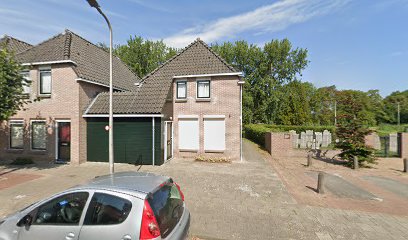
| Description | : | In 1722, the community opened a cemetery on the Leeuwarder Schans (also known as the Kleine Schans). The cemetery was also used by the Jews of nearby Meppel. In 1851, a new cemetery was opened behind the new synagogue on the Baanstraat. |
frequently asked questions (FAQ):
-
Where is Joodse Begraafplaats?
Joodse Begraafplaats is located at Baanstraat Zwartsluis, Zwartewaterland Municipality ,Overijssel ,Netherlands.
-
Joodse Begraafplaats cemetery's updated grave count on graveviews.com?
0 memorials
-
Where are the coordinates of the Joodse Begraafplaats?
Latitude: 52.6413820
Longitude: 6.0723750
Nearby Cemetories:
1. Joodse begraafplaats
Hasselt, Zwartewaterland Municipality, Netherlands
Coordinate: 52.5929800, 6.0923800
2. Begraafplaats Van Stolkspark
Hasselt, Zwartewaterland Municipality, Netherlands
Coordinate: 52.5897916, 6.0961902
3. Rouveen New General Cemetery
Rouveen, Staphorst Municipality, Netherlands
Coordinate: 52.6157100, 6.1842900
4. Stad-Vollenhove General Cemetery
Vollenhove, Steenwijkerland Municipality, Netherlands
Coordinate: 52.6808200, 5.9459100
5. Giethoorn Kerkhof
Giethoorn, Steenwijkerland Municipality, Netherlands
Coordinate: 52.7397600, 6.0764900
6. Israëlitische Begraafplaats
Meppel, Meppel Municipality, Netherlands
Coordinate: 52.7134680, 6.1898920
7. Grafhorst General Cemetery
Grafhorst, Kampen Municipality, Netherlands
Coordinate: 52.5782500, 5.9340800
8. Nijeveen Old Protestant Churchyard
Nijeveen, Meppel Municipality, Netherlands
Coordinate: 52.7324800, 6.1639500
9. Joodse Begraafplaats
Blokzijl, Steenwijkerland Municipality, Netherlands
Coordinate: 52.7253110, 5.9623440
10. Blokzijl General Cemetery
Blokzijl, Steenwijkerland Municipality, Netherlands
Coordinate: 52.7253900, 5.9624600
11. Kampen Roman Catholic Cemetery
IJsselmuiden, Kampen Municipality, Netherlands
Coordinate: 52.5705100, 5.9352400
12. Joodse Begraafplaats
IJsselmuiden, Kampen Municipality, Netherlands
Coordinate: 52.5696100, 5.9342100
13. Algemene begraafplaats IJsselmuiden de Zandberg
IJsselmuiden, Kampen Municipality, Netherlands
Coordinate: 52.5688100, 5.9350200
14. Zwolle Bergklooster Cemetery
Zwolle, Zwolle Municipality, Netherlands
Coordinate: 52.5338710, 6.1309080
15. Zwolle Kranenburg Begraafplaats
Zwolle, Zwolle Municipality, Netherlands
Coordinate: 52.5307910, 6.1302850
16. Voorst General Cemetery
Zwolle, Zwolle Municipality, Netherlands
Coordinate: 52.5210700, 6.0575500
17. Zwolle Katholieke Begraafplaats
Zwolle, Zwolle Municipality, Netherlands
Coordinate: 52.5186200, 6.1047100
18. Zwolle Algemene Begraafplaats
Zwolle, Zwolle Municipality, Netherlands
Coordinate: 52.5179970, 6.1084200
19. Ruinerwold General Cemetery
Ruinerwold, De Wolden Municipality, Netherlands
Coordinate: 52.7133700, 6.2489200
20. Onze Lieve Vrouwe ten Hemelopneming Basilica
Zwolle, Zwolle Municipality, Netherlands
Coordinate: 52.5121050, 6.0901940
21. Ijhorst General Cemetery
IJhorst, Staphorst Municipality, Netherlands
Coordinate: 52.6636200, 6.2851200
22. De Wijk General Cemetery
De Wijk, De Wolden Municipality, Netherlands
Coordinate: 52.6679600, 6.2860500
23. Joodse Begraafplaats
Zwolle, Zwolle Municipality, Netherlands
Coordinate: 52.5107800, 6.1402900
24. Steenwijk General Cemetery
Steenwijk, Steenwijkerland Municipality, Netherlands
Coordinate: 52.7863900, 6.1284800