
| Memorials | : | 0 |
| Location | : | Longsleddale, South Lakeland District, England |
| Website | : | www.longsleddale.co.uk/pages/churchf.htm |
| Coordinate | : | 54.4189730, -2.7706810 |
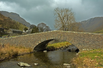
| Description | : | The cemetery was consecrated in 1712. The register of baptisms dates from 1670, marriages 1679, and burials 1712. The Parish Church of St Mary is a small building with churchyard mid way along the Longsleddale valley, situated half way along the valley with the parish hall on the opposite side of the road. The present church was built in 1863 by Lady Howard and occupies the site of an earlier building. On an old county map of Westmorland, a chapel is shown here dated 1670. Some of the features of the earlier building have been retained including a beautiful carved oak... Read More |
frequently asked questions (FAQ):
-
Where is St Mary Churchyard?
St Mary Churchyard is located at Longsleddale, South Lakeland District ,Cumbria ,England.
-
St Mary Churchyard cemetery's updated grave count on graveviews.com?
0 memorials
-
Where are the coordinates of the St Mary Churchyard?
Latitude: 54.4189730
Longitude: -2.7706810
Nearby Cemetories:
1. St Cuthbert Churchyard
Kentmere, South Lakeland District, England
Coordinate: 54.4294920, -2.8396150
2. St. Thomas' Churchyard
Selside, South Lakeland District, England
Coordinate: 54.3861600, -2.7169400
3. St James Churchyard
Staveley, South Lakeland District, England
Coordinate: 54.3801350, -2.8183670
4. St. Anne's Churchyard
Ings, South Lakeland District, England
Coordinate: 54.3802940, -2.8541350
5. St Oswald Churchyard
Burneside, South Lakeland District, England
Coordinate: 54.3546500, -2.7634950
6. Mislet & Broadgate Quaker Burial Ground
Windermere, South Lakeland District, England
Coordinate: 54.3892040, -2.8756960
7. St. John the Baptist Cemetery
Skelsmergh, South Lakeland District, England
Coordinate: 54.3521700, -2.7253800
8. St. John The Baptist Cemetery Extension
Skelsmergh, South Lakeland District, England
Coordinate: 54.3519250, -2.7249650
9. Jesus Church Churchyard
Troutbeck, South Lakeland District, England
Coordinate: 54.4170100, -2.9064230
10. St. Catherine's Churchyard
Crook, South Lakeland District, England
Coordinate: 54.3480260, -2.8462220
11. St John the Evangelist Churchyard
Grayrigg, South Lakeland District, England
Coordinate: 54.3681500, -2.6501200
12. Crook Chapel of Saint Catherine
Crook, South Lakeland District, England
Coordinate: 54.3445250, -2.8477290
13. Stricklandgate Methodist
Kendal, South Lakeland District, England
Coordinate: 54.3321160, -2.7493720
14. St. Thomas Churchyard
Kendal, South Lakeland District, England
Coordinate: 54.3316130, -2.7489140
15. Quaker Burial Ground - Grayrigg
Grayrigg, South Lakeland District, England
Coordinate: 54.3664563, -2.6483654
16. Saint Mary's Churchyard
Windermere, South Lakeland District, England
Coordinate: 54.3810140, -2.9099750
17. Castle Street Cemetery
Kendal, South Lakeland District, England
Coordinate: 54.3301600, -2.7365160
18. Kendal Unitarian Chapel Burial Ground
Kendal, South Lakeland District, England
Coordinate: 54.3287120, -2.7450940
19. Kendal Quaker Meeting House
Kendal, South Lakeland District, England
Coordinate: 54.3287200, -2.7431900
20. The Sepulchre Quaker Burial Ground
Kendal, South Lakeland District, England
Coordinate: 54.3270022, -2.7502978
21. Windermere Cemetery
Windermere, South Lakeland District, England
Coordinate: 54.3823360, -2.9173970
22. Quaker Burial Ground
Kendal, South Lakeland District, England
Coordinate: 54.3278200, -2.7285500
23. Holy Trinity Church
Kendal, South Lakeland District, England
Coordinate: 54.3223970, -2.7448770
24. All Saints Churchyard
Underbarrow, South Lakeland District, England
Coordinate: 54.3262900, -2.8268240