
| Memorials | : | 0 |
| Location | : | Emmen Municipality, Netherlands |
| Coordinate | : | 52.7790860, 6.8700710 |
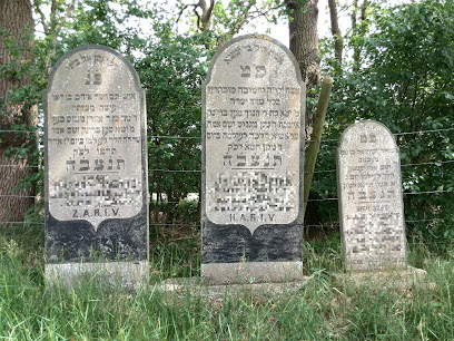
| Description | : | In use from 1885-1915. |
frequently asked questions (FAQ):
-
Where is Joodse Begraafplaats?
Joodse Begraafplaats is located at Achter het Kanaal Emmen Municipality ,Drenthe , 7814Netherlands.
-
Joodse Begraafplaats cemetery's updated grave count on graveviews.com?
0 memorials
-
Where are the coordinates of the Joodse Begraafplaats?
Latitude: 52.7790860
Longitude: 6.8700710
Nearby Cemetories:
1. Joodse Begraafplaats Beatrixstraat
Emmen, Emmen Municipality, Netherlands
Coordinate: 52.7805510, 6.8994390
2. Emmen Kerkhoflaan Cemetery
Emmen, Emmen Municipality, Netherlands
Coordinate: 52.7816300, 6.9006200
3. Joodse Begraafplaats
Sleen, Coevorden Municipality, Netherlands
Coordinate: 52.7799300, 6.8089600
4. Sleen General Cemetery
Sleen, Coevorden Municipality, Netherlands
Coordinate: 52.7773200, 6.8045800
5. Joodse Begraafplaats
Veenoord, Emmen Municipality, Netherlands
Coordinate: 52.7239410, 6.8443680
6. Nieuw Dordrecht General Cemetery
Nieuw-Dordrecht, Emmen Municipality, Netherlands
Coordinate: 52.7524200, 6.9653600
7. Nieuw-Amsterdam Algemene Begraafplaats
Nieuw-Amsterdam, Emmen Municipality, Netherlands
Coordinate: 52.7120300, 6.8534200
8. Oosterhesselen Geesbrug General Cemetery
Oosterhesselen, Coevorden Municipality, Netherlands
Coordinate: 52.7552100, 6.7119900
9. Algemene Begraafplaats Schoonoord
Schoonoord, Coevorden Municipality, Netherlands
Coordinate: 52.8499985, 6.7500000
10. Joodse Begraafplaats
Gees, Coevorden Municipality, Netherlands
Coordinate: 52.7492000, 6.7080000
11. The Old Churchyard Barger-Compascuum
Barger-Compascuum, Emmen Municipality, Netherlands
Coordinate: 52.7565091, 7.0358214
12. Dalen Protestant Churchyard
Dalen, Coevorden Municipality, Netherlands
Coordinate: 52.6970500, 6.7547900
13. Valthermond West Cemetery
Borger-Odoorn Municipality, Netherlands
Coordinate: 52.8810600, 6.9405060
14. Oud Schoonebeek General Cemetery
Schoonebeek, Emmen Municipality, Netherlands
Coordinate: 52.6608800, 6.8827100
15. Algemene Begraafplaats
Roswinkel, Emmen Municipality, Netherlands
Coordinate: 52.8403700, 7.0479840
16. Witteveen Communal Cemetery
Witteveen, Midden-Drenthe Municipality, Netherlands
Coordinate: 52.8106200, 6.6705900
17. Weiteveen Algemene Begraafplaats
Weiteveen, Emmen Municipality, Netherlands
Coordinate: 52.6611800, 6.9637100
18. Coevorden Nieuwe Begraafplaats
Ballast, Coevorden Municipality, Netherlands
Coordinate: 52.6729900, 6.7367800
19. Coevorden Oude Begraafplaats
Ballast, Coevorden Municipality, Netherlands
Coordinate: 52.6713700, 6.7362900
20. Joodse begraafplaats
Coevorden, Coevorden Municipality, Netherlands
Coordinate: 52.6712850, 6.7349550
21. Ter Apel General Cemetery
Ter Apel, Vlagtwedde Municipality, Netherlands
Coordinate: 52.8746800, 7.0560200
22. Joodse begraafplaats
Borger, Borger-Odoorn Municipality, Netherlands
Coordinate: 52.9291240, 6.7993350
23. Joodse Begraafplaats
Ter Apel, Vlagtwedde Municipality, Netherlands
Coordinate: 52.8744000, 7.0760300
24. Westerbork General Cemetery
Westerbork, Midden-Drenthe Municipality, Netherlands
Coordinate: 52.8523100, 6.6100500