
| Memorials | : | 0 |
| Location | : | Ter Apel, Vlagtwedde Municipality, Netherlands |
| Coordinate | : | 52.8746800, 7.0560200 |
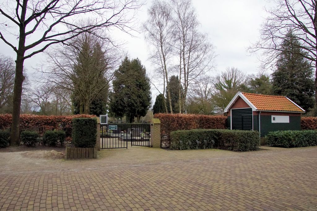
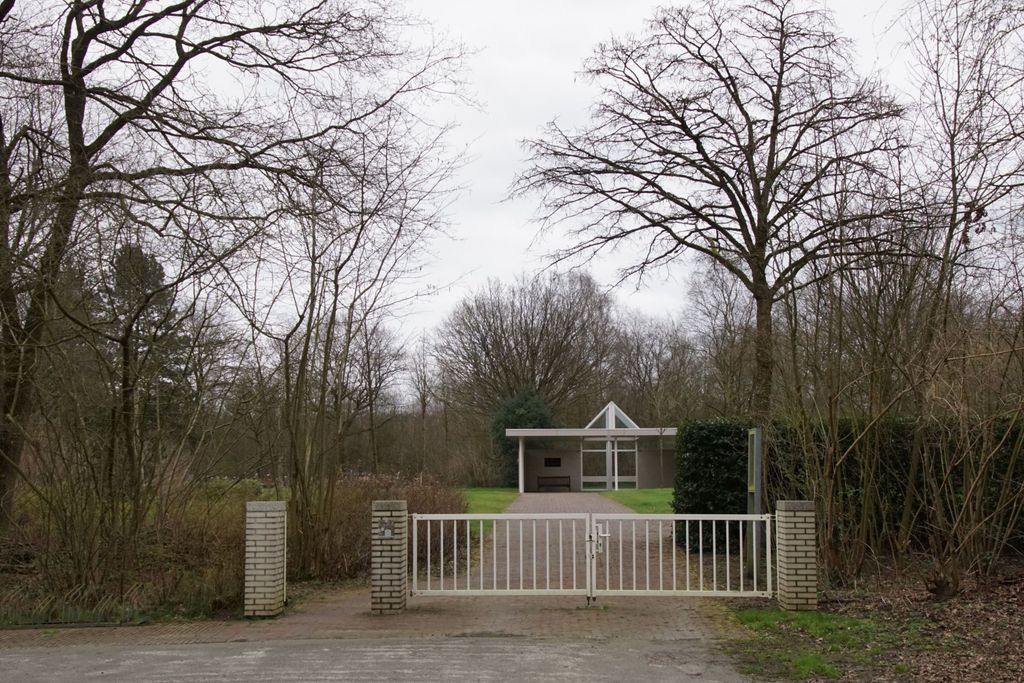
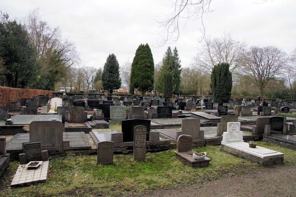
| Description | : | Ter Apel, a village administered by Vlagtwedde, is close to the Dutch-German border. The cemetery is on the northern outskirts of the village of Hoofdstraat. Turn into Hoofdstraat by the church, follow the road round the church and past the Roman Catholic cemetery, go over the crossroads and the cemetery is on the right in Kapelweg. |
frequently asked questions (FAQ):
-
Where is Ter Apel General Cemetery?
Ter Apel General Cemetery is located at Ter Apel, Vlagtwedde Municipality ,Groningen ,Netherlands.
-
Ter Apel General Cemetery cemetery's updated grave count on graveviews.com?
0 memorials
-
Where are the coordinates of the Ter Apel General Cemetery?
Latitude: 52.8746800
Longitude: 7.0560200


Nearby Cemetories:
1. Joodse Begraafplaats
Ter Apel, Vlagtwedde Municipality, Netherlands
Coordinate: 52.8744000, 7.0760300
2. Algemene Begraafplaats
Roswinkel, Emmen Municipality, Netherlands
Coordinate: 52.8403700, 7.0479840
3. Floralaan
Musselkanaal, Stadskanaal Municipality, Netherlands
Coordinate: 52.9359046, 7.0092084
4. Valthermond West Cemetery
Borger-Odoorn Municipality, Netherlands
Coordinate: 52.8810600, 6.9405060
5. Joodse Begraafplaats
Stadskanaal Municipality, Netherlands
Coordinate: 52.9686940, 6.9737780
6. Gemeentelijke Begraafplaats Ceresstraat
Stadskanaal, Stadskanaal Municipality, Netherlands
Coordinate: 52.9702635, 6.9754545
7. Begraafplaats Oosterkadekerk
Stadskanaal Municipality, Netherlands
Coordinate: 52.9776980, 6.9640720
8. Gemeentelijke Begraafplaats Brugstraat
Stadskanaal, Stadskanaal Municipality, Netherlands
Coordinate: 52.9774600, 6.9632400
9. The Old Churchyard Barger-Compascuum
Barger-Compascuum, Emmen Municipality, Netherlands
Coordinate: 52.7565091, 7.0358214
10. Emmen Kerkhoflaan Cemetery
Emmen, Emmen Municipality, Netherlands
Coordinate: 52.7816300, 6.9006200
11. Joodse Begraafplaats Beatrixstraat
Emmen, Emmen Municipality, Netherlands
Coordinate: 52.7805510, 6.8994390
12. Nieuw Dordrecht General Cemetery
Nieuw-Dordrecht, Emmen Municipality, Netherlands
Coordinate: 52.7524200, 6.9653600
13. Joodse Begraafplaats
Emmen Municipality, Netherlands
Coordinate: 52.7790860, 6.8700710
14. Friedhof Wesuwe
Wesuwe, Landkreis Emsland, Germany
Coordinate: 52.7582110, 7.2099680
15. Vlagtwedde General Cemetery
Vlagtwedde, Vlagtwedde Municipality, Netherlands
Coordinate: 53.0252400, 7.1198700
16. Stadskanaal Noorderbegraafplaats
Stadskanaal, Stadskanaal Municipality, Netherlands
Coordinate: 53.0071900, 6.9182500
17. Friedhof Lathen
Lathen, Landkreis Emsland, Germany
Coordinate: 52.8650490, 7.3166330
18. Joodse Begraafplaats
Bourtange, Vlagtwedde Municipality, Netherlands
Coordinate: 53.0134700, 7.1837900
19. Joodse Begraafplaats
Vlagtwedde Municipality, Netherlands
Coordinate: 53.0266000, 7.1584000
20. Joodse begraafplaats
Borger, Borger-Odoorn Municipality, Netherlands
Coordinate: 52.9291240, 6.7993350
21. Begraafplaats Veelerkerkhof
Veele, Vlagtwedde Municipality, Netherlands
Coordinate: 53.0372680, 7.1001330
22. Onstwedde General Cemetery
Onstwedde, Stadskanaal Municipality, Netherlands
Coordinate: 53.0425700, 7.0436300
23. Lagerfriedhof
Versen, Landkreis Emsland, Germany
Coordinate: 52.7245552, 7.1886227
24. Boven Pekela cemetery
Boven Pekela, Pekela Municipality, Netherlands
Coordinate: 53.0342900, 6.9338300